On The Road - 3
Water management is becoming an ever greater field of battle in Florida. Huge metropolitan areas around Orlando demand ever increasing quantities of water for consumption and watering the ever-present golf courses. Agricultural and industrial concerns ignore the ecological issues, and even the Corps of Engineers is having to spend huge amounts of money to undo damage it did in years past with channeling and water diversion. The natural aquifer is unable to keep pace with the demand, and entire ecosystems are being threatened. I had wanted to paddle the St. Johns last year, but found when I contacted the St. Johns County Water Management District, that the headwater regions of the river were so dry that people were running the river by ATV, so the trip was off.
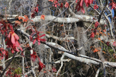
Winter comes even to North Florida, and autumn was present in early January. I thought it interesting to see the contrast between autumn colors and Spanish moss, or the colors of changing leaves between palm trees.
A few miles up river I turned into the channel at Gibson Dry Dock, where I had earlier seen Tommy Kight. Because it is small and fully enclosed, the marina’s basin is the best hurricane hole on all of the St. Johns, and because of the large dry storage area, people with less than 45-ft. bridge clearance come here for long term layovers from up and down the East Coast. It is also the home of the Rat Island Yacht Club, a very active sail racing group on the river.
White Heron
Great Blue Heron
A few miles further along, I turned into the beautiful Dunn’s Creek, which twists and winds its way southeast into Crescent Lake. All along the river there are continual opportunities to see wildlife from birds to gators. Shortly after turning into Dunn’s Creek, Murphy’s Creek turns west. I was once anchored in Murphy’s with a group of Boy Scouts. After dinner, they wanted to take the dinghy for a row. They became quite upset when I refused, telling them it wasn’t safe in a small round-bottom dinghy on the creek at night. They couldn’t understand until I took the spotlight and shined it up and down along the shores so they could see the reflected red eyes of all the alligators staring back at us. I continued a few miles beyond the Rt. 17 Dunn’s Creek bridge before turning back. The round trip was 15.0 miles, and a nice preparation for the first day’s run in the Keys Challenge.
Dunn's Creek Bridge


No comments:
Post a Comment