Tuesday, March 22, 2016

Paddling Clinic

Granddaughters Maggie and Lucie 


 We finally had the chance to get both granddaughters with us during their spring break.  To get them out on the water, all we needed was a decent weather day.  Like my paddle on 5 March, with the water still cold, we needed a paddle that would keep us close to shore and in shallow water.  With the wind still from the SE, I had identical conditions from that previous day trip, so another run down the shore through the rushes was in order.

The girls had no real experience paddling.  They had been to a church camp a couple years ago, but “training” amounted to little more than splashing about and wetting each other, so we started from the beginning.  I told them I would teach them six paddle strokes, and we started with a dry practice in the backyard.  I threw in a little background about never lying a paddle on the ground, never loading or stepping into a canoe until it is fully waterborne, the different types of hull materials and their advantages/disadvantage, the bowman setting the cadence, the stern paddler keeping time with the bow paddler and calling a ‘hut’ to switch sides, etc.   We had lunch, and with two canoes on the Dodge Ram, headed for the lake.

We started out from the Longdale ramp and again headed south along the shore.  In the first 45-minutes, we managed to make good only two-tenths of a mile, and a good bit of that was in circles.  It was chaos.  Like most tween sisters, the bickering and yelling was making me feel sorry for the emotional well-being of area wildlife and birds.  “You’re supposed to turn your thumb down---DOWN.”  “Stop telling me what to do.”  “No, you’re going the wrong way.  Over there, go over there.”  “What do you think I’m doing?  Why aren’t you paddling?  Paddle!”  “Shut up!  I am paddling.”  “No, you’re not.”  “I am so.”

By the end of their outing, success.

Finally, I called them into a spot where the water was shallow, and they were mostly surrounded by rushes that shielded them from some of the wind.  I told them to use their strokes to practice keeping the boat stationary and straight.  I was surprised how quickly they caught onto the use of the pry and draw, and they began to get control of the canoe, so we started on down the shore.  The idea of control over just moving forward made the difference, and they began to settle in.  Quickly they started picking their own route and made a couple rest stops on sandy spots along the shore.  They made it two-and-a-half miles to the dam and Blackjack swim beach, where I suspected they would be ready for another rest break.  Instead, they opted to come about and head straight back non-stop.  Five miles for their first real paddle was good.

The transition was fun to watch.  They were going straight, picking their own route through the shoals and obstructions, and paddling in unison.  I could hear them counting “1-2-3-4-5-6-hut” as they switched.  Before long, they were singing, and at times, I was busting my gut to keep up.  It was wonderful to see.  The next day we were having Oklahoma gales again, so we took them to the Cherokee Strip Museum in Alva, OK.  They wanted to paddle again the following day, but after much consideration, I called it off.  A cold front had moved through with a rapid drop in temperatures.  The temperature was barely going to break 50-degrees for a high.  If they got wet, even if they were close to shore and could wade out of the water, the risk of hypothermia seemed too great in the time they would need to change into the dry clothes they had carried.  It was decided to err on the side of safety.

When their Dad picked them up, they both told me they wanted to go canoeing again.  They later told their father the best time they had had on spring break was canoeing with me.  What sweeter words could a canoeing grandfather hope to hear?

Sunday, March 20, 2016

Northern Forest Canoe Trail

Credit: Google Images
Well, it’s official.   I had entered a raffle at Canoecopia for a free membership with Northern Forest Canoe Trail.  I didn’t win.   That, of course, is not a surprise.  Had I won, that would have been huge, because I was really interested in the trail and paddling it.  Four people won memberships, and I wonder how many of them will actually through-paddle the trail.  There are two advantages of membership.  The first is that it supports the paddling trail and helps to spread the interest for people actually camping and paddling the trail.  The second is the 15% discount on the cost of the trail guide and maps. 

So, being a big loser, I went onto their site and bought my own membership.  So there!  And, I ordered the guide and complete 13-map set for paddling the trail.  While I was at the NFCT booth, I also met Katina Daanen, and purchased her 2nd Ed. NFCT Through-Paddler's Companion, a guide she wrote after her 2011 through-paddle of the trail.  The upside, of course, is paddling the trail can’t help but make me a winner.  How could anyone spend one or two months in such beautiful country without feeling like a winner?  One of our fondest memories from early in our marriage was a winter camping trip on Eighth Lake, which the paddling trail goes right through.  We came close to being shot by a couple poachers spotlighting deer, but it was still a wonderful time in our lives.  The country is pristine, beautiful, and the trail offers the widest possible variety of paddling experiences and challenges from upstream, downstream, flatwater to class IV, easy reprovisioning, isolation when you want it, or friendly, quaint villages when you don’t feel like being alone.  It is 740 miles long, follows the oldest hunting and trade trails in the country that were used by Native Americans, fur trappers, voyageurs, etc.  It takes the paddler through 22 rivers and streams, 58 ponds and lakes, over 63 portages (ouch!) totaling 55 miles, over beaver dams, through bug swarms, through three national wildlife refuges, 45 towns and villages, spans four states plus a crossing into Canada and back, and allows for camping or lodging about every 15 miles in the beautiful Adirondacks and Northern New England.  The following link will take you to the blog section of the Northern Forest Canoe Trail, where you can read posts from the through-paddlers that have actually done the trip.  Enjoy the beautiful photographs they share.  Share the experiences.  Maybe you too will be moved to make the trip.  See http://www.northernforestcanoetrail.org/Paddler-2/Paddler-Blogs-73


Friday, March 18, 2016

Canoecopia - 2

The other side of the expo draws as many people as the trade show does.  Rutabaga amasses a long list of speakers that offer programs each day from when the doors open until everyone staggers tiredly out the doors at the end of the day.  The speakers include those that have completed impressive expeditions and are there to show their films and slides while answering questions about what the experience was really like and how it was accomplished.  Other speakers explain how to pick a boat, outfit it, catch a fish, pack, plan menus and cook a meal, introduce your kids or dog to paddling, get fit and stay that way, experience birds and wildlife and photograph them, navigate, explore new areas, become a happy camper, and everything you need to know from beginner to expert.

If Kevin Callan is on the schedule, he's a must see.  He's not only a
fountain of information and inspiration, but he's as entertaining as any
Vegas show.  I was sitting by the projector when he needed to come back
for some adjustments, and as soon as he saw me swing around with the camera,
he flashed his iconic thumbs-up.  If you ever see a guy that's always upbeat
and fun to be around, you've probably just bumped into "The Happy Camper"
himself.

If you should plan to go next year and order the show guide and colored wristbands, which serve as your entry tickets, early enough, both arrive in the mail.  If you wait until the last minute, the 84-page guide can be printed off the Canoecopia web page pdf.  Parking at the Alliant Energy Center is $7.00 a day unless you purchase the 3-day parking pass.  That doesn’t save much money, a dollar-and-a-half, but it saves a lot of time each day sitting in line to get through the gates.  Lodging abounds in the area, but the longer you wait to make your travel plans, the further you will be commuting each day to and from the exhibition.

No, I wasn't on this trip with Kevin and Andy, his equally upbeat
camping partner.  I just shot this picture of the screen during Kevin's
presentation.  These two met by accident, but make the perfect duo
by all appearances.  Photo credit: Kevin Callan

Was it worth the 1,700 mile road trip?  Yes.  Everyone should make the trip at least once even if you think of it as a pilgrimage.  For us, the 3-day show was a 6-day round trip, but it was a great experience.  The show is in the middle of the heart of paddling country for both Americans and Canadians.  Those that live close are fortunate, but I did see one person whining that they didn’t know if they’d make the trip since it was four hours away.  Wow!


Credit: Wikipedia
On several occasions while watching a Callan video, Jean and I have
talked about how much Andy looks like Red Skelton.  (If you're young
enough you don't know who Red Skelton was, you missed out on a lot. 
You should talk to your parents about that.)  His appearance, expressions,
mannerisms, and great sense of humor would have you thinking he's 
Skelton's reincarnation or his son.  So, we had to chuckle when we saw
Callan labeling him as Andy, alias, Red Skelton.

For a final word that may be of interest, Jean wanted to know how a paddling outfitter came to be named after an obscure turnip.  Here’s the story.  “Back in 1974, the original owner of Rutabaga and his friends would play Frank Zappa and the Mothers of Invention’s album, 'Absolutely Free,' on repeat.  There is one song called “Call Any Vegetable,” and at one point in the song there is a repeated chant of “Rutabaga.”  The neighbors used to call them the Rutabaga kids, and that’s what they named their business.  We hold with the legacy today, but we don’t play too much Frank Zappa over the stereo anymore.”  To plan your trip, see http://www.canoecopia.com/canoecopia/page.asp?pgid=1001

Wednesday, March 16, 2016

Canoecopia

We’ve been talking for three years about making the trip to Canoecopia.  We always enjoyed the trade shows.  Being from the Chesapeake, we went to the Annapolis Sailboat Show for decades.  We were even there when they rolled out the new Cruising World Magazine, and we became charter subscribers.  Now Cruising World is arguably the standard in the sailing world.  We also got cornered in a pub one evening by a recruiter/fundraiser for the Irish Republican Liberation Army, who was seeking funds for guns.  The more he drank, the scarier the stories and threats became.  We weren’t looking for that level of excitement on this trip, but the trade shows are always fun, and living in the desert, we have missed the crowds of like-minded people.


For those of you not familiar with Canoecopia, it is an annual paddling industry show that is held each March in Madison, WI.  What is promoted as the world’s largest paddlesports expo in the world is organized and sponsored by Rutabaga Paddlesports.  At least 20,000 paddlers, campers, fishermen, and photographers attend every year during the three-day event.  There are basically two sides to the expo.
The greatest thing about the shows is you get one-on-one contact
with the staff and instructors of any supplier, manufacturer, or
outfitter.  Here, we spoke with staff and instructors from  Camp
Manito-wish.  If you wish to send your child to an established program,
you get to have all your concerns addressed by the people actually working
with your child.  This camp, by the YMCA, in Boulder Junction, WI,
has been in operation since 1947.


This was the new Chesapeake Light Craft tear-drop camper.  It was
a big draw, and I had to run in early Sunday morning to get a picture
when people weren't crawling all over and in and out.  It really was nice.

The trade side of the show is where booths are manned by the experts from every canoe, kayak, SUP, camping gear, boat rack, sports apparel, paddle maker, and fishing gear manufacturer you can name.  This gives you the chance to be educated about and try on drysuits, paddles, and boats that you may have previously only seen pictures of, and compare them side-by-side.  There are also well known authors that you can meet, talk with, and even get a book signed by.  There are unusual things to see like the log canoe that paddled around Lake Michigan, or the newly designed and built teardrop trailer built by Chesapeake Light Craft.  You can meet any number of guides and outfitters that will introduce you to their paddling or fishing areas, or you can meet representatives from any number of national and state parks, paddling trails, like the Northern Forest Canoe Trail, scouting, paddling instruction, paddling clubs, and gosh, just name it.  You can also meet and discuss concerns with people working to protect our lands and waters from those like Friends of the Boundary Waters, the Apostle Islands, the Wisconsin River, Florida waters, and the Sierra Club.  For the first-timer, walking through the doors to the exhibition hall is a bit intimidating and overwhelming, but with the map of the hall and show guide in hand, it doesn’t take long to settle in.

Saturday, March 5, 2016

A Nice Paddle Day

Can you believe I took off without the camera?  So, I had to pull
a file picture of Ibi from the 2012 River Rumble on the Missouri.

The winds have been horrendous, torturous, and incessant for the last week.  Gusts have been hitting 45-50 mph, and that is without storm activity.  Today was supposed to be better, before we get back to gale force again tomorrow.  The winds were forecast to be low until mid-afternoon, and would be out of the east all day, veering from NE to E to SE.  If I stayed on the eastern shore of the lake, I’d be in the lee of the land.

First things first, however.  This morning was the start of the WaterTribe Everglades Challenge.  They pushed off from Fort DeSoto State Park, on the north shore of Tampa Bay, at 8 a.m., Eastern, for the 300 mile paddle to Key Largo.  I watched them all get started, and will now follow Class 1, which allows the use of a one-square-meter sail with no outriggers or dagger boards, and includes a couple friends who are participating.

I launched from the Longdale ramp.  This campground has been unusable for about eight years due to the severe draught.  Since there has been no maintenance going on, I found a bumper crop of sandburs.  I ended up with them everywhere, including inside my dry suit, so I felt like I was sitting on a mound of fire ants all day.   The draught had withdrawn water from the east shore a considerable distance, which allowed the growth of brush and trees in the fertile dry lake bottom.  With water levels back up, I could now paddle through a labyrinth of foliage, which was providing good habitat for ducks.  I was able to evade a good bit of the wind and experience a whole new and interesting environment.  I paddled to the south end of the lake and pulled out.  The cabled string of big orange floats that mark the swim area had been sitting in a dry field of weeds for much too long, and it was nice to see them floating again.  I sat on one above the shoreline, and enjoyed lunch as I watched water lapping against Ibi nearby.  

With lunch over, I got back on the water, turned Ibi to face downwind and into more open water, and popped the WindPaddle Cruiser sail.  We took off.  I reached 5.6 mph, which is the fastest I’ve ever gotten the canoe going.  The wind wasn’t steady, however, and gusts kept backing more forward.  It both drove me further offshore, and as I was already sailing on the edge of trying to hold a beam reach, backed the sail and blew it over my head.  The Cruiser is 1.6 sq. meter.  In a canoe, that’s big, and when it backwinds and flops over my head, I find myself sitting inside a big yellow tent as the wind, now gusting to near 20 mph, is trying to blow me sideways toward open water.  A couple times it got a bit exciting.  It would have been really nice if I could have kept the wind behind me, but it was backing more.  I finally had to furl the sail and just enjoy the paddle.  By gosh, spring is coming.  I can feel it.

When I got home, I checked in again with the WaterTribe.  In eight hours, Class 1 had traveled 40-45 miles down the Florida coast.  That blows my mind.  Canoe or kayak either one, that’s moving.  If you want to watch the track, which is updated several times an hour, check the site at: http://www.watertribe.com/Events/ChallengeGMapper.aspx.  Be quick, or this thing will be over.  To qualify with a finish time, they have to have completed the 300 miles in eight days. 

Monday, February 29, 2016

DeLorme Update

I received an email concerning a 30% savings (available today only) on the Earthmate PN-60 mapping GPS.  While it was a very attractive offer, I was concerned about the effect of the Garmin buy-out of DeLorme, so I gave them a call.  The sale of DeLorme was indeed completed.  The only impact on the printed Atlas and Gazatteers is that they are no longer available for walk-in purchase at their company store, but their availability for on-line purchases should continue unchanged.  That's the good news I felt I should share.  The PN-60, on the other hand, looks great, and continued R&D in hi-tech applications is an area Garmin is heavily invested in, so that should only get better.  I'll add more later when I've had time to use the PN-60.

Friday, February 26, 2016

DeLorme Atlas About to be History


The DeLorme Atlas & Gazetteer published for every state, and which has led millions of outdoorsmen into areas not covered by any state map, may be about to disappear.  The purchase of DeLorme, of Yarmouth, ME, is in the works by Swiss-based Garmin.  Their interest is satellite communications and high-tech development, and they have already said one of their first moves would be the elimination of the map publishing business.  This is tragic, and proof that not all progress is progress.  This would definitely be a step backwards.  Here's the link to the story.
http://www.pressherald.com/2016/02/11/yarmouth-based-mapmaker-delorme-sold-to-garmin/

Canoe Country Camping


Canoe Country Camping: Wilderness Skills for the Boundary Waters and Quetico,  by Michael Furtman.  Pub by Pfeifer-Hamilton, Duluth, MN, 1992, 194pp with additional resource list, illustrations by Susan Robinson)

With a quarter century of experience in the Boundary Waters, the author writes specifically about what leads to a successful trip in this area.  However, the topics apply equally to any flatwater paddling and camping.  I’ve read a lot of books by a number of authors, and yet I found here many useful recommendations that I had not encountered before.  Mr. Furtman feels that once you arrive at the paddling area, the success or failure of the trip will rest mainly on your preparation.  If you’ve planned poorly, it’s hard to salvage a chain of mistakes, but with successful planning, little can happen to mar your pleasure or leave you unable to deal with mishaps that do occur.  The book is not organized by topic, but takes you step-by-step from the idea of making a trip until you complete your portage and arrive at the campsite.  The nice thing about this book is that regardless of your level of experience, there is still more to be learned, and you can find it here.  I don’t think there’s any greater compliment any author can achieve, and it’s well earned.  The book was also awarded the “Best How-to Book” award by the Mid-West Independent Publishers’ Assoc.

The author made a couple points throughout the book that are important to all of us regardless of where we paddle and camp.  The first is to promote the idea of not just successful camping, but ethical and responsible camping, and he explains how these are accomplished.  The second has to do with enjoying wildlife.  He has a section on how to find and photograph wildlife, but he adds that a simple rule followed by professional wildlife photographers is that the welfare of the subjects is more important than the photograph.  The lives of birds and wildlife revolve around two activities:  feeding and reproducing.  Each time we disrupt their feeding or their abilities to care for their young, we cause them stress.  The consequence is that stressed birds and animals have lower survival rates.  He emphasizes that we paddle quietly and stop our approach when an animal begins to show signs of fright or agitation, nervous movement, quick furtive glances, muscle tenseness, etc.  All together, this is a book you will enjoy and find rewarding.

Tuesday, February 23, 2016

The Spring Kill

Credit: weblearneng.com
We wait for spring.  We can't wait to get out of doors in our flip-flops,
shorts, and light tops.  But if we are heading to the water, this spring season,
 more than any other, is when we have to remember that water is an alien
environment we have to be ready for.

The day on Canton Lake was really warm for mid-February.  On my way to the lake, I was riding with the pickup window open, and it was still warm.  When I crossed the dam, however, the wind was chilled as it passed over the cold water.  I was afraid while I was ashore that I might be over-dressed in the dry suit, but once on the water, I was quite comfortable.  The air was 74-degrees, but the water was 42, an ideal recipe for a hypothermic catastrophe.  Basking in the warm sun of spring causes more people to die of hypothermia in the spring than any other time of year, even the dead of winter.  It is not the air temperature that one needs to dress for, but the ice-cold water that kills when someone falls overboard or capsizes.  In that 42-degree water, I would retain consciousness for little more than 30 minutes before drowning.  The more I moved, like trying to swim ashore, the faster my body would lose heat.  With a tight-fitting PFD to retain core temperature and keep my head out of the water, I could last 1 or 2 hours before expiring from hypothermia-induced cardiac arrest.  Any PFD is great, even essential, but a loose-fitting PFD, while keeping me afloat and preventing drowning, would allow more water exchange, and lower my survival time, so it’s important to make sure the PFD is properly fitted and snug.  If the combined air and water temperature reach a sum of less than 120 degrees Fahrenheit, a wet or dry suit is needed in addition to the PFD to prevent core temperature cooling.  The 74 + 42 degree air and water temperatures totaled 116, making a suit essential, especially when on open water alone.

Here is a link to a table every paddler should have laminated and kept handy.  It lists the water temperatures, times for loss of dexterity, loss of consciousness (which translates to drowning), survival time, and the recommended clothing for managing these conditions.  Here is one point that tables don’t include, but which should be remembered.  If on the water with children, you will be totally occupied trying to save yourself.  The kids will be on their own, which means they need to be properly outfitted for their own survival.  You would be very limited to totally incapable of coming to their aid.

There are a couple ways to confirm water temperature.  One is to check for fishing reports on the internet for the body of water you are heading for.  If that information isn’t available, it’s often helpful to have your own thermometer.  This one by Fishpond has a metal case that protects it while it jostles about in a backpack or tackle box.  Remember that surface water will be substantially warmer than what you will be swimming in if you go overboard.  On this day, there was an 8-degree difference in temperature between the water six feet below the surface and water found on the boat ramp in the sunlight, so the reading needs to be taken off the end of a pier or somewhere you can reach at least a depth of six feet.

Fishpond air/water thermometer in metal case.

For a complete understanding of the risks, read this from the Center for Cold Water Safety:

Monday, February 22, 2016

Confused?


I admit feeling confused at times, but nothing in comparison to what
these poor daffodils are experiencing.  Flowers in mid-February?  In
a few days they could be covered by ice!


Sunday, February 21, 2016

First 2016 Paddle

I went to Canton Lake for a paddle.  I mean how could I not, when the temperature is running into the mid-seventies and the wind is forecast to ease below 35 mph.?  When I got there, I was surprised by how many other victims of cabin fever had also ventured out.  There were probably two-dozen campers.  Only one was in a tent, the remainder in RV’s.

This was the Buffalo Bluffs at Canton Lake 18-months ago.  There 
are actually two elevations here---one in the foreground covered with
grass, and the tall bluffs set back a hundred yards or so.

Now, with water in the lake, the surface is half-way up the tall
bluffs pictured above.

Boy, these government types take their funding cuts seriously.  Before heading out, I decided to make a head call.  I was also feeling the force of the wind and beginning to have second thoughts about launching as I watched the scattered whitecaps rolling down the lake.  I stopped at the first restroom---locked.  I drove to the second restroom---locked.  Seeing the trend, I drove back out to the pit toilet---locked.  I mean, why the heck would anyone lock the door to a pit toilet?  I had one more shot, and drove a mile north to another pit toilet with no door.  Ahh, it was open, but, of course, no TP.  No matter, I just went back out to the truck and grabbed the appropriate dry bag out of my backpack.


The Ram and Ibi arrive at the long-unused ramp.

I then drove around to three launch ramps to see waves rolling up the ramps.  They were usable in a pinch, but not without scrubbing the canoe on the concrete.  The lake, thank heavens, is full, but that means there is no sand or grass for a shore launch, as the lake is surrounded by riprap for erosion control.  There was an old ramp in a discontinued campground out on Cty. Rt. 2460 to the west, so I hopped back in the truck for another ride.  With the drought of the last half-dozen or more years, there had been no water within a half-mile of that ramp, but it was worth a shot. The water was all the way up the ramp; the water was smooth, and many ducks and Sandhill cranes  were enjoying the return of water and revitalized marsh.  It was an isolated and beautiful setting with only one other vehicle there.

Getting out of the wind for lunch.

Once I paddled out of the protected waters, I was going north into the wind.  One thing became very apparent.  The winter had already been too long.  My arms, waist, and shoulders said I needed more time on the Total Gym.  I continued north until it was time for lunch.  With the wind still blowing, I entered a small bay and drove the canoe’s bow into a thicket to hold me fast.  I kind of rushed lunch, because I was anxious to try the WindPaddle Cruiser for a run back down the lake.  It was a nice ride, but the wind was beginning to soften.  After all, that is what winds do when one starts to sail.  But, it was a nice ride that was interrupted by only a few paddle strokes.

I just told Jean about this, so should add it for all you ladies (and men).  The mark of a good trailer operator is their backing ability.  The American Trucking Association has an annual national driver competition that seriously tests a driver's backing ability.  Unfortunately, trailer backing is usually considered a guy thing.  Many women won't even try.  The one other vehicle at the ramp was a pickup and pontoon boat trailer.  As I was about to leave, the pontoon boat came in to the ramp.  The woman jumped off while the man operated the boat.  She came up, jumped in the truck, and after exchanging a few words with me, swung the truck and trailer around, backed the trailer a couple hundred feet (at about 10 mph), backed straight down the dead-center of the ramp, and stopped at exactly the right spot for the boat operator to pull right onto the trailer.  And, this was all done in one shot with no pull-ups or straightening maneuvers, just a beautiful thing to see.  There you go ladies, grab the keys and go practice.
  

Thursday, February 18, 2016

Catching Up

I've been as busy as a cat covering dirt, but I guess it doesn't show here.  I've spent a lot of time watching Richard Brand paddling around the Eastern U.S.  (Captured Heartbeats)  If you haven't been following, you are missing a great adventure.  Just click Captured Heartbeats Tracker and Facebook in the right margin under Favorite Links.  He passed St. Marks Lighthouse night before last, and has now turned south on the Florida Big Bend.  He is now sleeping soundly (at this writing) in the Econfina River campsite.

Credit: Rutabaga and Canoecopia
They just labeled this picture as 'boy and birch canoe.'  What a great
picture of the birth of an obsession.

Well, the die is cast.  We've been talking about going to Canoecopia for several years.  This year we've made the leap.  I ordered tickets and made a reservation for lodging, and will now watch the weather in the frigid North.  We always loved going to the annual sailboat show in Annapolis, but only had to drive about 40 miles for that.  This will be 1,700 miles round-trip.  Unless this will be something that will get in our blood, it will probably be a once-in-a-lifetime experience, but we're looking forward to it.

I made 100.75 miles for my 3-P-100 in January, but this month the weather has been horrid.  It has been warmer than normal, and that is nice, but the wind has been 35 to 45 to 55 mph.  When I go out for my walk, I collect aluminum cans to help Canton Lake with their reforestation fundraising project.  Everything was destroyed by a tornado three years ago.  Climbing up and down deep ditch banks in 45 mph winds gets exhausting in short order.  After a mile and a half, I'm convinced it's three miles and call it a day.

Bike riding is my other means of keeping the body working, but I went out several days ago and broke a spoke in the rear wheel.  This was the third spoke broken and replaced.  I called the bike shop only to find they have taken a winter vacation.  That's a smart move, considering this has to be their slowest time of the year.  All the spokes will be replaced with stainless steel shortly, and I'm hoping that will solve my problem.

Beyond these happenings, I've been working in the shop on wood projects.  The smell of wood dust is surely a better harbinger of spring than a sleepy groundhog.

Friday, February 5, 2016

Losing Sight of Shore


Credit: Losing Sight of Shore film page

I just saw something on Facebook that made me excited, amazed, and angry.  It starts with the Upworthy trailer for the planned documentary about four British women that rowed across the Pacific Ocean totally unsupported.  They covered 8,446 miles over ten months.  Leaving San Francisco, they made provisioning landings in Hawaii, American Samoa, and finished in Cairns, Australia, making them the first to complete this trial of endurance.  Below I include the links to their blog and the upcoming film.  They just arrived back in Great Britain yesterday.

The excited and amazed parts will be self-evident to anyone that looks closer at what these four women accomplished.  The angry part comes from the fact that this is the first I’ve heard of it.  They left an American city, provisioned in another American city, then landed on an American protectorate, set a world record, and kept at it for ten months, and this is the first I’m hearing of it.  The American media is yet again asleep at the controls.  I listen to the news programs every day, usually two or three news programs a day, so it’s not like I live under a rock, and this is the first I’m hearing of this effort.  I told my son that the only way the U.S. media would have heard of this would be if they had taken Howdy Doody along (alias Donald Trump).  While these women are doing something positive, amazing, challenging and uplifting to the human spirit, the news can’t get away from his vulgar, valueless, negative, senseless, comedic rants.  Instead of what these women are doing, the news wants to cover Donald Trump’s wife posing nude and Jeb Bush dragging out is 90-year-old Mommy to lead him through his campaign.  If you want to get away from Howdy Doody for a while, check out these links for something positive.


Sorry, I know that began to sound like a political rant.  It isn’t, just an angry rant.  These women deserve more credit and recognition than is apparent, and congratulations to them for such a great accomplishment.

Wednesday, February 3, 2016

In the Cause of the Paddle

Credit: Alex Comb

What sets a canoeing expedition apart is that it purifies you more 
rapidly and inescapably than any other.  Travel a thousand miles by 
train,  and you are a brute.  Peddle 500 miles on a bicycle,
 and you remain basically bourgeois.  Paddle a hundred in a canoe,
 and you are already a child of nature.

Canadian Prime Minister Pierre Trudeau

Saturday, January 30, 2016

Epic Wanderer

Credit: goodreads.com

Epic Wanderer: David Thompson and the Mapping of the Canadian West, by D’Arcy Jenish (pub. by the University of Nebraska Press, Lincoln, NE, 2003, 293pp. plus index and bibliography)

As a fur trader, explorer, surveyor, artist, mapmaker, and an entrepreneur, who spent 28-years in the Canadian wilds, David Thompson did as much for Canada as anyone else we can name, and yet, he died penniless and obscure in 1857, being unknown to the public until the “David Thompson’s Narrative” was published in 1916.  Thompson's
 story began after he left a school for the poor in London at the age of 14, and sailed in May, 1784, for Churchill Factory, Hudson’s Bay, to work as an apprentice in the fur trade.

Thompson quickly became known to Hudson Bay Company partners for his meticulous work ethic, mathematical skills, and navigational abilities.  His thirst for exploration and travel was something they were happy to satisfy, as he traveled all over Canada, recorded the magnetic heading of every stream, did celestial observations to record the exact location of every bend, island, cliff, rapids, falls, and transformed all this information into the best maps of the time.  His maps were created on huge paper sheets that would cover entire walls.  Plans for establishing forts, trading posts, and seek natural resources  were all based on his maps by those both in Canada, the U.S., and back in London.  He established the boundary between Canada and the United States.  Also, Thompson had traveled more than any other man.  Only three other expeditions had been led to the Pacific, those by Simon Fraser and Alexander Mackenzie in Canada, and Meriwether Lewis and William Clark in the United States, but Thompson had traveling more than any other man, covering over 50,000 miles.  He also kept extensive journals on both his work and all of his adventures.  This book is taken from those journals, and will give you as precise an understanding of the man and the young and previously unknown country as you will find anywhere. 

Wednesday, January 27, 2016

Ibi's Day Out - 3

Credit: WindPaddle Sails
My set-up looks a little different from what this picture shows.  
First, my sail is yellow to match Ibi’s deck.  Then, this young 
lady looks a heck of a lot cuter with her sail than I do with mine.  
What can you do?

From the north end of the lake, I continued south to the very southwest corner of the lake where a stream connects to Lake Elmer Thomas.  Another sand and gravel beach there made a wonderful place for a lunch break.  With the wind blowing straight out of the southwest, the water off the beach was flat, and the wind would carry me straight back to the campground.  I had carried my WindPaddle Cruiser sail along, and since I rarely get the chance to use it, I popped it open for a downwind run back home.  It carried me right back to the beach, where I could relax and enjoy the full moon over the lake.

Friday, January 22, 2016

Ibi's Day Out - 2

About halfway down the lake, I saw an island in the center, and decided to investigate, since it was time for a break to stretch my legs.  I expected that the landing would be thick, red, clay-based mud, but it was firm gravel and sand, so I was out for a walk.  To my surprise, an old building sat in the middle of the island, obviously dating back before the flooding of the region, and constructed of the same red cobblestones seen in Medicine Park.  The lake level was down about four feet, but during higher water, the washing of the waves against the foundation of the building had undermined the walls, which had collapsed.  A concrete front porch is still evident, but trees have grown up through the center of the remains.  I originally thought it had been an old home, but I called the lake office to investigate it and the two large concrete structures I had found in the first bay north of the campground.  It turned out that the building had been a small store.  The concrete structures, and another between them that is totally submerged, were piers for a bridge that carried the road out to the store.

As I entered this bay, I was curious about two huge monolithic
concrete structures I encountered, this one with a cormorant
perched on top.  The docking cleats mounted on top were even
more bizzare.  Looking closely, you can see one on the top near
the right end.

Viewing the two structures together with the docking cleat again
visible on top.

Looking across the prairie towards the mountains as 
sunset approaches, and viewed from the north end of the lake.


Wednesday, January 20, 2016

Ibi's Day Out on Latonka


This is what Lake Latonka looked like the morning I got up for
what was supposed to be my paddling day.  That is what led us
to take the day in Medicine Park.

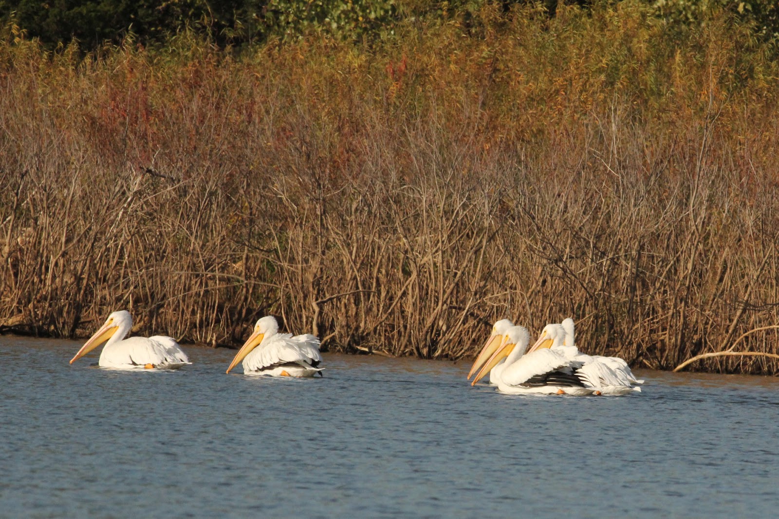
The settled weather forecast for yesterday finally arrived today.  I loaded Ibi on the canoe cart and walked her to the beach for an easy launch.  Jean walked along to see me off.  Lake Lawtonka has a 19-mile shoreline.  I paddled north to do the shoreline in a counterclockwise direction.  I was earnestly hoping that I’d get a chance to see an elk along the shore, but wildlife was limited to coots, herons, cormorants, geese, a few sandhill cranes, even fewer lonely mergansers, but a lot of pelicans.  I continued north until I reached a long peninsula that juts to the southwest.  Once I rounded it, I could reach the headwaters and a marina/campground complex along the Meers-Porter Mill Road.  Just then, unfortunately, a breeze sprang up from the south.  Considering how unsettled the weather had been, I was concerned about being too far downwind if the wind strengthened, so I cut across to the western shore and paddled south along the base of Mount Scott.


Mergansers aren't common here, so I was pleased to see them.

The white American pelican, however, can be seen in flocks
of hundreds.

Isn't it nice to be able to take your hard-shelled camper wherever
you go.  As an aside, I just learned that Chesapeake Light Craft
has designed a tear-drop camper trailer for the same construction
methods used for their canoe and kayak building.  They are now
finishing the construction manual and video, which should be ready
shortly.  If you'd like a closer look, go to:
 http://www.clcboats.com/shop/boats/development-projects/clc-teardrop-trailer.html


Tuesday, January 12, 2016

Wichita Mountains Wildlife Refuge

This was the bison we sat and watched for about a half hour.  In
the background is Quanah Parker Lake.

So here I sit at 4:30 a.m., awake and unable to get back to sleep.  It isn't waking up that's the problem, but my mind waking up.  It won't shut up and let me get back to sleep.

So, anyhow, leaving Mount Scott, we continued into the Wichita Mountains National Wildlife Refuge.  Elk were reported to be in the area, as well as buffalo.  The 59,000 acre wildlife area runs along the north boundary of the Fort Sill Military Reservation.  The artillery explosions continued all day, every day, and signs along the roadway, reading “Caution, Impact Area”, warned against getting out and wandering about.  Also, this is still a wild area in spite of the presence of humans passing through, and an artillery officer had been struck and killed by a rattle snake just before our visit.  We saw buffalo, properly called bison, but elk are best spotted at sunrise and sunset, and we missed out there.


Flocks of wild turkeys wandered about and just seemed as unconcerned
about us as could be.  For the best pictures, we could just move ahead of
them and wait for them to come to us.   Pretty cool!

At one time the American plains were home to 60-million buffalo.  They were hunted and slaughtered to near extinction, and by the turn of the 19th century, could be found only in two small herds making a total of 550 buffalo in the entire country.  In 1905, a move was begun to acquire and reintroduce buffalo to the Oklahoma plains.  I thought it was hilarious that they had to turn to the New York Zoological Society and the Bronx Zoo to acquire 15 buffalo, 9 cows and 6 bulls.  Maybe it’s just my sense of humor, but I equated that with an eskimo having to go to Zimbabwe for ice cubes.  They were crated and loaded in boxcars for a seven-day, 1,500 mile trip to the railhead at Cache, OK.  Hundreds of people, including the Comanche Chief Quanah Parker, came out on October 18, 1907, to see their crates reloaded on wagons for the 13-mile ride to the wildlife refuge.  From 550 bison nationwide, there is now a healthy herd of 650 bison in the Wichita refuge alone, and annual auctions are held to sell Texas Longhorn cattle and bison to maintain proper herd populations.


Everyone has seen a colt frolicking in a sand patch on its back, feet flailing in the air as it dusts itself and scratches its back.  Seeing a 2,000 pound bull bison doing the same things is something else again and makes a significantly greater impression.  He’d lay on his back and twist and turn until he had gyrated out of his dirt patch, then get up, move back to the best spot, and do it again.  After he had resolved all the itchy patches on his back, he rolled onto his hunches and knees (carpus), and rocked forward and back scrubbing his belly on the ground.  With all that taken care of, he got back on his feet, had a good shake all over, and returned to grazing.


This is Antelope Flats, a prairie region in the refuge where the
wildlife roam free.

During all this I made an inspection tour of the lakes in the wildlife area.  There were Lakes Elmer Thomas, Johnson, and Quanah Parker.  We also found another campground we hadn’t seen mentioned before, Camp Doris, which puts you right in the middle of the wildlife refuge.

Here's that elk I missed seeing.  I borrowed this picture from the
wildlife service photo file.

Okay, wish me luck.  I'm going back to bed.

Friday, January 8, 2016

Last Visit to Mount Scott

Just a couple of the remaining pictures from Medicine Park and
Mount Scott.


These boulders do roll down the mountain.  There were thousands
we saw that had already made the trip, and some of them leave
you with the impression that they could rain down at any minute.


Some more yellow and orange lichens, and trees in crevices but
determine to survive the best they can.

Thursday, January 7, 2016

The Computer is Shaking

Credit: U.S. Geodetic Survey

Yesterday, in a single day, there were 19 earthquakes in Fairview according to the USGS.  The larger ones were 3.7, 4.0, 4.7, and 4.8.  Yet the injection wells in this area last night were going full-bore with lines of trucks waiting to unload more fluids at the injection wells at the same time that the earth was trembling beneath their feet.  There have been another eleven so far today.  We get news warnings about the impending “big one”, and advice from experts and scientists about how the home owner can mitigate their damage.  How damned stupid is that?  Why concentrate on how to mitigate damage and totally ignore the cause of the earthquakes?  Why are we not hearing anything about what the state is doing to prevent the quakes, namely shutting down the injection wells and fracking so as to prevent the big one, rather than advice about securing TV’s and bookcases.  Wells in affluent neighborhoods around Edmund have been ordered to stop injection, while wells operated around Fairview are being told that the same measures are a ‘suggestion’, which they openly state they fully intend to ignore.  France and Bulgaria have outlawed fracking because of the risks.  Pennsylvania has stopped fracking statewide because of the hazards.  Florida has already unanimously passed a ban on fracking in one house of their legislature and anticipate its passage.  Michigan passed a liability presumption law that holds any company or person injecting a single, repeat, single, hazardous chemical near public water liable for all damages.  In the last five years, over 100 bills have been introduced in 19 states dealing with hazards posed by fracking and injection.  What progress have we made in Oklahoma to deal with potential threats to public health or earthquake causation or promotion?  Are we really so bound and intimidated by oil and gas companies and lobbyists that all of our legislators, the governor, and regulatory agencies are willing to follow blindly into disaster and widespread financial loss just to appease oil and gas companies?  Yes, I know drilling interests say earthquakes are not related to fracking and injection, and their spin machines rave about how devoted they are to environmental protections, and we are in the position we find ourselves because too many uninformed people blindly and unquestioning swallow whatever they dish out.  The media just parrots what they say word for word.  We are in the position we are in because financial interests have been allowed to operate in the shadows with no challenges to what they say.  

Sunday, January 3, 2016

Captured Heartbeats


Photo credit: from Rich's Facebook page

If you haven’t caught up with Rich Brand yet, this trip will be an interesting one to watch.  This will be a circumnavigation of the Eastern United States that will total roughly 7,300 miles.  Those that have done the trip before ran about 6,000 miles.  The difference is that this trip is planned to run around the Gaspe Peninsula and up the St. Lawrence Seaway rather than the normal course through the Hudson River and Erie Barge Canal.

The paddler is Rich Brand from Denver, CO.  He pushed off from north of New Orleans at 11:03 this morning (Sunday, the 3rd).  
The map for tracking his progress may be found at: https://capturedheartbeats.maprogress.com/expeditioninspire
His Facebook page is at: https://www.facebook.com/Captured-Heartbeats-1389455564651776/?fref=ts
And his blog is at: http://blog.capturedheartbeats.com/

For your convenience, so they can be accessed directly from here, the tracker map has been added in the right margin under Favorite Links, and the blog is under it at Favorite Blogs.


A Trip to the Top

From the top of Mount Scott, you can look down the chain of 
mountains that, one behind the other, line up to look like the
teeth of a saw.

Mount Scott was named for General Winfield Scott (1786-1866), the longest serving army general in U. S. history.  He was commissioned a captain of the Army’s Light Artillery in 1808, shortly before his 22nd birthday.  Serving as a commissioned officer for 53 years, he held a general’s rank for 20 years.  You can name any conflict between the War of 1812 and the Civil War, and Scott was either there or otherwise involved.  He campaigned for the Presidency in 1852, but was defeated by Franklin Pierce.


It is amazing that delicate flowers can persevere to grow in the
most hostile and uninviting places.  Maybe there's a lesson
about life here.

A road corkscrews around the mountain to its top.  It has several overview pull-outs where motorists can stop for photography, but the view of the plains and mountains from the summit is worth the wait.  The road was opened in 1938.  A private company was given the contract to build the road in 150 days.  They went bankrupt and destroyed all their equipment when they faced solid granite walls 20 to 60 feet thick.  Engineering was obviously new in the area, as they were surprised by how hard granite was to drill and break, even with explosives.  Ironically, the boulders are broken up by lichen, a symbiotic combination of algae and fungi, which sends its roots into the granite, making it more and more porous over time and susceptible to weathering.  The mountains become smaller boulders, rocks, stones, gravel, sand, and ultimately the ubiquitous blowing Oklahoma dust.


Unlike most mountains where earth settles into the crevices to help
settle boulders in place. these just remain in place out of habit and
some fine and seemingly insecure balancing acts.

Leaving Mount Scott, we continued into the Wichita Mountains National Wildlife Refuge.  Elk were reported to be in the area, as well as buffalo.  The 59,000 acre wildlife area runs along the north boundary of the Fort Sill Military Reservation.  The artillery explosions continued all day, every day, and signs along the roadway, reading “Caution, Impact Area”, warned against getting out and wandering about.  Also, this is still a wild area in spite of the presence of humans passing through, and an artillery officer had been struck and killed by a rattle snake just before our visit.  We saw buffalo, properly called bison, but elk are best spotted at sunrise and sunset, and we missed out there.

I found the orange and yellow lichen interesting.  You can see 
the orange here, with a touch of yellow, but a lot of yellow around
the pictures purple flowers.

Friday, January 1, 2016

Happy New Year!

Credit: Celebrate the Seasons


Happy New Year
Happy New Resolutions
Happily Achieve with Small, CONSISTENT Steps
Happy New Attitude, even in the Worst of Times
Happy New Canoe, Kayak, or SUP
Happy New Paddle
Happy New Destinations
Happy New Campsites
Many Happy Returns from Trips due to Constant Thoughts of Safety First
Happy New Year