Wednesday, May 31, 2017

Lake Hefner, Oklahoma City

The trail leads through the park and around the lake.  Here is a great
spot where a nice landing shore combines with grass and park benches
for a beautiful spot for stretching muscles.
 
 
The National Crime Index ranks cities across the country according to how safe a resident can expect to be.  At 100%, such a city would be the safest possible place to live.  Oklahoma City has an index of 7, meaning that only 7% of the cities in the country are more dangerous than OKC.  93% of all the cities in the country are safer.  Crime rates are higher in Oklahoma City than the national average, making almost any place else safer.  For example, the chance of being a victim of a violent crime nationally is 3.8/1000 residents.  The statistical odds in Oklahoma City are 7.7, or more than twice as likely.  Then individual posts on line, like this one from 2013, add to the negative reputation: “Hefner is one of the most crime-ridden areas in OKC.  It is the city’s number one hot spot for theft, burglary, robbery, and prostitution.  Avoid Hefner at all cost.”

But, while the dark side of Lake Hefner has been well publicized, is there a counterpoint?  I suppose it would be the effort the city has put into trying to create a beautiful and inviting green space with broad appeal.  There is Stars and Stripes Park with a large children’s playground, a golf course, two marinas for recreational boating, fishing, a nine-mile long paved jogging and biking path, an airport for radio-controlled planes, a YMCA sailing school, a convoluted shoreline at the south end of the lake with many forested bays that are havens for birds and waterfowl, and upscale restaurants along the east shore that provide dining with a view across the lake.  Lake Hefner is enjoyed and loved by thousands of local residents.  In spite of all this positive development, there are always stupid people that will seek out, or be drawn to, places where they can display their stupidity and perverted and evil natures.  Police have had to investigate assaults, robberies, and a problem with homo-sexual prostitution.  One sting alone netted 34 arrests for this activity, and police have begun regular patrols through the area.  Indeed, I saw the Oklahoma City Police patrolling even the most isolated areas around the lake while we were there.  So, what is the take-away from all this conflicting information?  I guess it would be that with any place, especially municipal parks where you can encounter two-legged wildlife, commonsense and good judgment should be practiced by the visitor.  Visit with a companion or more, utilize well-trafficked and populated areas, visit during daylight hours, especially in the mornings, and remain aware of your surroundings, which is really not different than warnings recommended for visiting shopping malls or anyplace else.  Our bottom line was this.  My wife had severe misgivings about visiting Lake Hefner.  She had indeed refused to go with me if I paddled there.  As I prepared for the trip, however, she finally agreed to go with me at the last minute.  In the end, we both greatly enjoyed the park and our day there. 


An egret poses nicely on a piling in a pier.
 
 
There are two things a paddler visiting the park should know.  There have been reports of overzealous marine enforcement on the lake that borders on harassment.  A lady I spoke with at the lake office said that has been addressed, and more efforts are being made to be more user-friendly so as to encourage more use of the lake.  One of the most unusual requirements has been for carrying running lights for paddle craft in broad daylight.  The city also requires the paddler to have a boating permit in possession while on the lake.  These are $6.25 daily for boating, another is required for fishing, and they are available also by the season.  The city has a number of local vendors where permits can be obtained.  See https://www.okc.gov/departments/parks-recreation/lakes-and-fishing/boating.


The lighthouse is along the east shore near several restaurants.  In
the evening, it makes a nice feature in a photograph of the sunset.
 
 
With a 100-mile drive to reach Lake Hefner, we got an early start.  Including a stop at Walmart’s sporting department for the boating permit, it was still 11:00 before we made it to the ramp.  (L35.54922N, Lo97.59534W)  The water was still cold, but it was a rare, calm day with air temperatures reaching 74.  Even though it was a Wednesday, the shoreline was well-populated with fishermen.  On the water, however, I was the only paddler, with fewer than six fishing boats encountered during the day.  I enjoyed the company of hundreds of waterfowl including egrets, herons, grebes, pelicans, Canada geese, gulls, Chinese geese, and osprey.  The Chinese geese are not at all sociable.  I saw one nesting on shore and wanted to take a picture, but the drakes were so noisy and aggressive, that even though I was already a good distance away, they made it clear that I’d better vacate the area or risk wearing a huge, violent goose as a hat.  I took the hint.


Ibi pausing for a rest in the southwest corner of the lake.
 

Lake Hefner was built in 1947 to improve water supplies for Oklahoma City.  While the south end of the lake is fairly natural and attractive, the north two-thirds of the shoreline is riprap, and the banks are high enough to provide little view of the surroundings.  The dam is at the north end.  The lake covers 2,500 acres with a 16.4 mile shoreline, and is up to 76-feet deep.  
On the way home, we stopped for dinner at the Tower CafĂ© in Okarche, OK.  This is a small town that sat on the old Chisolm Trail, and at the eastern end of the Cheyenne and Arapaho reservation.  In all, it was another day well lived.


Saturday, May 27, 2017

Editor Note

I managed to find a couple pictures from American Horse that were from the afternoon of the trip and in another file.  Those have been added to the post for American Horse if you wish to take a look back.  Thanks.

Friday, May 26, 2017

Building Infrastructure for Ants


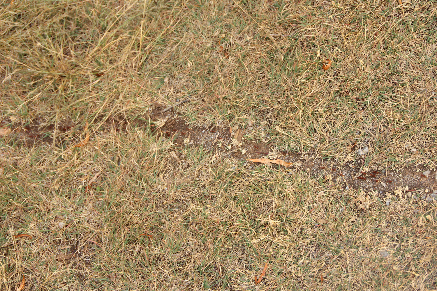
I've heard and read about this activity.  I even think I've seen it in movies, but this is the first time I've seen such construction on so large a scale.  When we visited Lake Ellsworth, we walked up to the dam.  Nearby we saw this line in the grass that extended from the woods clear across the grassed area above the dam.  Large ants had build a highway through the grass.  For ease of movement, everything that impeded their progress had been removed.  Grass had been cut off either side of the path and removed.  Gravel or leaves that they had to climb over or walk around were likewise removed.  If they couldn't pass it in the course of normal walking, it had to go.  It was really fascinating, and best of all, they didn't have to wait for federal funding to get the highway done.

Sunday, May 21, 2017

American Horse Lake

Several of the arms off of the lake have considerable stump fields.
 
American Horse Lake is located in Blaine County, OK, northwest of the town of Geary.  I spent some considerable time trying to find the source of the name for the lake without success.  The lake came from the damming of Squaw Creek in 1966, which runs through a ravine or canyon.  The lake has a 6.8 mile shoreline and depths of up to 70 feet. 

This was my second attempt to paddle American Horse Lake.  The first visit a couple years ago was when the lake was drained and closed for a reconstruction of the dam.  While water has returned to the lake, according to one visitor, the level is still below normal.  The first visit when the lake was dry was interesting in the number of rods and reels that I found on the canyon floor after being lost overboard through the years. 

Blaine County was created out of the 1892 Land Run across lands promised to the Creek and Seminole Tribes after their forced relocation during the 1820’s and 1830’s.  The area was also the home of Clarence Nash, the voice of Donald Duck.  Not surprisingly, he became known as ‘Ducky’ and passed away in Los Angeles in 1985.

This shot of Buddy was taken on the St. Croix National Scenic River
between Minnesota and Wisconsin.
 

We had been experiencing April weather in February, when I made this trip, and between warmth and the healing of my bone fracture, it was time to hit the water.  The state was under a blanket of dense fog.  The forecast was for the temperature to climb close to 70 degrees, and the fog to clear off by noon.  Hoping for clearing skies, I took the time to enjoy blueberry pancakes with my wife before heading south.  Just south of town I saw a roadrunner crossing the road in front of me.  It finished its frantic run by taking flight when it reached the shoulder.  I think that was the first time I have ever seen a flying roadrunner.  The new experience sent me to Google.  It turns out that they rarely fly, because they can run at 20 mph.  They are more inclined to fly to evade a predator (Wile E. Coyote) or to descend a steep bank or hill, but can usually fly only for a minute.  The latter was the case this morning, and when the roadrunner reached the edge of the road, it took off to fly down through a deep ravine.  We always think in terms of car travel, but roadrunners got their name from routinely racing alongside horse-drawn carriages and wagons.  Anyone that has spent time at sea is accustomed to seeing porpoise racing alongside boats and ships, and it seems horses provided just the competitive pace the roadrunners enjoyed. 

Looking up an arm of the lake.  The fog still just clears the trees. 

Between the towns of Greenfield and Geary, I headed west on Cty. Rd. E0940.  It is an 11-mile run west to the sign for the lake pointing south on Cty. Rd. N2520.  When I came through a tree clearing, I saw a herd of a dozen white-tailed deer just off the road on my left that I suppose were equally disoriented by the fog.  My camera was still in its dry bag.  That was not going to be an issue, because as soon as I slowed, they threw their tails in the air and headed for the cover of the woods.   

American Horse Lake offers some confusion for those wanting to launch powerboats onto the lake.  Varying signs I saw said no powerboats capable of more than 6 mph, electric trolling motors only, or bank and tube fishing only.  Any of the above is a boon for paddlers.  There is one concrete ramp and a few picnic tables.  Primitive camping is permitted (no toilet facilities) for a maximum of 3 days.  You would need to carry water.  While the lake’s search page mentions a water well, the hand pump has been stolen and not replaced to date.   

Visibility was still limited when I launched, and blowing mist made the camera a challenge, but we paddled the circumference of the lake.  The water is clear.  The ravine was not bulldozed when the dam was built, so many trees that grew there are still in place in the lake.  There are two main braches and a number of fingers that make exploring the shoreline interesting.  The shoreline is blanketed with countless nickel-sized white freshwater clams.  I spotted one blue heron, and three or four kingfishers.   

I turned on the heater and listened to the radio as I headed from the lake for home and the Super Bowl.  The radio announcer said, “Regardless of what the forecasters promised, we just have to admit that the rest of the day is going to be plain yukky.”  It was fine with me.  I had been in the canoe and on the water. 
This was a day very well lived.


Tuesday, May 16, 2017

The Coming Storms

If I suddenly disappear, it may be that we have joined Dorothy and Toto somewhere over Kansas.  We have tornadoes forecast starting this evening, and the chances continue at least through next week.  I've moved things around so we can drop directly into the storm shelter, made sure the spiders are vacuumed out, water jugs are at the ready, the battery-powered light, rations and screw-lid bucket are in place, and the phones are fully charged.  Then it's just a matter of staying glued to the TV and computer-generated radar screen.  The broadcast stations out of Oklahoma City do a very good job of analyzing storm probabilities and tracks.  So good a job, in fact, that they preempt all other broadcasting so there is no option but to sit and obsess over the possible looming doom.  It is rather like lying on your back looking up at the guillotine blade.  It becomes quite impossible to look away or think about anything else.


On a happier note, this is the latest litter of critters to come out of the shop.  These bunnies have already hopped off to their new homes.

Sunday, May 14, 2017

Oklahoma Bike Ride

Everyday can't be a paddling day.  When the wind is blowing hard, it's
time to resort to the gears on the bike.  Out where there are no
visible address markers, gate signs help you find your way.
Open Oklahoma prairie. 
Name something that takes whatever it wants, wherever it wants, whenever
it wants, with or without permission, takes, takes, and takes, and never
gives anything back.  That, of course, would be the oil and gas industry. 
Years and years of the state legislature giving the industry concessions,
tax breaks, and incentives have left the state 900 million dollars in debt. 
                     Part of that is the lobby arm-twisting, and part of it is the stupidity of
the legislators allowing themselves to be led by the nose, or corrupt enough
to be bought off.  In any event, education suffers, infrastructure
suffers, emergency services suffer, everything suffers, but when oil and gas
is asked to chip in and pay their way, to show appreciation for all they
have been given for free, they still want more.  So, here, while they can't
afford to help rebuild the roads that their heavy, oversized truck loads
destroy, they can still afford to put yet another pipeline across
private land.
There are no end of dirt roads.  These sometimes allow the only chance to
see sights never visible from the paved highways.

When a highway is paved, what happens to the dirt road grader? 
 Sometimes it is just pulled off to the side of the road to provide
decades of interest to break up the endless prairie.

Thursday, May 4, 2017

Lake Ellsworth - Part 2

A juvenile Great Blue Heron leapt into flight from Chandler Creek.
 
I continued up the lake until I was far enough into the headwaters to have only a foot of water.  Telegraph or phone poles and fence posts were found frequently that were left from the days before the lake was built.  Lacking water depth, I crossed to the north shore and followed it west as I continued to explore the shoreline.  Only 25 feet or so from the shore, I repeatedly felt strands of spider web across my face.  Others were draped across the canoe and other parts of my body, so by the time I got back, I had a decent population of stowaway spiders with me. 

 
The shore varies from gradual to rocky and bold like this spot where
the lake turns into Hassenbach Arm.
 
Coming around the point on the north shore brought me to Fisherman’s Cove.  This area is primarily for tent camping.  The cove on the south side of the point looks downright heavenly with acres of mowed grass, a long, gradually sloping shoreline, and trees for pitching a tent under.  It couldn’t look better.  If you round the point to the north side, there is another concrete ramp, but the fisherman’s bait and tackle concession has been abandoned and vandalized.  The town of Lawton is working on developing the property, but the bad news is that they are looking to rent it to a dune buggy and ATV operation.  That would be the end of the quiet for miles around.


An egret hiding in the foliage at the head of Hassenbach Arm.
 
Another takes flight from its tenuous perch atop a wood fence
post submerged but for an inch above the lake's surface.
 
The lake was flat calm when I left Fisherman’s Cove, so I struck out straight across the lake and around the north shore of Treasure Island.  It appears to be a nesting or resting place for migratory waterfowl, and the island was so densely covered with large flocks of Canada geese and pelicans that getting ashore would be messy through all the guano. 

There are many places to stealth camp if weather or time make
it necessary, like this gradual shore into a field without a human
or building in sight.
 
Getting back to the west shore, I paddled under the railroad bridge and into Chandler Creek.  The bridge just cleared my up-reached arm by a couple feet, and has no opening.  The train had come through the evening before at 1620, so I kept an eye on my watch so I could be back by the bridge in time for a nice picture.  It became obvious, as I waited, that the trains run on an as-needed-basis rather than on a schedule.  Meanwhile, at the head of the creek, I found two bridges.  One was the 62/281 bridge, and next to it, on its east side, was the original concrete bridge that spanned the stream before the lake was created.  It sat in the water making a complete barrier to further paddling up the creek.

 
Two bridges in Chandler Creek.  One from before the lake was
created now sits in the water, and the new bridge just behind it.
 
There are big differences between Lake Ellsworth and Lake Frederick, which we had just left.  On Ellsworth, the potential for stealth camping is almost limitless, while on Frederick, it is very spartan.  On Ellsworth, camping is limited only by one’s imagination.  Please be sure to pack in/pack out to preserve this happy situation.  Also, Frederick and Latonka are the party lakes with loud drinkers and fast boats.  Ellsworth is for quiet, basic camping and enjoying nature---at least until the ATV’s show up.


Monday, May 1, 2017

Lake Ellsworth, OK

Union Pacific freight train crossing the junction of Lake
Ellsworth and Chandler Creek.
 
On leaving the Wichita Wildlife Refuge, we proceeded east on Rt. 49 to I-44, north of Lawton.  We traveled I-44 just one exit before jumping off onto Rt. 281/62 north for Lake Ellsworth.  The map shows Lakeside Village, but it’s not easy to find.  It will be the first turn to the right when headed north after passing the commercial intersection of Rts. 62 and 277.  At this intersection is the Valero truck stop, and the only place around to find WiFi.  As you turn onto NE Pine Ave, you may spot a small sign for Ralph’s Resort (580-492-4763).  The ramp is there at L34.79975N Lo98.37323. 


Just below our campsite was a sandbar that made a gathering
place for birds and waterfowl.
 
After leaving Quanah Parker, Lake Ellsworth, with its 53 mile shoreline, is huge by comparison.  It was created in 1962 by the damming of East Cache Creek, its main tributary, but two secondary branches making contributions to the lake are Chandler Creek from the west and Tony Creek from the east.  Ellsworth and Lake Latonka, which we wrote about earlier, are the water sources for the City of Lawton and the Fort Sill military base.  It you cross the railroad tracks to the east from Ralph’s, the campground is a short distance on the left.  For launching a canoe or kayak, there is a nice beach to launch from there rather than going back to Ralph’s.


The gates of the Lake Ellsworth dam.
There is a sand bar on the east side of the campground where ducks, birds, and pelicans congregate.  When I arose our first morning hoping to hit the water, it was so foggy we couldn’t see the sandbar or out onto the lake.  My handheld VHF radio had decided to stay home, so having no way to get weather, we just had to wait and watch.  The area has no WiFi, so even my ‘smart’ phone was dumb on the subject of weather.  We drove down to the Valero truckstop, where I was able to downloaded a weather app on my new phone.  Guess what we learned.  We were under a dense fog advisory.  Tadaaa!


East Cache Creek continues 40-feet below the dam.
 
Unless there are city vehicles going into the maintenance yard across from the campground, nothing stirs unless a train comes through.  It is dead quiet and serene.  Except for one evening, we had the campground to ourselves.  We sat during the evening and watched killdeer, a rabbit with a couple young, several woodpeckers, pelicans, cormorants, bluejays, osprey, cardinals, and a small flock of 6 or 8 bluebirds.  When Treasure Island, which sits in the middle of the south end of the lake 8/10th of a mile offshore, began to peak through the fog at 1115, I rolled Ibi down to the water.
 

The first day of paddling had to wait for the fog to burn off.
Ralph’s Resort is in the SW corner of the lake.  The marina is just inside the low railroad trestle the crosses by the ramp and blocks the mouth of Chandler Creek.  It does a nice job of blocking lake access to any boats much larger than a bass boat.  I paddled east past the dam and into the Hassenbach Arm.  There were a number of coves and branches off the Arm to explore, and where I encountered a large number of egrets, herons, cormorants, and osprey.  They were the only ones out fishing this area, as over the course of 4 ½ hours, I only saw three boats, so this is a very paddle-friendly lake.


Friday, April 28, 2017

Oklahoma is Closed

Illustration credit to Bill Edgar
 

If you want something mismanaged, it isn’t like you don’t have options.  You could give the responsibility for management to #45.  Or you could give the project to one of his administration---almost any of them.  Being from Oklahoma, it is with great chagrin that we confess Scott Pruitt’s ability to endanger public health by increasing air pollution, increasing amounts of mercury, arsenic, and acidic gases in the environment, denying climate change, and more.  Or, you can select the State of Oklahoma, and its governor and legislature for their mismanagement prowess.  They have managed to make Oklahoma among the worst states in the country, like 48th of 50 in educational standards, 6th worst obesity rate, 8th worst support for underprivileged children, as well as poor teacher salaries, poor care for the elderly and ranking 49th for the health of seniors, 49th for addressing teen smoking or 42nd for teen suicide, 45th for general population health, 45th worst incarceration rates, 44th worst for addressing mental illness, has one of the most severe shortages of primary care physicians in the country, poor fiscal responsibility, fifth highest rate of occupational fatalities in the country, and we could go on and on.  However, one of the most ridiculous mismanagements is killing the state’s golden-egg-laying goose---you know, the tourism operation that brings 6.2 BILLION (with a B) dollars into the state each year.  Tourism is the third largest industry in Oklahoma.  The natural beauty encountered in the parks is the one thing that puts a good face on Oklahoma, so it’s obvious that the state’s managers should kill parks and tourism!  To the tourist wanting to visit Oklahoma, the state is posting a large “OKLAHOMA IS CLOSED” sign at the state line by considering closing most or all of 16 state parks they have chosen for the chopping block.  Oh, and best of all, since the state is run by the political party that claims to create jobs, this idea would terminate 80 full-time jobs.  Maybe I didn’t understand. Perhaps the claim was for creating the most job vacancies.     

Wednesday, April 26, 2017

Lake Quanah Parker & the Wichita Mountains - Pt. 2

Geese love the east end of the lake and dense vegetation.
 

The lake is very small, with only a 3-mile shoreline.  The eastern half of the lake is shallow, with geese often seen wading knee-deep amidst a lot of vegetation.  The most scenic area is the western half of the lake that lies west of the launch at L34.71265N Lo98.63972W.  Bison can often be seen dusting themselves in the bare area west of Rt. 49, where you first turn west for the lake.  Bison, longhorn cattle, and elk roam free in the foothills of the Wichita.  The lake was created by the damming of Quanah Creek.  Rt. 49 continues east through the refuge, where you can’t miss seeing bison.  Elk are usually only seen around twilight.

There is no formal ramp, but the road from Rt. 49 to the dam on
the south side of the lake has three pull-offs with walk-in access.

 
For accuracy, it should be pointed out that there is no such thing in the U.S. as buffalo.  A buffalo is a water animal found only in two areas of the world: Africa and Asia.  Early settlers mistakenly called them ‘bufello’, because of their similar appearance, and the name became stuck in the immigrant and settler vernacular.  Some argue that the name goes back as far as the French fur trappers, but there’s one thing for sure.  It is a name given by white men and never used by the original Native Americans. (Note: If you visit the area, do not do something silly like get out of the car to get closer for a better picture.  While they look lumbering, bison can run 40 mph and weigh up to 2,000 pounds.  In Yellowstone, more people have been injured by bison than by bears.)

View across the lake from the launch.

Scenery on the drive to the dam and third pull-off.

Sunday, April 23, 2017

Lake Quanah Parker and the Wichita Mountains

Chief Quanah Parker, Last Chief of the Comanche
 
Leaving Lake Frederick, we were back on the road by 0900.  Because Baseline Road was closed to the east for road construction, we had to backtrack through Manitou.  Going back north on Rt. 183, we turned east on Rt. 62 just south of Snyder.  At Cache, we went north on Rt. 115 through the Wichita Federal Wildlife area.  After the bison were hunted to near extinction, this is where they were reintroduced to the plains. (See post for Jan 12, 2016, Wichita Wildlife Refuge)  This is an interesting area to visit, and Doris Campground is right in the refuge on the north side of Lake Quanah Parker.
Quanah Parker was the last chief of the Comanche, and this area was home to him for most of his life.  He was born between 1842 and 1852 (he estimated in 1850) to Comanche Chief Peta Nokona and Cynthia Ann Parker.  His mother had been taken at the age of nine in a raid on Fort Parker in 1836 near present Groesbeck, Texas, and was assimilated into the Comanche life.  It was from Fort Parker that he adopted the last name of Parker later in life.  His mother was recovered by Texas Rangers after 24 years with the Comanche and returned to her family, but she refused to return to white culture.  She died in 1870 from influenza.


Chief Parker became a very successful farmer and
business man.  In these meetings he would most
likely be seen in his white man's dress.
 
Quanah was recognized as the natural leader of the Comanche, but had never been elected chief by the tribe.  He was a tribal representative at Medicine Lodge, but refused to sign the treaty and led the Comanche on an 8-year battle against the whites and the Army.  He is recognized as the only warrior leader to have never lost a battle to the whites.  The Army tried to starve out the Native Americans by killing off all the bison, and then in 1874, they killed 1,500 Comanche horses, the tribe’s most valuable resource.  Quanah finally gathered the Comanche and led them to the reservation in 1875.  Because of his leadership with the tribe, the rank of Chief was granted to him by the U.S. Government for their own convenience.  The Comanche had never had a central chief, as each tribal band had its own chief.  Designating a sole chief gave the government one person to negotiate with.  Chief Parker, through wise investment and shrewd operation as a rancher near Cache, became recognized as the wealthiest Native American in the U.S.  He built Star House at Fort Sill to finally move his five wives and children out of tipis.  Star House still stands, but was moved to a property at Cache where efforts are still being negotiated to save it.  He was visited a number of times by Theodore Roosevelt, and he led the President on hunting trips in the area.  He died in 1911, at the age of about 66, and is buried on Chief’s Knoll at Fort Sill. 

Thursday, April 20, 2017

The Energy Industry

Photo credit: Damien Ch'ng
 

There is indisputable proof that energy drinks don’t work.  The evidence is along both shoulders of any road you walk down.  How else can you explain people gulping 16 or 20 ounces of liquefied energy and still having too little energy to drop the empty can in the trash?  They can just barely drag the .57 ounce of heavy aluminum to the open vehicle window and shove it out.  Twenty-percent of all energy consumed is used to power the brain, more than any other organ of the body.  If there was really any energy in that drink, the consumer would suddenly have the brain power needed to remember that there are garbage containers by the pumps of every gas station, by the doors of nearly every convenience store, a half-dozen around every fast food restaurant, lining the sidewalks of every town, and inside every store and office. Before reaching home, they will undoubtedly pass a hundred or more half-empty garbage cans.  When they arrive home, they will probably even find one or more trash cans there.  So why does the road shoulder or ditch seem to be the smartest place to leave that empty can or bottle?
One day's collection from a short walk around town.  Amidst the
pile of soda and beer cans are a large percentage of "energy" cans
with all their energy gone to waste.
 
We need to think more about trash, and more about how we properly dispose of it.  Maybe part of the problem with roadside littering, besides laziness and stupidity, is the assumption that “out of sight, out of mind.”  While the litter does seem to blur a bit the faster we drive, it’s still there.  It’s there at least until the wind and rain force it into the ditch, flush it into the nearby stream, creek, river, bay and ocean, where it kills birds, pollutes fish, poisons bottom vegetation, and otherwise destroys the beauty of nature and all it touches.  It doesn’t decay and disappear.  Most of it continues to destroy everything it surrounds for decades, and some of it, forever.  If nothing else, it enters the food chain and returns to us as poison to give cancer to us and our children.  How is this a good idea?


Tuesday, April 18, 2017

The Paddler's Birthday

Many of us tend to scale back celebrations when our birthday
candles risk violating fire codes.  This was my last birthday
"cake", and no I didn't eat both of the éclairs.
 

The older we get, the more painful birthdays become, and the less likely we are to celebrate birthdays or make any fuss about them, like having a party or receiving gifts.  Where did this idea of celebrating a birthday come from?  That question prompted some searching.  Celebrating birthdays was a pagan ritual that dates back to at least ancient Greece.  Because of the birthday being linked to paganism, Christians were slow to warm to the idea of celebrating the day of their births.   Evil spirits were believed to linger about days of important change, like the day you turn a year older, and from this eventually sprang the idea of incorporating candles in the celebration to bring light into the darkness. The Germans were credited with starting the tradition of celebrating children’s birthdays in the 1700’s and having a party, called a kinderfeste, and incorporating a cake or torte with a candle for each year of life.

Somewhere around the time the candles are blown out, everyone usually starts singing “Happy Birthday to you,” the most commonly sung song in the English language according to Guinness World Records.  This music was written as a song for school children.  The original lyrics were “Good morning to all.”  In 1893, two Kentucky school teachers, Patty and Mildred Hill, wrote the song and incorporated it in a book of songs for school teachers.  No one knows when or how the lyrics were changed for birthdays, but it first appeared publicly in a 1933 musical by Irving Berlin.  One of the Hill sisters sued Berlin for copywrite infringement and won.  The copyright is believed to remain in force until 2030, and the Hill estate still receives roughly two million dollars a year for its use, so make sure there are no copyright attorneys at your next birthday party before bursting into song.


Saturday, April 15, 2017

Leave Nothing But Footprints

These pictures were not staged, but were taken as they occurred
on no particular day in a municipal park in Oklahoma.
 

A Missouri paddling club had a large annual party on a river’s sandbar.  It was a huge affair with tables, chairs, and large coolers all floated in.  The sandbar was packed with people.  Everyone enjoyed having a good time throughout the afternoon, but kudos go to these folks who respected nature and the environment enough to insure that Mother Nature wasn’t the victim of their good time.  The code of conduct for all of us venturing into the wild is to “take nothing but pictures; leave nothing but footprints,” as well as “carry in; carry out,” and these were followed beautifully by these paddlers.  Every scrap of waste was picked up to be carried out, the campfire was dismantled and the ashes buried, and the bar was swept with branches so even the footprints disappeared.  After dozens of people had left, it was impossible to tell a human had ever been there.  Not only should such conduct be a source of pride for all the members of the paddling club, but their behavior will be enjoyed even more by those who follow.  This does not just apply to paddlers though; this should be proper conduct for anyone ever raised by responsible parents and teachers, and the most positive use of peer pressure.

So, the question is:  Why is such conduct so foreign to most of the general public?  Why are humans seen to be such selfish, oafish clods more often than not?   How can they conceivably think it is okay to throw bottles, cans, aluminum foil, plastic, and all kinds of waste into every stream and bush, or throw trash out the vehicle window when driving to and from their destinations?  Here are a couple pictures to illustrate.


Drinking straws and their paper wrappers on either end of a park
bench a mere ten feet from a trash can.

It would have been at least a 15-foot walk
with that soda can to the trash can.
 

Maybe there’s something wrong with my thinking.  I just don’t get it.  Here in Oklahoma, sports are the largest and most reverently followed religion of all.  So, where is the logic that people will support, follow, cheer, buy booster shirts, flags, fingers, drink cozies, seat cushions and all manner of stuff emblazoned with the name of the town or state the team comes from only to then go out and trash the community the team represents?  Why cheer “Rah, rah, rah Oklahoma State,” and then bury the State of Oklahoma in garbage?  There’s a definite disconnect there.  It would seem that the best way to show team pride would be to take pride in the communities the teams represent.  Another disconnect is having every road shoulder littered with drink cans emblazoned with the Oklahoma City Thunder team emblem.  Why would a sports franchise spend millions of dollars of publicity money to have their team’s name and reputation transformed into highway litter?  You would think they would at least put a banner on the can saying, “Respect your community. Dispose of empty containers responsibly.”  Of course you can transpose these team, community, and state names with any other without changing the message.


Friday, April 7, 2017

The Report is in on Oklahoma

Pumping Oklahoma oil 24-hrs. a day.


Well, the reports are in for Oklahoma.  The report released by U.S. News and World Report recently should have had Governor Mary Fallin doing cartwheels around her office.  It was, in my opinion, exceedingly rosy.  Oklahoma normally ranks at or near the bottom in every category, but this year it ranked 44th out of 50 overall, but still received a 48 for healthcare.  Nursing home care for the elderly ranked 48th two years ago, but dropped another point last year to 49th. (CBS)

The report by Oklahoma’s own “Oklahoma Watch” gave the state a D+ in education, ranking it 48th out of 51 (including District of Columbia) in 2015.  This new report by U.S. News and World Report ranks the state at 30th.  The odds of it beating out 17 other states in one year when it continues to underfund everything is in a word---inconceivable.  The bulk of the problem comes from the state prioritizing the oil and gas industry for lucrative incentives and tax breaks at the expense of pretty much everything else.  While the state couldn’t fund better teacher pay or educational programs, it handed out $645-million in incentives for FY2010-FY-2012.  (OKPolicy.org)  The standard tax rate of 7% on oil production was instituted in the 1970’s.  While taxes on everything else continue to go up, taxes on oil production have gone down.  Legislation passed in 2014 dropped the tax rate to 2% on new wells for the first three years, and to 1% for 2 years for wells drilled before 2015.

Wednesday, March 8, 2017

CLC Teardrop Camper

Credit: CLC
 

We saw this camper last year at Canoecopia right after they had completed the prototype and put it on the road for the show tour.  It is beautiful and amazing.  This is especially so if you are young and active and don’t have a thousand pounds of kids, grandkids, and cages of birds to haul around as part of your touring entourage.  If building a boat has been floating about in your mind, this is the obvious follow-up to provide economical and carefree traveling and camping.  These are the links for both the construction video, which CLC just finished, and the Chesapeake Light Craft site.