I just received an email from Gus Bianchi about a couple guys paddling the Florida Circumnavigation Saltwater Paddling Trail. He's joining them for a few days in the Big Bend area. If any of you that don't correspond with Gus would like to follow the trip, the link is below. They've been beset by the cold and rain the last couple days, but it will undoubtedly develop into a real interesting trip of about 1,500 miles. They're just getting started, so it's a great time for jumping on board. Thanks, Gus, for the heads-up.
http://kayakaroundflorida.wordpress.com/
Friday, November 29, 2013


Thursday, November 28, 2013
Happy Thanksgiving to All
Best wishes to everyone’s family for a healthy and joyous Thanksgiving. Whether it’s the turkey, stuffing and pies, parades, or football, or all the above, enjoy the day.
Jean just slid the bird in the oven, and the stove and counters are covered with all the other makin’s. We have no family with us, but Jean just enjoys the activities. Her favorite part is the leftovers and not having to cook for the next week. Actually, since our furnace is broken, it’s just as well that we have no company. The thermostate or blower relay died, so we have heat, but I’m acting as the thermostate to turn the heat on and off at all hours. The house temperature roller-coasters up and down from about 58 to 70, but as long as we have heat, I’m not complaining. It’s really not much different than when we heated with wood and had to tend the stove and fire all the time. The only down side is the repairman says he won’t be able to get to us for about a week. It’s still all good.
This is a lot better than the Thanksgiving when we did have the house walls bulging with people and the water pump died. After fighting the water pump for about an hour, I started gathering about a hundred yards of hoses, and ran water from the neighbor’s house. That got us through until I was able to replace the pump motor the next day.
Jean just slid the bird in the oven, and the stove and counters are covered with all the other makin’s. We have no family with us, but Jean just enjoys the activities. Her favorite part is the leftovers and not having to cook for the next week. Actually, since our furnace is broken, it’s just as well that we have no company. The thermostate or blower relay died, so we have heat, but I’m acting as the thermostate to turn the heat on and off at all hours. The house temperature roller-coasters up and down from about 58 to 70, but as long as we have heat, I’m not complaining. It’s really not much different than when we heated with wood and had to tend the stove and fire all the time. The only down side is the repairman says he won’t be able to get to us for about a week. It’s still all good.
This is a lot better than the Thanksgiving when we did have the house walls bulging with people and the water pump died. After fighting the water pump for about an hour, I started gathering about a hundred yards of hoses, and ran water from the neighbor’s house. That got us through until I was able to replace the pump motor the next day.
Sunday, November 24, 2013
Demi-charge

Demicharge Rapids on Google Earth.
Friday, November 22, 2013
A Half-Century Ago

Credit: wikipedia
I’d flounder trying to put an explanation into words. The fact is that in life and death, that’s the influence and impact he had---to create a foreign influence and respect that our nation has never experienced since, to strengthen the United Nations and League of Nations, to lead us into the Age of Space, to create the Peace Corps, to take the greatest steps since Lincoln to eliminate racial segregation and discrimination, to steer the nation through a nuclear stand-off with the Soviet Union, to promote the arts as an essential and uplifting ingredient in life, and numerous things more. Perhaps equally important was the fact that Kennedy was not just the nation’s president. Throughout his short time in office, he was the people’s president.
Jean and I were both drawn by the need to somehow respond to what had happened. I also was working part-time for the state’s largest newspaper, the News-Journal. I was excused from my normal work schedule there to go to Washington to witness the funeral and write a local-perspective article. For many years I kept the aluminum engraving plate used for Kennedy’s portrait that accompanied the article. The portrait was a file photo from President Kennedy’s dedication of the Delaware Turnpike shortly before his trip to Dallas.
When the president was being flown back to Washington, we drove to D.C. On Saturday following the assassination, the president’s flag-draped casket lay in state in the East Room of the White House. On Sunday, a horse-drawn caisson carried him to the Capitol Building where the public could pay their respects. The line of people waiting to pay their respects stretched 40 blocks, or roughly ten miles. We stood in line for hours to file by his casket and military guard of Green Berets in the rotunda. It must have been the early morning hours when we left the Capitol. Wanting to remain near, we slept the best we could on the cold sidewalk in front of the White House the rest of the night. To move about, we had to step between the legs and bodies of the thousands of other people keeping us company. The next morning, as the funeral procession was assembling, we were asked to move to the sidewalk across the street in Lafayette Square. It was from there that we watched the procession being led back from the Capital to the White House led by the Marine Band and the Scottish Black Watch pipe band. While the rest of the precession continued on, a Marine guard accompanied the cortege to the North Portico. From there, they walked to St. Matthew’s Cathedral for the funeral, and went later across the Potomac to Arlington National Cemetery.
With the huge number of foreign dignitaries present and the crowd that had now assembled, we knew we stood no chance of actually being able to witness the burial, so we headed home. We returned to Washington weeks later to visit the grave and eternal flame.
Wednesday, November 20, 2013
It Bears Repeating
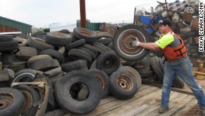
Credit: Erika Clarke, CNN
“Chad Pregracke, an Illinois man who has dedicated his life to cleaning the Mississippi River and other U.S. waterways, was named the 2013 CNN Hero of the Year on Tuesday night. Pregracke organizes community cleanups across the country through his nonprofit, Living Lands & Waters. About 70,000 volunteers have pitched in, helping Pregracke collect more than 7 million pounds of trash in the past 15 years.
“The garbage got into the water one piece at a time,” Pregracke said earlier this year. “And that’s the only way it’s going to come out.”
Pregracke was recognized Tuesday night along with the rest of this year’s top 10 CNN Heroes---everyday people doing extraordinary things to help change the world. He was chosen as Hero of the Year through a five-week public vote on CNN.com.
“I’ll just keep on cleaning up America’s rivers and loving every minute of it,” said Pregracke as he accepted the award Tuesday night. For being named CNN Hero of the Year, Pregracke receives $250,000 to continue his work. That is in addition to the $50,000 that each Hero receives for making the top 10.
On Tuesday night, Pregracke pledged to spread some of his Hero of the Year money to the rest of the top 10 Heroes. “I’ve met so many great people today, the other Heroes, and I’m really moved by all their stories and all the things they do around the world. I’m going to give 10 grand to each of them, because they’re awesome.”
Pregracke, 38, grew up in East Moline, Illinois, where the Mississippi River was in his backyard. As a teenager, he worked as a commercial shell diver and began to notice the heaps of debris in the fabled waterway, which supplies drinking water to 18 million people in more than 50 U.S. cities.
“I saw thousands of barrels, thousands of tires, cars, trucks, and tops of school buses. I got sick of seeing it and just wanted to do something about it,” said Pregracke, whom some have called “the river’s garbageman.”
For more than nine months out of the year, Pregracke lives on a barge with members of his 12-person crew. They go around the country with a fleet of boats, and they try to make cleanup fun for the volunteers who show up in each city.
They use skits, music and mock motivational speeches to get the volunteers amped up, and sometimes they even do a little karaoke. Teams also compete to see who can find the “best” garbage. “We do everything in our power to get people excited about it.” Pregracke said. “We want people to leave feeling good about what they did so they’ll come back.”
Close to 90% of what they recover is recycled. Pregracke said the rest gets disposed of properly.
In addition to the river cleanup, Pregracke has launched a floating classroom barge where his staff educates high school students and teachers about the damages of pollution on river ecosystems. In 2007, his nonprofit implemented a program to plant 1 million trees along river shorelines to protect and restore the natural environment. The group is halfway to its goal.
Pregracke says his nonprofit has already held more than 700 cleanups on 23 rivers, but he says he’s just getting started. He views his work as a different kind of service to the country.”
The nonprofit has a very interesting web site at
http://www.livinglandsandwaters.org/
Monday, November 18, 2013
Paddling the Boreal Forest
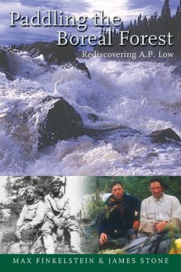
Illus.credit: barnesandnoble
Low left us little about his adventures. He lived in the day when the canoe was a tool, not a recreational vehicle. The canoe was how families moved about to follow migratory herds, how they hunted and fished, how they moved supplies into the wilderness, and how they moved furs out. For Low, the canoe transported him to find rivers, lakes, branches, mineral deposits, and reduce them to reliable maps and reports. The goal of our two authors was to follow and duplicate some of Low’s trips, and by their experience, tell their adventures and Low’s simultaneously. In their part of the world, except for what is destroyed by forest fires, little changes in hundreds of year.
Part of the appreciation of Low and his accomplishments is getting a glimpse of his Herculean determination and perseverence. At one point he had to use a sailing fishing boat for mapping. It was 28 feet long and weighed between one and two tons, and was capable of carrying two tons of provisions, two canoes, and six men. Like his canoe, this sailboat also had to be portaged across land---on rollers---through bog, rugged rocky topography, impenetrable forest, with the men being almost always soaked from continual rain. When the authors went to research Low’s field notes, century-old dried corpses of black flies fell from between the pages. In 1888, while doing the Big and Clearwater Rivers alone, Low performed 184 portages with all the boats, supplies, and surveying equipment. When there weren’t flies, they often endured temperatures between 51 and 101 degrees below zero. If nothing else, these accounts will help keep what you are experiencing on your next canoe trip in proper perspective.
Friday, November 15, 2013
Leaving a Clean Wake
This picture is not from their trip, but a sad sight that's
all too common everywhere we go.
As tough as the trip was, all went well until the next-to-the-last day. They were just getting back to “civilization”, and had to portage around the last falls. The people on both shores of the falls refused them access to their property in order to get around the falls. Kevin was truly shocked. People were portaging around falls in Canada before there was a Canada. It is a reality as expected and logical as finding gas at a gas station. How else are you supposed to get around a falls? He finally flexed his diplomatic skills and convinced the land owner that there was no alternative. He couldn’t go back the way he had come. Plus, it was a one-time deal; he had no plans to return and ask the same favor again. The owner finally relented and allowed them to cross her property, but with the admonition that it was this one time only.
Why would anyone be so disagreeable? I seriously doubt anyone would wake up one morning and decide to be obstinate enough to buck the culture and tradition of a nation so closely tied to the canoe, and thus the need for portaging. No, just as we deserve the government we get, we deserve the welcome we get, at least as a group. We are the heirs of the deeds of those who preceded us, just as Kevin and Andy were now being punished for the behavior of paddlers that had portaged the falls before. If the land owner finds strangers filling their water bottles at their home’s outdoor tap without permission, scattering their garbage around the owner’s property, mashing down their fences, or walking through their flowerbeds, no one should be shocked that those who follow will not find the welcome mat out for them.
When sailing, we had the saying that each of us should “leave a clean wake.” Right or wrong, those behind us will be judged by our actions and those who preceded us, and if we wish to go that way again, we will find the opportunities available to us before may now be absent. Each of us is an ambassador for canoeing and kayaking, and we need to protect our collective reputation tenaciously. Just as it takes a lifetime to build a positive reputation, but only one lie or deceptive act to destroy it, absent-minded or careless behavior on our part may never be forgiven nor any privileges restored. Our duty as a paddler is to leave the streams and wilderness unmarred, campsites looking better when we leave than when we arrived, and leave every person along the way a friend and supporter to all that follow. No one likes seeing trash on their property or in the wild, so if you can pack it in, pack it out. You know, do unto others as you would have them do unto you.
If you wish to see Kevin and Andy’s five-part series, you may start here.
http://www.youtube.com/watch?v=X7nPMROkWp8
Wednesday, November 13, 2013
Rocky Lake - 2
I’ve been trying to paddle Rocky Lake for two years. There is no particular reason for that other than wanting to paddle all the lakes of Oklahoma. The logic was that I’d start with the most drought stricken area first in the hope that conditions and enjoyment would improve as I moved further east.
 Conditions were horrible, but not a surprise. The travelok.com site on lake conditions was established to provide up-to-date information on lakes from both tourism and health perspectives, the latter mostly involving the presence of blue-green algae. Getting small towns to cooperate in providing timely information on lake conditions, I knew from outset, would be impossible, and I voiced that opinion to the lady overseeing the program as I wished her luck. Sure enough, the latest information is from the 3rd of July, 2012, with no update in fourteen months. Hobart’s interest in public health is best displayed by my effort to get current conditions before making the trip. I called the city to speak with the person responsible for reservoir oversight. I was asked why I wanted to speak with him, so I explained that I was coming to canoe the lake, and was looking for current conditions, like water level and the existence of blue-green algae, which can cause significant health issues. In response I heard, “What lake? We have a lake? I didn’t know we have a lake!”
 Since my arrival at Rocky Lake a year ago, the lake has been posted as closed to fishing due to fish kills from algae. The sign was still there, but I didn’t plan on fishing, and I also didn‘t plan on coming back for another try. This was going to get done. There were two issues here: water level and algae bloom.
 The sayings is, “If it’s green on top, STOP!“ Algae exists in all waters, all the time. However, their levels remain as a normal part of the ecosystem. If the water is not normally replaced or freshened by water flow or rain, and water temperatures and nutrients, such as agricultural run-off, become abnormally high, as in late summer, the algae can go into a “bloom.” At dangerous levels, blue-green algae, or cyanobacteria, will produce toxins that can cause allergic reactions like skin rashes and eye irritations, asthmatic symptoms, diarrhea, vomiting, liver and nervous system reactions. Toxicity can be particularly dangerous for small children and pets, resulting in illness or even death in extreme cases.
 The drive back to the lake was covered with debris and overgrown weeds. I could find no official site that gave water levels, but it was obvious the water was down a good ten feet. The water was as thick as a soup, and clarity reached only one-half inch. Algae was thick along both the shore and in open water. I wore 12-inch rubber boots to avoid the water as much as possible. My only exposure to the water was from sponging the mud out of Buddy before setting him back up on top the Ram. I didn’t even realize I had a hangnail on my right hand, but sure enough, by the next day it was infected. A day of Neosporin took care of it. Except for a central spine down the south end of the lake, near the dam, water was so shallow I dipped mud with nearly every stroke. At the northern end of the lake, the water was putrid and stunk badly, and most of the feeder branches was inaccessible. All I can say is that I’ve checked off Rocky Lake, and it’s history.

I'm standing at what would normally be the water's edge. There's
a drop of a couple feet off the end of the ramp, and still a good
distance to the water. The rust marks on the poles show where
the floating wharf would normally rest.

If it's green on top, STOP!

Winged bedlam as a large flock of pelicans take off.

It's not a great picture, since it's backlighted, but the stains on the
intake pipe show how far the lake level has dropped.
Tuesday, November 12, 2013
Rocky Lake
Rocky Lake is on P. 39, grid I-9 of the Oklahoma DeLorme Atlas and Gazetteer, and page 140 of the “Lakes of Oklahoma” guide by the Oklahoma Water Resources Board. It is 347 acres with an 8 mile long shoreline. It is also called Hobart Lake, as it is a reservoir for that town.
Hobart is another of those Oklahoma towns that sprang into existence overnight following the opening of reservation lands for white settlement. It has been part of the KCA Reservation (Kiowa, Comanche, and Apache). At the opening of the reservation, settlers drew lots of free Indian land. On August 6, 1901, 2,350 people descended upon the land, making it one of the smaller land rushes. They first settled in tents, giving the area the name of Ragtown. The town’s tents were gradually replaced by wood structures, and by 1903, the town had electricity and an ice plant. The name was later changed to honor Garret Hobart, 24th Vice President of the United States. Like many Oklahoma towns, its population reached a peak in 1950, and has since been in a steady decline.
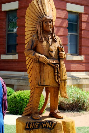 Chief Lone Wolf the Younger (1843-1923) was a Kiowa Chief depicted by a statue on the lawn of the Kiowa County Courthouse. It was carved from an elm tree by chainsaw carver Clayton Coss.
Before paddling Rocky Lake, it's important to understand how this area was settled. In October, 1867, 5000 Indians met U.S. officials at Medicine Lodge Creek in Southern Kansas to ratify the Treaty of Medicine Lodge. Kiowa and Comanche tribes were represented, but the Apaches refused to attend. The U.S. would set apart 2.9 million acres of land for the KCA Reservation, “for the absolute and undisturbed use and occupation of the Tribes.” In exchange for the 2.9 million acres, the tribes would cede 93 million acres, but no more lands could be ceded without signatures from three-fourths of all male adults living on the reservation.
In 1892, the Jerome Commission was one of 15 such commissions working to move Native Americans off the lands they had been forced to move to in the Indian Territories, and promised total dominion over. The objective was to give lands already promised to the tribes to settlers. The justifications for this action were such things as “it was God’s will,” or “the Indians didn’t know how to farm, so weren’t making proper use of the lands.” The Jerome Commission proposed changing the Medicine Lodge Treaty, but the tribes unanimously opposed reallotment, or the selling of their land, as well as any further railroad rights-of-way across their lands. They wanted their lands left undisturbed as guaranteed by the treaty. The Commission argued that the tribes did not need 2.9 million acres, but only 500,000 acres, and the remaining 2 1/2 million acres would be opened for settlers. In spite of much debating by both sides, nothing was resolved, so the Jerome Commission decided on a deception by returning to Congress and assuring them that they had the required signatures of three-fourths of the Indians needed to set aside the provisions of the Medicine Lodge Treaty.

In June 1900, Congress passed legislation taking title of the 2.9 million acres of the KCA Reservation. Lone Wolf fought for an injunction through four courts over three years, including the U.S. Supreme Court. There Lone Wolf was told that Indians were the ward of the U.S. Congress, and Congress therefore had the right to annul, abolish, or repeal “any provision of the treaty that went against the best interests of the United states.”
By July 24, 190l, over 150,000 people had registered for the lottery drawing for the 11,638 homestead sites on the reservation lands. Of the 500,000 acres the KCA were forced to accept, 480,000 acres had been set aside for common use, which meant that farmers and ranchers were free to use 96% of the Indian lands for grazing cattle. By 1906, that too had been opened for white settlement. By the end of the “allotment era,“ their 2.9 million acres had been reduced to 3,000 acres.
Following his defeat in all the courts, Lone Wolf returned to his allotment on the reservation, where he remained with his family until his death in 1923. It was not until 1955 that the Indian Claims Court finally ruled in the KCA’s favor, and they were paid $2 million for the lands they could never reclaim. The bottom line was the tribes had given up 93,000,000 acres of land for the eventual $2 million, or 2 cents per acre.
Hobart is another of those Oklahoma towns that sprang into existence overnight following the opening of reservation lands for white settlement. It has been part of the KCA Reservation (Kiowa, Comanche, and Apache). At the opening of the reservation, settlers drew lots of free Indian land. On August 6, 1901, 2,350 people descended upon the land, making it one of the smaller land rushes. They first settled in tents, giving the area the name of Ragtown. The town’s tents were gradually replaced by wood structures, and by 1903, the town had electricity and an ice plant. The name was later changed to honor Garret Hobart, 24th Vice President of the United States. Like many Oklahoma towns, its population reached a peak in 1950, and has since been in a steady decline.
Depiction of Chief Lone Wolf the Younger
Hobart, OK
Photo credit: city-date.com
Before paddling Rocky Lake, it's important to understand how this area was settled. In October, 1867, 5000 Indians met U.S. officials at Medicine Lodge Creek in Southern Kansas to ratify the Treaty of Medicine Lodge. Kiowa and Comanche tribes were represented, but the Apaches refused to attend. The U.S. would set apart 2.9 million acres of land for the KCA Reservation, “for the absolute and undisturbed use and occupation of the Tribes.” In exchange for the 2.9 million acres, the tribes would cede 93 million acres, but no more lands could be ceded without signatures from three-fourths of all male adults living on the reservation.
In 1892, the Jerome Commission was one of 15 such commissions working to move Native Americans off the lands they had been forced to move to in the Indian Territories, and promised total dominion over. The objective was to give lands already promised to the tribes to settlers. The justifications for this action were such things as “it was God’s will,” or “the Indians didn’t know how to farm, so weren’t making proper use of the lands.” The Jerome Commission proposed changing the Medicine Lodge Treaty, but the tribes unanimously opposed reallotment, or the selling of their land, as well as any further railroad rights-of-way across their lands. They wanted their lands left undisturbed as guaranteed by the treaty. The Commission argued that the tribes did not need 2.9 million acres, but only 500,000 acres, and the remaining 2 1/2 million acres would be opened for settlers. In spite of much debating by both sides, nothing was resolved, so the Jerome Commission decided on a deception by returning to Congress and assuring them that they had the required signatures of three-fourths of the Indians needed to set aside the provisions of the Medicine Lodge Treaty.

From a distance, Rocky Lake looks almost idyllic.
In June 1900, Congress passed legislation taking title of the 2.9 million acres of the KCA Reservation. Lone Wolf fought for an injunction through four courts over three years, including the U.S. Supreme Court. There Lone Wolf was told that Indians were the ward of the U.S. Congress, and Congress therefore had the right to annul, abolish, or repeal “any provision of the treaty that went against the best interests of the United states.”
By July 24, 190l, over 150,000 people had registered for the lottery drawing for the 11,638 homestead sites on the reservation lands. Of the 500,000 acres the KCA were forced to accept, 480,000 acres had been set aside for common use, which meant that farmers and ranchers were free to use 96% of the Indian lands for grazing cattle. By 1906, that too had been opened for white settlement. By the end of the “allotment era,“ their 2.9 million acres had been reduced to 3,000 acres.
Following his defeat in all the courts, Lone Wolf returned to his allotment on the reservation, where he remained with his family until his death in 1923. It was not until 1955 that the Indian Claims Court finally ruled in the KCA’s favor, and they were paid $2 million for the lands they could never reclaim. The bottom line was the tribes had given up 93,000,000 acres of land for the eventual $2 million, or 2 cents per acre.
Saturday, November 9, 2013
River Horse

Illus. credit: goodreads.com
There are tidbits that make our history better appreciated. “Plowboy Bend bears the name of a sternwheeler sunk there…,one of more than four hundred steamboats to go down on the Missouri, half of them from hitting snags. The average life of a nineteenth-century paddle-wheeler on the river was less than two years.”
There’s a lot on environmental topics, from ranchers shoving their dead cattle, cars, trucks and machinery into the river to use it as their personal sewage canal, running barbed wire across streams to claim running rivers as private property, the greed of miners that would blow sixty-five million tons of mountain into a scenic river to claim just thirteen pounds of gold, or the sign he saw that reflects this attitude: “Hungry? Eat an environmentalist.”
If you can’t find the opportunity to make your own trip from Atlantic to Pacific, make your way through this book. You’ll enjoy the ride.
Friday, November 8, 2013
The Long Road Home
We were up early and ready to go at 7a.m., but we were greeted with a heavy downpour. We waited for a lull in the rain so I could get the RV ready without being drowned in the process. We didn’t do too badly, as we were still on the road by 8:30.

 Going down I-35, we stopped at a rest area north of Ames, Iowa, at Mile Marker 117. They had done a unique thing that was both artistic and provided supplemental lighting for the rest area during the night. Black silhouettes of Iowa cultural and historic scenes had been cut and placed over translucent boxes that were illuminated from the inside. The silhouettes were quite visible during the day, and were backlighted at night.
 At 7 p.m. we arrived at Nine Eagles State Park near the Iowa state line on I-35 (at exit 4 Hwy 69, near Davis). It’s unfortunate that the campground doesn’t seem more heavily used, as its quiet and enjoyable. There are three campgrounds in the park, and we had the campground we were in entirely to ourselves. The land had once been the home of the Winnebago tribe, but it became a state park some time after the tribe had been forced to the Indian Territories in Oklahoma. We had a very enjoyable visit from a campground volunteer whose family used to live on these lands. His grandfather was a Winnebago brave, and his mother was a McCoy, of the notorious Hatfields and McCoys, of West Virginia and Kentucky.
 By late afternoon the next day, there was no question that we were back in Oklahoma. The wind was blowing, the soil was parched, and the thermometer was topping a hundred degrees. Cool, green, and beautiful Wisconsin was too far in the rear-view to be seen, and we have just our memories to hold us over until we’re able to return.


Ames, Iowa, rest area's functional art.

Hwy. 69 was a pretty drive. An Amish wagon had us in tow for
a couple minutes. Since we were on both a curve and approaching
a hill crest, passing was impossible. When he realized we were there,
he politely pulled off onto the grass to let us pass.
Fields were filled with wildflowers. As close as I can determine,
this is checker mallow, but I won't put any money on it.
Wednesday, November 6, 2013
Joy Johnson Crosses Finish Line

Joy Johnson, named Joy because she was born on Christmas Day.
Credit: Rachael Levy, New York Daily News
Tuesday, November 5, 2013
More on Wisconsin
Sunday was an R&R day. We got up late, had pancakes for breakfast while we watched the birds, turtles, and fish outside our RV window. The Wood River didn’t look like anything we could paddle, but it was a haven for wildlife activity. I read a paddling book I’d have to get back to the library as soon as we got home, and then went over the maps to lay out our return trip from Wisconsin to Oklahoma.
 In the afternoon, Jean wanted me to see the Crex Meadows that she had visited while I was on the St. Croix. Crex Meadows is a 30,000 acre wildlife area outside of Grantsburg. It is part of the 1,500 square mile Northwest Wisconsin Pine Barrens, a sandy plain left when the glaciers receded 13,000 years ago. The glaciers left countless pockets in the soil that now provide small, shallow lakes which are ideal for birds, waterfowl, and game.
In 1912, the Crex Carpet Company purchased 23,000 acres of the existing wildlife area to grow grass for the production of grass rugs until linoleum replaced grass as a floor covering. The decline of this market drove the carpet company into bankruptcy in 1933, but the Crex name remained. Through the depression and 1940’s, many people attempted agriculture in the barrens, but the soil was not adequate to support crops, and the lands were soon tax delinquent. In 1946, Wisconsin purchased the land to create the wildlife area.
 The DeLorme Atlases are great for finding every landing and access road in an area, so we followed the atlas down to the river’s edge at Norway Point to see the St. Croix north of the wildlife area. The National Park Service publishes a very nice set of maps showing all the camping areas, put-ins, and ramps along both the St. Croix and Namekagon Rivers, as well as all the facilities at each location. The NPS tries to keep segment maps in boxes along the route, but rather than risk some of them being missing from a location when we may need them, as soon as we returned home, I called the NPS and requested the full set of maps covering the St. Croix National Scenic Riverway. Their contact information is: St. Croix National Scenic Riverway; 401 N. Hamilton Street; St. Croix Falls, WI 54024.
Phone: 715-483-2274.
 To have complete information on the area, I also obtained two books, Paddling Northern Wisconsin and Paddling Southern Wisconsin. Both are authored by Mike Svob, and they cover 27 rivers and 32 rivers respectively. While they are intended as reference books, I’ve read both cover to cover, and would strongly recommend them for anyone wishing to take advantage of the great paddling opportunities in Wisconsin. They include camping information, water levels, gradients, access locations, shuttle routes, river class, and maps for each run with mile markers. I only found two shortcomings in the books. Mike is a whitewater paddler, so he enjoys charging through any rapids, so information on portages around rapids is sparse. He considers any water that isn’t noisy and frothy to be dead water, so he ignores any information on connecting lakes along a riverway. These shortages are minor, and I still consider the books a great resource.
Last Christmas Jean also got me the DVD “River Trails of Southern Wisconsin,” done by Morrall River Films. It’s a less academic approach, but still very complete, and with the color video of the areas being paddled, the DVD is both entertaining and theraputic if weather or circumstance have you locked in the house too long. In any event, the final point to stress is that I’m greatly indebted to Rex Klein and the Great River Rumble for introducing me to this stunningly beautiful area. I can’t wait to get back. Let’s face it, with 59 rivers and 15,074 lakes in Wisconsin, each surrounded with natural beauty, interesting history, and wildlife, what more needs to be said. See you there!

Phlox at James McNully Campground

Gathering pollen.

Last Christmas Jean also got me the DVD “River Trails of Southern Wisconsin,” done by Morrall River Films. It’s a less academic approach, but still very complete, and with the color video of the areas being paddled, the DVD is both entertaining and theraputic if weather or circumstance have you locked in the house too long. In any event, the final point to stress is that I’m greatly indebted to Rex Klein and the Great River Rumble for introducing me to this stunningly beautiful area. I can’t wait to get back. Let’s face it, with 59 rivers and 15,074 lakes in Wisconsin, each surrounded with natural beauty, interesting history, and wildlife, what more needs to be said. See you there!
Monday, November 4, 2013
River Rumble '13 - Day 8
Today we’d end our journey with the longest paddle of the trip---22 miles from Prescott, down the Mississippi to Red Wing, MN, the home of Red Wing shoes and boots. Anyone that has done more than work in an office knows Red Wing boots, from work boots, motorcycle boots, hunting and hiking boots, ski boots, and, yes, shoes, but they are best known for high-quality American-Made boots.
 Red Wing was established in the 1850’s, and named for the Dakota Sioux Chief Red Wing. His name, Hupahuduta, came from the practice of dyeing a swan’s wing red as a sign of his rank or office. Red Wing is the county seat of Goodhue County, the largest wheat producing county in America in 1873. In its days as a paddlewheel steamboat port, Red Wing could ship a million bushels of wheat a year.
 The downtown area has been revitalized, and Red Wing remains a lively and viable area. When we paddled into town we passed along the riverfront where a festival was in full swing. The St. James Hotel, where the Great River Rumble would hold our farewell banquet, was built in 1874. It was a popular stopping place for steamboat passengers and businessmen. Now on the Registry of Historic Places, it continues to host the city’s visitors in a lavish style to this day. It’s survival is due in no small part to Red Wing Shoes, which purchased the hotel in 1977 and financed its renovation. They also added a shopping court and a new section for business offices. Sixty-one of the 62 rooms bear the name of a steamboat that worked the Mississippi. The last room is called the Red Wing Iron Works Suite, a lavish apartment with granite counter tops, jacuzzi, fireplace, and a view of the Mississippi River. An enjoyable time can be spent just roaming the halls to look at the framed pictures of the town and river during the gilded age.
 Every effort was made to get as early a start as possible on this busy day. Robert Burns certainly knew what he was talking about when he said, “The best laid plans of Mice and Men oft go awry.” His words rang true at breakfast in the middle school. The caterer that accepted the challenge of breakfast for a couple hundred people had certainly over-stepped his skill level, and it was no more obvious than when they walked in with a 20-cup coffee pot. More followed, but neither the flow of food nor coffee was keeping pace with the long line of people that had rushed to get to breakfast as early as possible. As the old Army dictum goes: hurry up and wait. This is not sour grapes. It was just interesting how on the one day when haste was most needed, something came along to shift progress into a slowness competition.
The start down the Mississippi was like a picture out of Huckleberry Finn---quiet and peaceful, a mist rising off the water, and just a couple fishermen allowing their boats to drift with the gentle flow of the current. However, this was a Saturday, and powerboats began rolling into the river from this recreational-boating hub. As the day got warmer, the wakes became larger, but everyone seemed to take them in stride.
The most anticipated event of the day for most of our party would be locking through Lock and Dam #3 near the Prairie Island Indian Reservation. We had to wait for a large flotilla of powerboats to empty out of the lock, but when the signal turned green, we all paddled our way into the lock. The roughly 100 canoeists and kayakers divided and made their way down both sidewalls of the lock until they grabbed lines hanging from the top of the lock. Although the huge lock was made to accommodate large rafts of barges, we managed to cover its full length, rafted at least two-deep. After the gates closed, we slowly dropped eight feet before the lower gates opened to flush us back into the river.
Just for fun, see if you can detect a theme here. Prairie Island was chosen as a reservation for the Dakota Sioux in 1889. Then, “much of the reservation land was lost following the construction of Lock and Dam #3 along the river by the United States Army Corps of Engineers.” Then it was decided that some the remaining reservation lands would be a great place to build the Prairie Island Nuclear Power Plant. Then it was decided that reservation lands would be a great place to store radioactive nuclear waste in above-ground steel casks.
We paddled past the festival on the Red Wing waterfront, where hundreds of folks watched and waved. Then we passing under the Hwy. 63 bridge, which connects Red Wing with Wisconsin and a direct route to Minneapolis-St. Paul. Another mile further down the river brought us to Colvill Park, where we would take out and load our craft onto our vehicles. Then it was a race to find a place to take a shower and get ready for the farewell banquet to be held at the St. James Hotel.

Chief Red Wing

Buddy and I paddling down the Mississippi River.
Photo credit: Maryellen Self

After the 8-ft. drop in Lock #3 (see the wet area on the walls), the
lower gates opened to allow us to continue down the Mississippi.
Photo credit: Maryellen Self. The time stamp is off. The date was
Sat. 3 August. 13
The start down the Mississippi was like a picture out of Huckleberry Finn---quiet and peaceful, a mist rising off the water, and just a couple fishermen allowing their boats to drift with the gentle flow of the current. However, this was a Saturday, and powerboats began rolling into the river from this recreational-boating hub. As the day got warmer, the wakes became larger, but everyone seemed to take them in stride.
The most anticipated event of the day for most of our party would be locking through Lock and Dam #3 near the Prairie Island Indian Reservation. We had to wait for a large flotilla of powerboats to empty out of the lock, but when the signal turned green, we all paddled our way into the lock. The roughly 100 canoeists and kayakers divided and made their way down both sidewalls of the lock until they grabbed lines hanging from the top of the lock. Although the huge lock was made to accommodate large rafts of barges, we managed to cover its full length, rafted at least two-deep. After the gates closed, we slowly dropped eight feet before the lower gates opened to flush us back into the river.
Just for fun, see if you can detect a theme here. Prairie Island was chosen as a reservation for the Dakota Sioux in 1889. Then, “much of the reservation land was lost following the construction of Lock and Dam #3 along the river by the United States Army Corps of Engineers.” Then it was decided that some the remaining reservation lands would be a great place to build the Prairie Island Nuclear Power Plant. Then it was decided that reservation lands would be a great place to store radioactive nuclear waste in above-ground steel casks.
We paddled past the festival on the Red Wing waterfront, where hundreds of folks watched and waved. Then we passing under the Hwy. 63 bridge, which connects Red Wing with Wisconsin and a direct route to Minneapolis-St. Paul. Another mile further down the river brought us to Colvill Park, where we would take out and load our craft onto our vehicles. Then it was a race to find a place to take a shower and get ready for the farewell banquet to be held at the St. James Hotel.
Lobby of the St. James Hotel
Credit: historichotels.org
While I was paddling down the river, Jean had been staying in our RV and enjoyed the hospitality of Grantsburg, WI. She drove down to meet me, and was waving from the bank when I pulled in. The staff at the park pool building were gracious enough to allow a few of us to shower and change there, and then it was off to the hotel. Since we had a two-hour drive back to our RV in Grantsburg, we left at 8:45, shortly after dinner concluded. As soon as we got back to the RV, we dropped into bed exhausted. In fact, we would remain there at the James McNully campground an extra day for rest and relaxation before making the 900-mile run back home.
Saturday, November 2, 2013
River Rumble '13 - Day 7

Buddy takes a breather on the shore of the St. Croix.

An hour's relaxation and a dive into the food sack.

A slough along the St. Croix with its peaceful setting.

A Google Earth image shows Prescott, where the crystal-clear
waters of the St. Croix try to mix with the muddy Mississippi.
Thursday, October 31, 2013
River Rumble '13 - Day 6 (Hudson)
Hudson seemed to have a little trouble with its own identity. It was first called Massey’s Landing, but then named Willow River after being established in 1840. It was then renamed again as Buena Vista, and finally the first mayor petitioned to change the town’s name again to Hudson in 1852 since the bluffs along the St. Croix reminded him of the Hudson River Valley in New York, from which he had migrated. With a population of 12,719 (2010), Hudson is the St. Croix’s second largest city.
 After crossing under the Stillwater lift-bridge, we paddled into the harbor at Hudson. We had protected water, a nice sandy beach to land on, and a small park for camping. We had six porta-potties, which was a great luxury after the first night with two. We were on our own for dinner in town, and we scattered out to patronize most of the establishments in town. It was a very relaxing and friendly environment with children playing in the playground, sailboats sailing gently about the harbor on the light breeze, which was also being enjoyed by a number of hot-air balloons.


 One of the fun parts of large paddling groups is the opportunity to meet the wide range of people, from all walks of life, that are attracted to paddling. You have both the chance to share their life and paddling experiences, and pick up paddling tips that will enhance your abilities and your enjoyment of the sport (or philosophy for life, depending in which category you count paddling). For example, I decided to purchase Buddy, my 14-ft. Kevlar Hornbeck, because of meeting Ralph Schroeder, of Quincy, CA, on last year’s River Rumble. Ralph had a Placid Boatworks 15-ft.RapidFire solo canoe, an adaptation of the famous Adirondack pack canoe. Placid Boatworks advertises a finished boat weight of 25-30 pounds. Ralph said his was 25-pounds, and I marveled at every stop how he could just throw his canoe on his shoulder and start up the hill. We all chipped in to help each other get our boats up from the river to a secure area for the night. Ralph would just say, “Thanks, but I’ve got it,“ and off he’d go. We had been back from the Missouri River trip only a few days before I started a search for a lighter pack canoe, a search that led me to the Hornbeck 14. Placid Boatworks has since found new facilities, but at that time had lost their production plant to a fire.

I doubt there’s anyone on the Great River Rumble that doesn’t know Maryellen Self. If she doesn’t know you, you’ll see her heading right at you with her arm outstretched as she says, “Hi there. I’m Maryellen. That’s Mary and Ellen, but together as one name. Who are you and where are you from?” Every day she’s a floating Welcome Wagon as she paddles from one end of the fleet to the other so she can talk with as many people as possible.
 Being back in close quarters for camping, I again appreciated the necessity of earplugs for a good night’s sleep when camping. This night it was a half-dozen women sitting right outside my tent swapping stories and laughing, but as in the past, it could just as easily have been trains, tugboats switching barges, industrial noise, late-night guitarist/singer wannabes, card games, or any number of other distractions. Trust me. Don’t leave home without a good pair, or several good pair, of earplugs. The next morning will look a whole lot rosier after a good night’s rest.


I just liked this picture. The long focal length was able to combine
the nearby trees, a flag on a piling in the marina down the harbor, and
the balloon crossing the river from Bayport. The elements span a
couple miles, but the flag is superimposed on the balloon and framed
by the trees.


Ralph Schroeder and Maryellen Self at the Hudson park.

Michael Anderson passing one of the many bluffs along the St. Croix.

The Hudson park that was our camp for the night. Our canoes and kayaks
spent the night on a nice sandy beach mere yards from the water's edge.
Wednesday, October 23, 2013
River Rumble '13 - Day 6 (Stillwater)
On Thurs., 1 Aug., we had a 17 miles paddle from Marine on St. Croix to Hudson. The paddling pace was accelerated significantly for the remainder of the trip as we headed toward Stillwater and Hudson, the two largest cities along the St. Croix. On reaching Stillwater, the river widens quite a bit, and they indeed call it Lake St. Croix.
 Stillwater was another of the logging towns, but its local importance is seen by the sudden jump in population from the 700 of Marine to the 18,000 of Stillwater. It is often called Minnesota’s birthplace, as the convention held to commence the move toward Minnesota’s statehood was held in Stillwater. Three cities were selected as locations for the upcoming state’s important business: St. Paul as the state’s capital, Minneapolis for the University of Minnesota, and Stillwater as the location of the area’s first territorial prison, opened in 1853. With the sudden widening of the river a couple miles north of town, Stillwater became the site for a major log boom during the lumbering period. Steam-driven paddlewheelers were a common sight on the river, and a few still operate on the St. Croix in the tourist trade. It would be hard to get my day started without my morning coffee and toast with peanut butter, so I’m indebted to Charles Strite, of Stillwater, for his 1921 invention of the toaster.
 From the very beginning, Stillwater had all the ingredients for a rapidly developing community. It was on the stagecoach line, the large area of “still water” made it the natural site for log booming, and it became the supplying outlet for all the other sawmills along the river valley. Associated wood manufacturing followed to include roofing shingles, flooring, furniture, and windows and doors. Bayport, a suburb of Stillwater, is still the home of Anderson Windows and Doors.
 The Minnesota Territorial Prison in Stillwater was built on the site of the last great battle between the Ojibwa and Dakota tribes, but is best remembered as the home of the Younger Brothers (Cole, Bob, and Jim), part of the Jesse James gang. They were captured by a posse of more than 150 men following a botched robbery attempt of the Northfield, MN, bank in 1876. Bob died in prison of tuberculosis in 1889, and Cole and Jim Younger were paroled in 1901. When Jim committed suicide in October, 1902, his body was found to still contain 14 bullets from his days as an outlaw.
 The Soo Line was a railroad created out of the combined assets of the Wisconsin Central Railroad and the Minneapolis, St. Paul, and Sault Ste. Marie Railroad. The name came from the phonetic spelling of Sault. Until this was done, Chicago and Milwaukee, with their direct railroad connections with Eastern markets, had control of the movement of the grain and flour coming out of the Great Plains. The Soo Line, with investments from the Pillsbury and Kellogg families, gave area farmers better prices and greater control over the marketing of the area’s grain crops. The orginal bridge across the St. Croix, built in 1884, was much lower and had substantial grades into and out of the valley, and required the use of helper-engines to conrol the speed of trains descending into the river valley, and to enable them to climb back out again, The high bridge was built in 1909 to eliminate this problem, and is a significant landmark along the river. It is 184 feet above the river, and 2,682 feet long, and rests on five steel arches that rise above the valley.


In an ongoing effort to protect the pristine waters of the St. Croix,
rest stops are anchored at several locations along the lower river.
You simply pull your boat alongside the anchored barge and tie-off,
climb up to the deck of the barge, and visit one of several porta-potties
secured there, including one that's wheelchair-accessible.

Approaching the Soo Line Railroad bridge.

Three of the five arches elevating the rails above the river valley.

The Stillwater lift bridge.

Steamboats docked at Stillwater below the lift bridge.
Monday, October 21, 2013
River Rumble '13 - Day 5A

With a much larger area, we were able to spread out across a park of
lush grass beside the Millstream Pond in Burris Park.

Created first as the mill's company store, the general store has operated
continuously since 1849.

The Marine brass band assembled before the general store and town hall
on the 4th of July, 1905. Credit: Washington Co. Historial Society

From below our put-in the next morning, we could see the millstream
running gently into the St. Croix. The mill would later convert to steam
power, but the massive power of water can be appreciated when you look
at this brook and remember it powered the cutting of millions of board
feet of lumber.
Saturday, October 19, 2013
River Rumble '13 - Day 5
The folks in Osceola wanted to make sure we didn’t forget their hospitality, and if hot showers and the Bending Branches tour weren’t enough, they sealed themselves in our memories with breakfast. This would be the breakfast of the entire trip: three pancakes and scrambled eggs, Danish, coffee, cranberry juice, orange juice, sausage, and a huge bowl of mixed fruit on each table, and more coffee. If we didn’t get our fill from one heaping plate, they walked among the tables throughout breakfast with trays of extra eggs, pancakes, and everything else. I mean those folks in Osceola knew what they were about!
 Today was another short paddle, just 11 miles from Osceola to Marine on St. Croix, MN. This was the day I saw the seven bald eagles and the one golden eagle, and some of the huge second-generation white pines that made this area famous.
 We had a mid-day break on a sandbar where we were met by the St. Croix River Association. They are a volunteer group that fosters appreciation of the beautiful St. Croix River, do river clean-up projects, monitor activities in the watershed that may impact the river, promote public awareness, support and work with the National Park Service and natural resources departments of both states, and more. They had brought a pontoon boat loaded with snacks of pastries and fruit, and beverages, hot and cold, all of which they served to us on the up-turned hull of a canoe. One of their events is the annual St. Croix photo competition. To see some great river pictures, you can go to the following link and view the 96 pictures entered in the 2013 competition.
http://www.scraphotos.org/Contest2013
 We had some passing sprinkles in the morning, but it cleared off as soon as we landed at the take-out. We went ashore at a landing at the foot of Maple Street in Marine. Our canoes and kayaks were set along the path that led up the hill to town. Right at the top of the footpath was an ice cream shop that many of us returned to after dinner. We turned south on Judd Street and walked to a large, beautiful park set around Lower Mill Pond, from which the stream provided water-power to the first commercial sawmill in Minnesota. The park seems to be called alternately either Millstream Park, or Burris Park. In either event, it was shaded by stately old trees and covered with a lush, loamy sod that nearly made an airmattress redundant.
 Located in the park is the original home of settlers Sven and Stava Anderson. Built in 1852, the logs still show the marks of Sven’s axe as he trimmed and squared the logs. Between then and 1869, the couple raised three children in the cabin. Charles, their eldest, was born the day after Minnesota achieved statehood. Sven was one of the first wheat farmers in the area, and is also credited with bringing the first cattle to the area. In 1938, the cabin was moved from its original site on the Rosengren Prairie two miles northwest of town. With local contributions and volunteer support, the cabin has been maintained in its original condition.


Our put-in on the Minnesota side opposite Osceola, and
below the Osceola Road bridge.

Looking at Buddy on the river bank and the view of the river
downstream of our put-in.

Our sandbar meeting with the St. Croix River Association.

The Anderson cabin of 1852.

The care and detail that went into the cabin's construction explains why it
has lasted 161 years, and could be moved without falling to pieces. Instead
of half-lapping the corner joints, as was common with American cabins,
the logs are dovetailed at the corners, locking them in place. Then the logs
that comprise the interior walls are cut into long tenons which extend into a
mortise that extends clear through the exterior wall. You can see the line of
tenons coming through the wall just to the left of the window. This is
stronger construction than is found in most homes built today.
Subscribe to:
Posts (Atom)