Friday, November 30, 2012

Paddling Country?


Lake Tenkiller, Eastern Oklahoma, in a wetter time.  Even then
you could see the waterline on the rocks was down several feet.
 
I just returned from what was supposed to be a paddling trip. Being desperate to get out of town, get on the water, and find new material for the blog, I was determined, yes, desperate, to make something happen. Ibi was loaded on the truck and we, Ibi and I, headed southwest. The ‘plan’ was to connect several lakes over a few days by paddling a lake during the day, and finding a place to truck-camp for the night. As you will see, if maintaining a boating blog in a place with no water is difficult, paddling in a place with no water is even harder.
 

The S. Canadian River of sand.
 
Being on the water can indeed be hazardous for the unprepared and unwary. Of course for those with a little forethought and commonsense, any boating is a leisurely, pleasant, peaceful, soul-enriching experience. The normal hazards emphasized in boating safety literature concentrate on drowning and hypothermia. In Oklahoma, a more common hazard would be sustaining a concussion when you fall out of your boat and hit your head on the red dirt and sand.

The open Great Plains.
 
The trip turned into a photo-op as other things attracted my attention as I drove 219 miles across western Oklahoma. While Jean and I reviewed the pictures I returned with, she remembered that a long-time friend of ours from Delaware had said he’d like to see what Oklahoma looks like. So, for those who aren’t native Okie’s, I hope you enjoy some views from the Great Plains, or the area Lewis and Clark referred to alternately as the Great American Desert, or the lands unfit for human habitation. Of course for those who are born and grow up here, their prideful opinions are likely to differ from those of our famed explorers.  Nonetheless, for you and our friends from Delaware, over the next few days I’ll show you what boating and driving in Western Oklahoma has to offer.
A view of a "no wake" buoy from Canton Lake.  I used this awhile
ago, but it's descriptive enough to warrant repeating.
 
First, to be balanced in my presentation, not all of Oklahoma is a nautical wasteland. The Eastern part of the state that slid across the Arkansas state line can be quite nice. The picture above from a trip a couple years ago at Lake Tenkiller shows a natural and rugged beauty. Even Tenkiller is now down 28% of capacity, and nine feet of depth. This is a much rosier picture than lakes further west that are down 70 to 106%. But, rather than digress too far, let’s just let Western Oklahoma speak for herself over the next few days.


Friday, November 23, 2012

The Complete Wilderness Paddler


The Complete Wilderness Paddler, by James West Davidson and John Rugge

(246pp. and 3 appendices, 1975, by Vintage Books, Div. of Random House, NY)

The authors use a canoe trip on the Moisie River, one of the most beautiful rivers in North America, as the vehicle for teaching us everything we need to know to make any similar successful trip. The book is subtitled as a “detailed, working handbook on planning, outfitting, and conducting a canoe trip.” It cover sections on navigation, deciphering topographic maps, portaging, camping, and without a doubt, the best sections I’ve seen on reading rivers and learning how to plan descents, ferrying, lining, bracing, and maneuvering. Chapters cover everything from how to find a wilderness worthy of paddling, to managing capsizes and wilderness disasters. One of the sections I enjoyed most was on topographic maps. First they guide you through pointers on how to read them and what scales to use, but then give you sections of map to analyze. Then that is followed by an evaluation of what you learned, and what you missed. The appendices include one on paddle strokes, the ones you need to know and the useless ones you can ignore, a second on outfitting for any trip, and the third is a bibliography on rivers guides and other informational guides.

It’s unfortunate that the book hasn’t been revised. You soon find material that dates the book, like the aluminum canoe being the ultimate canoe to the advantages of the new 110 film. These points are minor and easily ignored, as the most valuable information on things like safety, wind and current, the behavior of whitewater, are timeless. Modern innovation has little impact on wilderness survival, and when it can contribute, for things like GPS or SPOT, or heaven forbid, smart phones, survival may still require knowledge of the basics for when the toys quit. Unlike some wonderful books that have gone out of print or become unavailable classics, The Complete Wilderness Paddler is still in print in paperback, and I’d recommend adding it to your reference library.

Friday, November 16, 2012

Thar She Blows

One little green pecan leaf in the center is ours.  The
rest of the leaves were delivered from afar.
 
It wasn’t a blowing whale, but a whale of a blow. For two weeks it kept on with from 25 to 50 mph winds. The gutter screens rattled, the windows whistled, the pecans fell by the hundreds, trees were stripped of their leaves, bike rides for exercise came to an end, and red dirt and sand covered everything. I had just raked the backyard to make finding pecans easier, and now the yard was covered with leaves, but none of the leaves were ours. The nearest cottonwood trees whose leaves now blanket our yard are downhill from here, and a hundred yards and more away.

An ambition from the past just won’t die. It haunts me night and day, and then the impetus that drove me over the edge was a four-day 50%-off sale on state DeLorme Atlases and Gazetteers. My Christmas present to myself was atlases for New Jersey, New York, Ohio, Michigan, Illinois, and Wisconsin. I’ll leave it to your imagination to decide what’s percolating in the back of my brain. They arrived today.


Tuesday, November 13, 2012

Lashing With a Centipede


The centipede is at “C” in the previous post, and is a second choice for an open boat because it is more involved, but still a lot simpler than several independent lashings. It requires a fixed athwartships line forward and aft of the cargo area being secured. This can be a thwart if one exists at that point, or a static line. A number of short lines create attachment points as loops along either side of the canoe. The centipede is a parachute cord or other sturdy line that runs between the two athwartships lines or thwarts. To simplify, at least one end of this line can be an S-hook. Secured into that line, with a clove hitch or lashings, are a series of black rubber tarp straps of appropriate lengths. These natural rubber tarp straps are stronger than the normal elastic bungie straps. Once the center line is secured, measure carefully between each pair of loops for the length of straps needed.  The tarp straps are hooked into the loops along either side of the boat. “C” shows the center line in place, and the straps hooked along the port side, with those on the starboard side hanging free. The loops and athwartship lines remain in place for the duration of the trip. Only the centipede (straps and center line) are unhooked and removed to unload the boat. To get at a single pack, only one end of a single strap may need to be unhooked.
Cheers, jim

Monday, November 12, 2012

Lashing In (Securing Gear)


As I wrote this the wind continued to howl 35 mph and gusting to 45 and higher. Forget canoes and kayaks; I wouldn’t enjoy being out in a 65-foot ketch in these conditions. Those of us with pecan trees, however, are enjoying the harvesting winds. The trees are being thrashed, and the pecans are falling like rain. The cats are sitting on the back of the sofa watching leaves flash by the window, their heads whipping back and forth like they’re watching a high-speed tennis match.

More to our normal topic of discussion, there are many nice advantages to a decked canoe, and one of those near the top of the list is the ease of securing gear in the boat so it doesn’t come adrift if you decide to go for a swim. Like a kayak, the decked canoe keeps the majority of the gear under the deck so it’s secure no matter how many times you roll, but like a canoe, all the gear is still easily accessible and able to be quickly loaded and unloaded. Only a short space exists between the paddler and either the forward or after ends of the cockpit, so the area where gear needs to be secured in the boat is minimal.

One of the disadvantages of an open canoe is the time needed to lash and unlash the buoyancy bags or all the packs. I’ve heard some grumbling about tying and undoing a spider web of lines every time you make or break camp, or even take a break for lunch. Short of using a full expedition skirt or cover, tying and untying every time you need something can get laborious. I’ve seen a number of attempts at minimizing the lines lashed along or across the canoe, but the ones I like best use a single line for managing all the packs in the entire boat. For Ibi, I use a single-link daisy chain, which can be expanded nicely for an open canoe. As a second choice, another that makes sense for an open canoe is the centipede.

The daisy chain may be new to a lot of paddlers, but we used it in sailing all the time. Like the stitching in the mouth of a feed sack, you just untie a single knot, and then just pull. No matter how long the application, like flaking headsails or securing the mainsail cover in a blow, the single line pulls through and unlashes everything in an instant. Normally, the daisy chain uses the single line to wrap an item 360-degrees. In an open boat, since we’re only wrapping less than 180-degrees, we use two lines, but only one is employed. The other remains static the entire trip.

There are a number of ways to secure line to the canoe. We won’t go into those here. Ibi uses through-bolted eyestraps. In “A” (illus. above), the eyestraps are in blue. A length of parachute cord is secured permanently with a bowline to the eyestrap under the deck, then led to another on the adjustable seat bracket. It’s run through that eye, and then led back and is tied to an eye created in the line with an overhand knot. The black line shows how the line remains in the boat when day-paddling or not carrying camping gear. Another is positioned on the opposite side of the hull and exactly the same way.

When you are ready to lash gear in the boat, release one of the lines. Holding the bight of the line over the center of the cargo, make the end of the line off to the second eye. Once this line is adjusted for proper length, it remains as is for the duration of the trip, never having to be touched again. The other line, let’s say it’s the starboard one, is untied from where it is secured, led through the loop created in the port line, tightened and secured back to the eye on the starboard side. The red lines in the drawing show how you now have two lines in an “X” across your gear. Depending on where the eyestraps are placed, you can have as many “X’s” across the boat as you want, as shown in “B.”. It doesn’t make a difference in how this works. My apologies for the rough drawings. It looks like those canoes have gone broadside into boulders way too many times.

When ready to remove your gear, untie the starboard line from its eye and pull it through the loop of the port line. If you have ten “X’s”, pull it through all ten loops. The port line is just allowed to drop into the canoe. There’s no need to do anything with it as long as you will be using it again. When you’re ready to secure your gear back in the boat, run the starboard line through the bights in the port line, tension, and tie it off. If you position eyestraps on either side of the paddling positions, the line can be run straight by the seats, and the whole boat can be done with a single line. Everything can be lashed or unlashed in well under a minute.  To shorten this post, I'll go over the centipede tomorrow.
Cheers, jim

Sunday, November 11, 2012

Storm Housing

Photo credit: Debbie Winogracki


Jean is a Jersey girl by birth, now far from those home roots, but deeply concerned about the Jerseyites who have been made homeless by Hurricane Sandy.  "Why," she asks, "can't many of those people be given a place to stay at Ft. Monmouth?"  Ft. Monmouth, some will know, has been shuttered, with the military services formerly sited there removed to another location.  Ft. Monmouth has many empty residential facilities, was not damaged in the storm,  is located close to Tom's River where so many homes were ruined, and was very recently closed so the buildings there should be in good shape.  How about it???  Such a solution would surely relieve the distress of many people who have been so hard-hit and would allow for good use of an empty military facility!

Friday, November 9, 2012

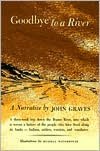
Goodbye to a River

Illus. credit: barnesandnoble.com
 
Goodbye to a River, a narrative by John Graves (301pp, 1959, Curtis Publishing Co, and 1960, Alfred A. Knopf, New York)

The electrical repairs have been done to satisfaction. I was anxious to see them done after having to wait a week for materials to be shipped here. There’s nothing available locally except the most rudimentary supplies, and everything else must come by FedEx or UPS truck, which we see in town every day. Sometimes you can drive the 200-miles round-trip to “The City”, but in this case, when the parts became as much electronic as electrical, what I needed wasn’t even available there. With the repairs done and the river beckoning, the winds piped up to twenty-five to forty miles per hour with higher gusts for the last two weeks. There’s nothing that can be done about it. This is just yet another example of how life gets in the way of living. If life and reality and encroaching ice don’t have a strangle-hold around your throat, get out there and share some time with nature. If, however, you’re bound to your armchair, here’s a good tale to preserve your sanity and bide you over.

John Graves grew up along the upper-middle Brazos River of Northeast Texas. He returned after thirty years absence to paddle the river he knew before it disappeared beneath a series of dammed lakes. He launched his canoe just below Possum Kingdom Lake Dam, west of Palo Pinto, and started downstream. Making the trip with him was a six-month old, 12-pound dachshund pup. Graves admitted he wasn’t much of a dog for such a trip, but companionship was companionship. Throughout the book, the pup is known only as “passenger.”

As the river snakes around bends, past creeks, under bridges, by gravel bars, and past small towns, the author recounts the history and folklore that occurred there, from The People, as the Comanches called themselves, starving settlers, get-rich-quick tycoons, or as Graves put it, “cattle kings and horse thieves and half-breeds and whole sons of bitches and preachers in droves and sinners in swarms.” From the ol’ timers he knew as a kid and those he met in his travels, he uses the river and canoe as vehicles to carry you through the Wild West as it really was, not as it became in movies and dime novels.

For the paddler and camper, he shares his campfire with accounts of battling the winds, fishing the gravel bars, encountering people who wander into his camp or he meets while exploring about, and watching the geese, ducks, and deer that entertain him and passenger along the way. For example, he tells of the man who decided to noodle for a huge catfish that he knew lived in a cave under the river’s bank. Knowing the fish was too big to take by hand, he had a harpoon fashioned, and went noodling. He speared the fish, and in its haste to escape, it broke the man’s shoulder in two places. He had the harpoon cabled to a barrel, and as it went downstream, the fish was finally tuckered enough to be pulled ashore. It spun the scale’s needle to 117 pounds.

Or the day that Potts walked into his camp. “Potts lingered, watching me and the boat and glancing up toward my camp. It looks great, what I was doing, he said.” “I never did much of it. It looks like fun.” “He said he got most of his exercise mowing his lawn, and the winter before he had built a picket fence around his back yard…That was what he told me, or rather told himself in answer to the discontent that sat plain on him as he looked at me and the boat and the Brazos River. He said, ’There’s never enough time.’”

Graves even adds a little camp lore, like the camper’s choice in woods for a fire. Cottonwood and willow are too soft and are quickly devoured. Cedar burns up even faster, and gives a bad taste to food. Any elm will ruin the flavor of food. Ash is okay. Oak, red or white, makes a nice fire and is one of the most pleasing aromatic fuels. Live oak and any nut woods are about the best fuels, and if it’s available, mesquite puts the nicest finish on barbecued meat.


Friday, November 2, 2012

Hurricane Sandy Relief


We contributed to the Salvation Army Hurricane Sandy Relief.  We hope that you will do the same.  The Red Cross can use the funds as well, but we recommend Salvation Army because their administrative and salary levels are much lower by comparison, so much more of your dollar goes to helping those in need.  Here is the site that makes contributing quick and easy. 

https://donate.salvationarmyusa.org/disaster

Thanks, jim 

Wednesday, October 31, 2012

Nothing Exceptional

There's nothing earth-shattering here, but I'm grateful for those that come to check up on the blog, and didn't want to leave you hanging.  The materials to make the electrical repairs left Hodgkins, IL, this afternoon, and are on their way.  While waiting, I've tended to the usual autumn tasks like flowerbeds, disconnecting the irrigation system for winter, and caulking joints in the house's siding.  Tomorrow it will be a little painting of the caulking joints to blend them in.

Monday, October 29, 2012

Oh for Two

This is both frustrating and extremely disappointing, but to keep things in perspective, compared with what folks are dealing with along the East Coast, this is a non-occurrence.

We’ve lived here for five years, but it wasn’t until the canoe was on the truck, the gear was loaded, and the Corps of Engineer maps and atlases were in the map case, that the problem would rear its head. Three hours before we were due to pull out of the drive, Jean discovered a problem with an electrical circuit. It wasn’t working, then it was intermittent, then off again. Having looked forward to this trip for so long, and being anxious to get on with it, I decided to just turn the circuit off and deal with it on my return. We were going.

A couple swans and a mallard at the Will Rogers State University, Claremore, OK.
 
As we drove toward Catoosa, OK, my decision haunted me. I didn’t know what the problem was; I didn’t know where it was; and I didn’t know if turning the circuit off solved the problem. We arrived at the Microtel near the junction of I-44 and historic U.S. Rt. 66, just a few miles from my launch at Rogers Point. I don’t like gambling with electrical problems, so my mind continued to work overtime. I didn’t get to sleep until 3 a.m., and was awake again at 5:30. When Jean woke up, I told her we were heading home. To keep it from turning into a busted trip, Jean suggested shifting it into a road trip and visiting one of the local sights. We decided to visit the Will Rogers Memorial Museum in Claremore. On the way, I drove into Rogers Point Park so she could see the creek and Verdigris River where I would have put in, and then continued on to Claremore.

One of a large collection of original art featuring Will Rogers.
 
Will Rogers became known as the New Mark Twain for both his American humor and extensive writings. The memorial would befit a president. It is built of local limestone on a 20-acre hill overlooking Claremore, and houses Will Rogers writings, recordings of his speeches, his 71 movies, photographs, artifacts and memorabilia from his roping lariats and saddles to the clothes he wore and items from his pockets when the plane crashed in Pt. Barrow, Alaska, and took his life along with famed pilot Wiley Post. Rogers purchased the land in 1911 to be the site of his retirement home. His family donated it to the State of Oklahoma, and the museum opened in 1938, three years after his death.

Will Rogers riding "Soapsuds" before the Memorial Museum.  Directly behind
the statue is the gate to the family burial vault where Will Rogers and family are located.
 
His boyhood home is located only 20 miles north of the memorial, and was where he first began to learn the rope tricks that would begin his fame. His roping lessons came from a freed slave on the farm. From the farm, he worked as a cow hand in South America, joined Wild West shows and the circus, went into vaudeville, the Ziegfeld Follies, began to get movie contracts, wrote daily columns for 600 newspapers across the country, became a political humorist, had a regular radio program, and the list goes on. His fame became so widespread that he was nominated for president at the Democratic Convention in 1932, but lost the nomination to Franklin Roosevelt on the fourth ballot.

Looking across the front lawn and valley, above Claremore.
 
In the museum is a statue of Rogers, a casting from the original located in the Statuary Hall of the capitol, where his statue is located to look toward the House of Representatives so he “can keep an eye on Congress.” Standing next to his statue and looking out the glass doors and across the front lawn, you see the sunken gardens and another statue of Rogers on his horse Soapsuds. Directly next to the statue of Will and Soapsuds is the entrance to the crypt under the sunken gardens where Will Rogers, his wife, Betty, some of their children and other family members are interred.

A look out the front door reveals Will and Soapsuds on their last ride.
 
By the time we finished the visit of the museum, we decided not to make the run up to his boyhood home and ranch, as we still had nearly a four-hour drive home. After a 381-mile run, we returned home with dry paddles. If you happen through Oklahoma, I’d recommend a visit to the memorial museum. Be sure to see the roping movie. Will Rogers still holds the Guinness World Record for being the only man in history to successfully rope a running horse and rider with three lassos. If I remember the sequence correctly, he roped the horse with one, the rider with the second, and both the rider and horse with the third. He could also throw a lariat that would rope both the rider and horse with a figure-eight. One loop of the eight took in the horse, the eight was made and the second loop captured the rider, all while the horse and rider were running past. And I promise not to mention the Arkansas River again until its done.


Friday, October 26, 2012

Going With Food For A Month

The wind is still blowing pretty good. It’s not howling like it has been for the last couple weeks, which was just grating on the nerves, but still going strong. It’s was supposed to let up today, but the weatherman lied. After getting the grandkids off to school, it was getting a bit late, so I’m off tomorrow morning to give the Arkansas River a go. I’ll be starting from Roger’s Point, Catoosa, near Tulsa. By clicking in the right margin for Ibi’s SPOT, you can follow along, or switch the display from map to satellite for a more realistic presentation. Jean will update briefly while I’m on the river, and I’ll give you the full report with pictures on my return.

Alpine Aire and Mountain House Freeze-Dried Foods
 
I don’t usually eat this high on the hog. Normally it’s Knorr noodles and an envelope of tuna for dinner, but my son was supportive enough to present me with a gift of some pretty fancy and delicious victuals by Mountain House and Alpine Aire. Except for a couple 2-day meal bags, they are all done up in gallon zip-lock bags with one bag containing everything needed for the day for breakfast, lunch, dinner, snack, and hot beverages. If I tell you what’s in the feed sack for this trip, I expect a number of people will want to sign on.


Morning Coffee.
I’ve never gotten into fresh perked coffee since I left Thistle and moved into the canoe. After trying a number of unsatisfactory options, I settled on Folgers individual coffee-bags. Just like foil-sealed tea bags, they stay fresh and serve a great cup of coffee every time. They’re a bit pricey, but what’s the value of a hot cup of coffee on a frosty morning?
 
Breakfast: Choices of granola, blueberries, and milk, or blueberry pancakes and syrup,
or a selection of flavored oatmeals.
 
Morning snack: granola and fruit bars while underway.
 
Lunch: This is pretty much my normal fare---tortillas with peanut butter and fruit jam. Tortillas are pretty indestructible. However, several mornings I have packaged soup which I thicken a bit with either potato flakes or stuffing mix to make it stick to the ribs a bit longer.

Dinner: Choices of Shrimp Gumbo, Turkey dinner with garlic, buttered mashed potatoes and mixed vegetables, Fettuccine Alfredo and Tuna, Shrimp Alfredo with sun dried tomatoes, Hawaiian-style Teriyaki Chicken, and of course, Mac and Cheese.

For around the fire or star gazing: Pop-Tarts and hot drinks of cocoa or apple cider. The Pop-Tarts are an old stand-by. We used to use them on the night watches when doing ocean crossings under sail. For paddling, the foil envelopes keep them intact. No matter how long they’re in the food pack, even if you lay on them, sit on them, whatever, what comes out of the envelope is just as tasty, as long as you’re not concerned about presentation.


Thursday, October 25, 2012

Arctic & Mississippi Paddling

I feel like a kid at Christmas.  My parcel arrived today from the Minnesota Dept. of Natural Resources.  I could hardly wait to tear it open.  They sent me the guide book and nine maps that cover the Upper Mississippi River from Lake Itasca to the Iowa state line.  The Corps of Engineers pick the river up from Minneapolis, with one set of maps covering from there down to the Ohio River and Mississippi confluence at Cairo, IL, and another set from there to the Gulf of Mexico.  Right now I'm concentrating on the Arkansas River trip, but I can see these maps and the guide providing a lot of interesting inspection this winter.  Next, I'll order the two sets of maps from the Corps of Engineers.  They are done as double-sided maps, spiral bound into book form. 

I'm grateful to Norm Miller for steering me to this video on his Expedition Canoeing site.  If you didn't see it there, you'll enjoy this.  It is a 9:50 minute video from a 2001 canoe trip into the Arctic as seen from the eyes of a young boy traveling with his parents.  Besides enjoying the youthful exuberance, you'll greatly enjoy the wildlife.  The footage of the caribou migration was wonderful.  Here's the link.

http://www.youtube.com/watch?v=Z3G18sBKsDo&feature=fvwrel
   

Wednesday, October 24, 2012

Manning A Lighthouse

Every summer two volunteers go a couple miles off the Maine coast to tend the Seguin Island Lighthouse.  It is pretty footage of both the lighthouse and island, and for anyone fascinated by lighthouses, like myself, I think you'll enjoy this video.

http://money.cnn.com/video/pf/2012/10/18/pf-seguin-island-lighthouse.cnnmoney/

Tuesday, October 23, 2012

A Dry Great Salt Plain


In spite of the drought, the juniper had a bumper crop of berries. 
They look like berries, and are called berries, but they are actually
 miniature cones with tight, fleshy scales
 
We took a road trip to the Great Salt Plains in Northern Oklahoma to get out of town for a few hours. The drought has been really hard on all of us in this part of the country, but we were heartsick to realize how horrible it has to be for the wildlife. The Great Salt Plains is on a major bird migratory route. This is the time of year to see tens of thousands of birds and waterfowl here, so we went with my longest camera lens in hopes of getting some wildlife pictures. There were about a dozen ducks in the stagnant water between two parts of the dam, and that’s it. No cranes, no pelicans, no geese, not even any birds in the trees and brush. In Orwell “1984” fashion, the wildlife management area, the hive of wildlife activity this time of year, appeared dead.


A view across the corner of the salt flats.
 
From the ground, the wildlife management area is closed to entry, so you can’t get close enough to see the roughly 28 square mile saltpan. A look across the corner of the lake just shows a white band in the distance, but from the air and space, the salt flats stand out in stark contrast to the surrounding land. The waters are normally roughly 50% of the ocean’s salinity, but with the loss of water, the salinity must now be higher than that.

 
The Great Salt Plains Lake and salt flats.


The Great Salt Plain Lake was down so low there was not enough water to get within four feet of the sill of the dam. The dam is a stepped structure, almost like a salmon ladder. Two of the three sections were dry concrete. The wetlands, which the fowl depend on for food and rest on their migration, were totally dry. The tracks of deer could be seen where they had moved up and down the river bed looking for water.
 

This is the Salt Fork River, a branch of the Arkansas River.  All
that's left is some salt residue.
 

The killdeer seek food in the few remaining brine puddles.
 

Ironically, I'm parked in an area for fishermen.  I'm also standing in
the middle of what should be the Salt Fork River, north of the
Great Salt Plains Lake.  The only thing in the riverbed now are sandburs.
 

As the river dies, so do the businesses that depend on it.  Red's Corner
Mini-Mart provided live bait, ice, cold beer, and tackle for the
fishermen that have taken their business elsewhere.


Sunday, October 21, 2012

Preparation

I have mentioned it before in passing, but I have a wind chime outside my home office window that is tuned to the gong on Matinicus Rock sea buoy, Maine. I can hear the chime clanging away as I sit and read “The Complete Wilderness Paddler.” According to the sound, a nor’easter has been breaking across the shoals the last week.

Black-Eyed Susans outside of town are hardy
enough to withstand gale-force winds.
 
The wind has been carrying on like we’re in Oklahoma or something. A couple days ago it was gusting to 57 mph, the day before 45, then 35 the day before that. The wind was strong enough to pick up a plume of dirt 600 miles long, extending up into Nebraska, and easily seen from space. The dust storm blowing across I-35 blocked out visibility and lead to numerous chain-reaction crashes, one involving 27 vehicles. As for the future, the wind is supposed to ease off for the weekend, and then continue through next week. In the meanwhile, I sit and anguish over getting started on the Arkansas River trip. To go paddling here, there seems to be no such thing as a good weather window, except for those five days a year that fall into that category while one is unavoidably locked into some activity that prohibits getting on the water. The only way to make a trip appears to be to pick a date, say “screw the weather”, and go. I’m about at that point.

I have the Oklahoma and Arkansas DeLorme Atlases and the printed Corps of Engineer maps of the river set aside. This afternoon I’ll make a final check and review of the kit and swap out a few summer items for the drysuit, watch cap, mummy bag, and fleece undergarments that I’ll unavoidably need before reaching the end of the river in latter November.


Saturday, October 20, 2012

The Tyranny of Oil


This is a look down an oil pipeline in Oklahoma, one of a spider web of such lines. I’m not a political person, but, in my opinion, there is so much wrong here it’s hard to wrap one‘s mind around it. Since the word “pipeline” is itself a political word, it‘s hard to put gas into your car without being political. The issue is that energy companies have free reign nearly anywhere and over everything. If you own land here, you don’t own the mineral rights. Someone else can buy the mineral rights from under your feet to make money off your land. The dynamics of this played out in the Fairview Republican, the local newspaper, over the last couple weeks. A land owner expressed a concern over an oil pipeline being run over the aquifer that supplies drinking water for the entire Northwestern area of the state. The next week, an owner of mineral rights sent an opposing letter to the editor saying the woman should be quiet so those that own the mineral rights can get their money.

Then the energy company can run a pipeline across your land any time they want, whether you like it or not. Oil companies can not only run pipe lines across your land, but they can also erect any support facilities they wish, whether it be pumping stations, or tank farms. The claim on your property is supposedly granted by the government because of eminent domain, meaning that the general public benefit overrides your personal right to protect its use. Eminent domain is supposed to be a governmental power, but the government has acquiesced and extended that power to the oil and gas companies. The public benefit usually claimed under the current economic environment is that it provides jobs. The truth, especially in the Keystone XL case, is that it is a foreign company doing the work, using foreign employees except for a token use of local laborers and truck drivers, and all that oil is not for American energy independence, but for the highest bidder, which means it is going to China. 
 
Major oil pipelines in the U. S.
Credit: theodora.com/pipelines
 
There is no agency responsible for oversight or regulation if it‘s an in-state line, even if the pipeline passes over critical drinking water aquifers and rivers, and no enforceable safety standards apply until AFTER a rupture and spill occurs. The state foolishly grants the oil companies all kinds of tax breaks, supposedly to encourage them to drill here for oil and gas, as if they wouldn’t drill here anyhow. If there is oil, they will drill. With the energy companies not paying their fair share into the state coffers to cover the cost of repairing the damage they cause to roads and other infrastructure from thousands of heavily loaded trucks, the deficit falls on the local tax payer. Once the last gallon of crude has been sucked from the ground, the oil companies pack their trucks and move to the next sweet spot, leaving all their damage, and toxic and carcinogenic chemicals, behind for others to worry about.

When Enbridge planned to build the 731-mile Northern Gateway pipeline from Alberta to Kitimat, BC, there was an uproar heard around the world. The people in British Columbia had suffered the damage done by the sinkings of both the Exxon Valdez and the Queen of the North in their waters. The pipeline would cross some of the most pristine and environmentally sensitive areas on earth, including the Great Bear Rainforest. Then the flood of tanker traffic needed to handle the oil coming from the pipe, and carry it through the twisting and rock-studded channels of the Northwest, on what would become a supertanker expressway, virtually guaranteed one disaster after another. Sierra Club, International Wildlife Federation, the National Geographic, Greenpeace, the Natural Resources Defense Council, and photographers and film-makers from around the world were summoned to support the First Nations’ native people’s desire to protect their homelands. Finally, on October 5th, Jeffrey Simpson of Canada’s ’The Globe and Mail’ reported that the Northern Gateway appears to be dead. After decades of fighting and hundreds of millions of dollars spent by Enbridge for publicity and court battles, the fire of enthusiasm for a Northern Gateway Pipeline seems to be smoldering and dying.

Gas pipelines in the U.S.
Credit: eia.gov
 
When Trans-Canada and Conoco-Phillips wanted to build a similar pipeline, a route was sought among a less resisting and more apathetic public. Why not build it across the United States? So, the Keystone XL was designed to be a 36-inch diameter pipeline that will run 2,100 miles and carry 590,000 barrels of oil each day from Canada, through Cushing, OK, and to the Gulf Coast, where much of it will be shipped to China. There has been some resistance. One 70-some-year-old woman in Texas tried to stop the pipeline from coming across 450 acres of her ranch and was arrested for trespassing on her own property. Meanwhile, Trans-Canada is rushing the construction to get the pipeline in place before too many people notice. The project has been underway since 2008, and still you seldom hear a word about it.


Thursday, October 18, 2012

Voluntary Simplicity

Credit: duaneelgine.com
 
Review: Voluntary Simplicity: Toward A Way of Life That Is Outwardly Simple, Inwardly Rich
By Duane Elgin (219pp. 1993, Pub. by Quill, Div. of Wm. Morrow & Co., New York)
 
“You can’t tell a book by its cover.” For the second time this past year, I have found truth in that statement after feeling that I had been hoodwinked by a book‘s title. I read the title, and assumed it was about what it said---either finding or creating simplicity in life. I felt even more confident about the seemingly straightforward title when I saw that it was listed in the book section of Piragis Northwoods Company’s Boundary Waters Catalog. They said of it, it is “One of our most requested titles.” Perhaps that means too many other people are making the same mistake I did.

In fairness, in the beginning is does discuss some of the considerations facing someone wishing to exchange personal growth and peace for the corporate world’s insistence on ever greater consumerism, greed, waste, pollution, and the ever present expectation that we don’t fit in modern culture unless we are forever competing with the ’Jones’. Further, it explains that simplicity of life can come from different sources---voluntary simplicity or poverty. “Poverty is involuntary and debilitating, whereas simplicity is voluntary and enabling. Poverty is mean and degrading to the human spirit, whereas a life of conscious simplicity can have both a beauty and a functional integrity that elevates the human spirit.”

A life of simplicity is not meant to be a life of deprivation. “Life is occupied in both perpetuating itself and surpassing itself; if all it does is maintain itself, then living is only not dying.” Simplicity means being selective. It means prioritizing. We wish to have what we need, what we value, and what enriches us, but avoid the trappings of acquiring for fad, fashion, the hope of finding happiness in possessions, of becoming slaves to our things because of the demands of storage, of our time, and of the expense of maintaining things that demand attention but that add little to our lives. We go back to the New England Puritan adage we’ve probably heard our grandparents use---”Use it up, wear it out, make do, or do without.” A study by E. F. Schumacher, noted statistician and economist, found that people in the study discovered a new sense of freedom when they carried less baggage in their lives. The less they felt they ’needed’, the freer they became, and the more they could dispose of. The more they disposed of, the happier they became. Greater simplicity freed time, energy, expense, and promoted greater personal growth and self-improvement, family relationships, and other satisfying activities.

That struck a chord. Our family had taken a three-month sailboat cruise up the New England Coast many years ago. Having what you need for vessel operation, navigation, and safety, and then adding the personal things you’d like to have, and getting it all into a 29-ft. boat definitely requires selectivity and prioritization. By the time we had been underway a few weeks, I began to think of the rich experiences we were having in contrast to all that STUFF back home that I hadn’t needed or missed. If all that had disappeared, I could have continued on in much greater contentment than having to go back home and paint this, repair that, weed here, fertilize and trim there, pick up this, find a place to store that, and so on. I found simplicity and peace at sea, but it was definitely not part of my life ashore..

In the latter chapters the book suddenly swerves off the road. You begin to find that simplicity is not just for personal enrichment, but is a tool for dealing with the collapse of society, the environment, world economies, and wars over dwindling resources. You can adopt simplicity as a way of heading off world collapse, or, failing that, as a way of surviving after world collapse. The author makes the point that we are in civilization’s winter, the beginning of the end that doesn‘t have to come, but which is inevitable without drastic changes. If simplification became widespread, we could reverse this trend. He points out that 98-percent of all homes have a television, that the average person watches four hours of TV a day, and endures 35,000 commercials a year. More than advancing particular products, the commercials try to define happiness, satisfaction with life, attitudes, values, and lifestyles geared to ever-increasing commercialism. He says the most precious resource of any civilization is the shared consciousness of its citizenry, and our consciousness is being prostituted to the highest corporate bidder. “By programming television to achieve commercial success, the mind-set of entire nations is being programmed for ecological failure.” The remainder of the book deals with individual activism to change political and economic priorities, social reform, saving the world’s environment, seeking alternative energy programs, solving world hunger, etc. While I did found the book thought provoking, I think I needed one whole book just on how to change me, as the title suggested. Saving the rest of the world’s billions of citizens and their cultures would probably take at least a couple more volumes.


Wednesday, October 17, 2012

Expedition Canoeing and Kayaking

Credit: 2012 Trans-Territorial Canoe Expedition
 
I just found this site on Norm Miller's "Expedition Canoeing and Kayaking" Facebook page.  This is about a group of young men that made a 2,600 canoe trip this summer across Canada's territories, almost all of the trip being above the 60th parallel.  They started from Juneau, Alaska, and ended at the shores of Hudson Bay.  This is a must see blog if for nothing more than the stupendous scenery pictures.  You'll enjoy this.  I plan on going back and following the blog for the whole trip starting August a year ago.


Tuesday, October 16, 2012

Adoption Complete

Sailing Thistle toward an open horizon with the
wind and sun over our shoulders.  Heaven.
 
We’ve been without internet for a few days due to weather damage to part of the equipment bringing service to our house. Once the technician arrived, he had us back up and running in short order.

A couple from DeRidder, LA, and ourselves have been negotiating over Thistle for the last week. They arrived Monday for a thorough inspection of Thistle and all her gear, and liked what they saw. They agreed to give Thistle a new home and family, and this morning we stood in the yard and watched Thistle roll out of the yard for the last time.

Between living in Western Oklahoma and my age, that marked the end of sailing for the rest of my life, and to the greatest possible extent, the loss of my identity. No matter what else I did to pay the bills, I was a sailor first---a sailor that just happened to be doing something else to prostitute myself to utility, gas and oil, insurance companies and others.  My conscience would nag at me constantly about her sitting in the side yard, so she will have someone else to look after her now.

There were two nice surprises in the transaction. The new owners seem really dedicated to sailing and to putting Thistle to serious use. The second surprise was that they spoke sailing. We sat up into the evening last night and swapped sailing stories. It was wonderful for both of us to share our common language with another couple after a long, long social dry spell.