Monday, February 18, 2013

St. Johns River - Day 4A

After crossing Lake Washington, our second portage was to be at the Lake Washington weir, or low-level dam. There is an airboat ramp, so instead of doing the portage, we pulled our boats across the ramp and into the roughly 3-foot lower waters on the downstream side. Gus was able to just pull his kayak, but I had enough weight in Ibi I had to unload a few things before being able to get her to move.

Ibi at the airboat ramp at the Lake Washington weir.
Photo credit: Gus Bianchi
 
The Lake Washington weir or low-level dam.
Photo credit: Gus Bianchi
 
We arrive at Oak Tree Camp at 3:15. By this time, we were up to 180 gators in our count, but it wasn’t alligators that I was thinking about. James Cabell and A.J. Hanna wrote a book titled “The St. Johns: A Parade of Diversities.” They wrote that flocks of up to 50,000 ibis nested in the area, and their daily diet was countless grasshoppers and upwards of an estimated 40,000 water moccasins. It’s rare that I’ve felt such affection for a species of bird, even if their name is related to the name of my canoe. The water was so shallow in front of Oak Tree Camp that we had to pole through grass toward the shore, but still ran hard aground while some distance from shore. I was wearing heavy rubber boots, but still watched carefully for any ‘bird food’ swimming through the grass. As Ibi was unloaded, I continued to pull her further toward shore until we finally reached dry ground.

Making our landing at Oak Tree Camp.
 
Oak Tree is a popular airboat stop, so we carried our gear further inland to where we could set our boats and tents among trees so we wouldn’t get run down in the dark. Sure enough, we hadn’t been asleep too long before an airboat came sliding right into camp. We suspected they were out illegally spot-lighting alligators, as they came into camp with no lights on. Once they realized something was in the camp, they turned their strong lights on and flooded our tents with light before turning and moving on down the shore. We could still occasionally hear the report of their .22 rifles as they hunted well into the night.

We pulled our boats far enough ashore to put them and our
tents among the trees.  In the distance is the covered picnic
tables where we prepared our meals.
 
 
If the airboat sliding into camp wasn’t bizarre enough, I was jolted out of a sound sleep at 3:45 am by the loud growl and bark of a hunting dog that had his head stuck under the vestibule flap of my tent. After a couple more jarring barks from deep in his chest, I heard two men down by the river calling the dog back to them. Now my wildest imagination cannot figure why two men and a dog would be out wandering about in the swamp at three o’clock in the morning’s total darkness. Weird!


Sunday, February 17, 2013

St. Johns River - Day 4

Gus headed north on the headwaters of the St. Johns.
 
Little Blue Heron caught as he abandons his post.
 
Today we paddled from the Sawgrass Shelter on Little Sawgrass Lake, across Sawgrass Lake, and to Oak Tree Camp for a distance of 15.3 miles. When planning, the objective was to make daily runs of about 17 miles to make best use of available daylight. In the upper river, however, the day’s distance made good was most directly impacted by available stopping places. To give an idea of how remote this area is, this morning we were to see our first sign of human development, the buildings at Camp Holly by the US Rt. 192 bridge. The roadway is also called Rt. 500 or the Space Coast Parkway. Holly Camp is primarily a business that provides airboat rides, but they have a large picnic area and snack bar. It was a nice rest stop and a chance to get some Gatorades and ice.

Ibi on her arrival at Holly Camp.
 
What can say Florida better than two hammocks strung out
under palm trees, and a multi-passenger airboat?
 
After a break, we repack to head on down river.


Saturday, February 16, 2013

The Emperor's Pipeline

If you want a better understanding of one of the major issues of today, read "A child sees through the emperor's new pipeline."  Here's the link.
http://wwwp.dailyclimate.org/tdc-newsroom/2013/02/keystone-tar-sands-protest
Is this a paddling article?  Yes it is.  It applies to you whether you paddle in water, or just drink it, or breathe the air, or pay higher gas prices to finance it.

St. Johns River - Day 3A

Little Sawgrass Lake Shelter.
 
It was a 12.0 mile paddle to the shelter on Little Sawgrass Lake. This was the only solid thing around to raise us above the level of the swamp. We pulled our boats alongside, unloaded our gear, and set our tents up on the platform. There was an enclosure, but we opted to set our tents on the deck outside, as waterfowl and other wildlife had left quite a bit of manure in there while seeking shelter for themselves. We did put our gear in there, and used the enclosure for preparing meals on the surrounding bench.

We had to tip-toe around some holes in the decking, some weak boards,
and exposed nails, but it was home sweet home.
 
I had been having a problem with my camera from the start. It was something I hadn’t experienced before, so hadn’t taken measures to prevent it. The mornings were always at about 100% humidity, which would drop as the sun warmed the air. This meant that I couldn’t take any pictures until about noon. I kept my camera in a drybag, but as soon as I pulled it out, the entire camera, inside and out, would be covered with condensation in seconds, and any pictures would be foggy. It looks like I need to start collecting silica gel packets. That will protect the camera inside the bag, but I don’t know if that will make any difference once I pull the bag out. I guess I’ll find out. Are there any suggestions out there? The problem kept both you and I from seeing some nice images I missed getting.

Our tents on Little Sawgrass Shelter.
 
I had a schedule of calling home every evening at 6 pm. As remote as the St. Johns is, it runs parallel with the I-95 corridor, so we had good cell phone service the whole way. As I stood in the shelter talking with Jean, I recognized the distant drone of the approaching swarm…the sound of millions of beating wings. As it got closer, I could even see the dark cloud the mosquito swarm created, and Gus and I both dove in our tents. It was lights out at 6:20.

The view from our shelter as the early morning light
floods across the glassy lake and a few patches of water hyacinth.
This was one of only a couple early morning shots to make it.


Playak News Flash


I received notice this morning that for the second time, Playak News Watch: "Covering the World's Paddling News by the Minute," had pulled an article from Log of Ibi.  This photo and the story of our trip down the St. Johns River joined articles from Abu Dhabi, the Caribbean, Costa Rice, British Columbia, Scotland, Jamaica, Australia and elsewhere.  How cool is that?!  The link is at:
http://playak.com/paddle-news.php

Friday, February 15, 2013

St. Johns River - Day 3

The roar of airboat engines awoke us at 5 am. As soon as the first signs of light appeared in the sky, a barrage of gunfire commenced that could not have been surpassed by the largest National Guard training range. It seemed nearly impossible that any wildlife could survive that much lead in the air. Maybe it was the change of schedule, maybe being jarred awake by the heavy gunfire and airboats, but I was all thumbs this morning and seemed to have to do everything twice. We got off to a late start, not pushing off from the shore until ten o’clock.


We encountered our first two airboats up close. The first was just someone passing by, and the second was Ken Stafford, a field program supervisor for St. Johns Water Management. He stopped, and we floated along side-by-side for about 15 minutes as we talked. He reiterated about the dikes being private property, and that he had just seen a sheriff arrest a man on a dike a short time before. We had seen the sheriff’s car pass along the top of the dike. It seems the man was a jogger who felt the dike would be a quiet place to exercise. He received two citations for $250 in fines. Perhaps the district has been having some problems with damaged equipment, since their locks and dams are so isolated, but otherwise that seems like such an excessive measure. We were on the dike while portaging, and had a district helicopter make a couple low-level passes over us. I guess they understood what we were doing, as we never had a problem. I had had the passing thought that if we got in a jam we could always camp for a night on the dike. So much for that. After our conversation, we got a chance to watch Ken drive his airboat up a ramp and over the dike.

Ken Stafford, about to force his airboat up the ramp that
crosses the dike.
About to mount the top of the dike.
Gus moves out of the prop wash, which unfortunately isn't really
captured by the camera.  You can see the river's surface being
blown, but the lens totally missed the white spray that fills the air.
 
Just about 50 yards past where he left us, we turned from the canal into a narrow, twisting channel. It was the start of what they call the ‘hydrological St. Johns,’ or the first of the river’s natural channel. The next feature we passed was Bulldozer Canal, and a few miles later we entered and transited Lake Hell-N-Blazes.

An anhinga hanging its feathers out to dry.


Thursday, February 14, 2013

St. Johns River - Day 2A

Opposed to the Great Blue Heron, this is the Little Blue Heron.
 
Within a couple hours, we had reached our first portage around a dam and the junction of several dikes that control water levels in the upper basin. There are ramps over the dikes that airboats can slide up and over, but for us it was a basic hump and carry. Some time was lost in trying to figure which channel ran out into the river, and which ones flowed to other dams and canals. We decided to have lunch while we were there, and in all spent 1 ¾ hours there.

This was our view of the headwater land cut as we turned out
of Blue Cypress Lake and headed north.
 
We soon started counting alligators. Gus knew someone who had done the river several years ago and had counted over 600 gators. The water levels were lower then, however, so most of the alligators had been forced from the drying marshes and into the channels in search of water and food. With the water higher now in the marshes, the alligator populations was spread much more evenly throughout the area. That left fewer for us to see, but by the end of the week, we had still counted 281 alligators.

This was our arrival at Great Egret Camp.
 
By late afternoon, we had completed 15.6 miles and arrived at Great Egret Camp. The camp is so small, we had to paddle back and forth along the shore awhile before Gus spotted it. It is nothing more than the narrow rim of a dike with two wooden platforms mounted on the top of the ridge. As we had been warned, hunters often squat all winter on camping sites in violation of the seven-day limit, and sure enough, a tent had been set on one of the two platforms and left. With our two small two-man tents, we were able to barely set both on the remaining platform. If we had had other paddlers with us, we would have been out of luck. This was the only dry land about, and the platform represented the only horizontal surface. Our timing couldn’t have been better. We had moved all of our gear, set up camp, prepared and finished dinner just as the mosquito swarm arrived. We dove into our tents at 7 pm and called it a day.

Both of our tents barely fit on the one available platform
perched on the spine of the dike.


Wednesday, February 13, 2013

St. Johns River - Day 2

The land cut is as straight as a surveyor’s line of sight can make it. That may sound boring, but we found it anything but. The sides of the canal are choked with vegetation, but that provides cover for a lot of wildlife such as birds, ducks, and alligators, and also an interesting array of wild flowers, Spanish moss, and other plants. Two years ago when I first tried to do this trip, the St. Johns River Management District told me to forget my plans to paddle the river. The water levels were so low that large sections of the river had dried out, and people were running the riverbed with ATV’s. This year there was no shortage of water, and levels were in fact the highest that had been seen in many years. The staining of the marsh grass along the canal showed that water level’s had dropped by three feet before our arrival.

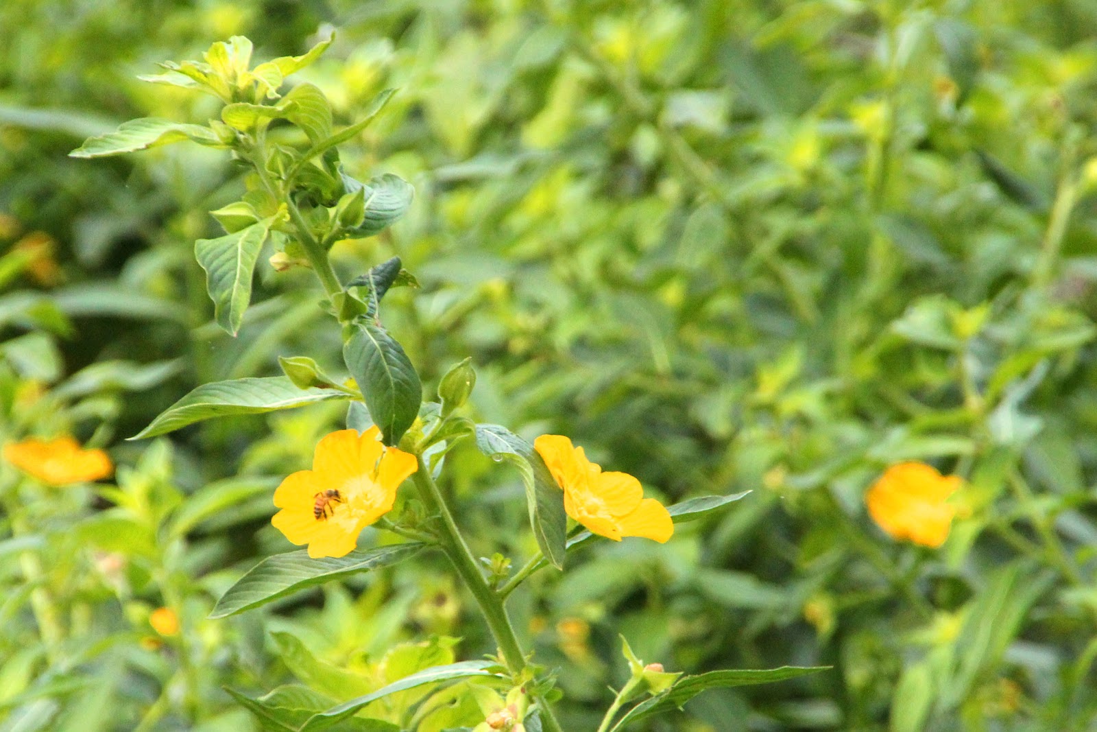
Florida wildflowers in the swamp.
 
The St. Johns River officially runs 310 miles. In that distance it drops only 27 feet, or barely an inch per mile. While we ran through short sections with fast current, other areas have no current at all. Most of the river is a lazy stream that requires constant paddling to make progress. This is not a river for those who like to float down a river.

Great Egret, Blue Cypress Lake
 
Other natural features of the river are the universal presence of hydrilla and water hyacinth. These are both invasive foreign plants that spread quickly and can grow an inch per day. They can close canals and river sections, starve fish, and destroy native plants. Much has been done to control these plants, and we did well with the higher water levels, being able to navigate through large areas of the plants without a problem. Only once did I have to change my route due to a channel being choked off.

A view down a canal at the village on Blue Cypress Lake.
 
Our second lake crossing was of Lake Hell-N-Blazes. It is nothing like its days of yore when floating islands of vegetation bobbed about making passage difficult and navigation impossible. There was no channel to follow, as the islands would move with the wind. As you made your way across the lake, unable to see what was ahead, you could look astern to see that the opening just used had disappeared. It was said that the most common expression heard from those on the lake was, “Where the hell and blazes are we?” Thus the name. Conditions have much improved since then, and we made a direct rhumb line crossing without any problem.


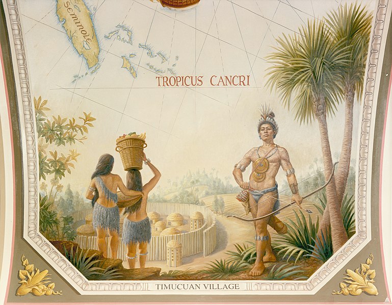
Timucua Indians and Village.
Illus. credit: Wikipedia
 
The St. Johns River was the home of the Timucua Indians, the indigenous peoples believed to be the first native population encountered by Juan Ponce de Leon when he landed in 1513 near St. Augustine. The arrival of the explorers brought new diseases to which these people had no immunity, and by 1595 their population had been reduced from 200,000 to 50,000. Fights with English settlers reduced their numbers further, and by the turn of the 19th century, their people had become totally extinct. When I learned that ibi was the Timucuan word for water, the root for the water bird ‘ibis’, it seemed only proper to recognize the native people of this region by naming my canoe with the Timicuan word for her natural element.


Tuesday, February 12, 2013

St. Johns River, Day 1

The original post was on January 14. To add to that, we made an early start to get down to Middleton’s Fish Camp on Blue Cypress Lake. The early start would enable Jean to get back up I-95 before dark. The upper St. Johns is a 2,000 square mile basin with canals cut for flood management and control. It isn’t even called the St. Johns this far up river, but is identified by canal or landcut numbers, like the C-40. Blue Cypress Lake is the last recognizable point in the headwaters of the St. Johns River. Middleton’s is a great resource for those pushing off to do the St. Johns, and I had talked to Jeanne Middleton several times in the two years that the trip had been in planning phase.

Joe and Jeanne Middleton operate Middleton's Fish Camp.
Joe's been here over 48 years.  If there's anything he or Jeanne
can't tell you about the area, it hasn't been discovered yet.
 
Gus Bianchi was joining me to do the river, saying the trip had been on his ‘bucket list’ for some time. He was in a frenzy to not miss the NFL playoffs, so we split the cost of a cabin with a television for the night. Lisa, a paddling friend of Gus’s, brought Gus in with his truck, boat, and gear. She sat and offered some recommendations on campsites before heading home with Gus’s truck for the week. Once we had our boats on the wharf in front of the cabin and our gear stowed inside, I took a walk to watch some of the local activity.

The elevated bridge that gives access from the ramp to the lake.
 
I could have done without the way the next morning started, but it is all part of the experience. It was about a foot-and-a-half drop from the wharf to the water’s surface. I loaded Ibi first, with the idea of sliding her off and into the water. Her bottom, unlike most canoes and even kayaks, has no flat section in the hull for initial stability. The bottom amidships goes to a slightly rounded vee, but it’s a vee nonetheless. As I slid Ibi into the water, the hull lay over on its side, and a bag I had fastened on deck took over and helped roll her further until the boat filled with water while still half in and half out of her natural element. (Color my face red.)  We had to pull her back out, and Gus pumped her dry with his bilge pump. After removing the bag from the deck, and with both of us holding Ibi level as she went in, we slid her back overboard with no problem, and I then returned the bag to its original place. In the process I sliced my thumb. With Ibi’s deck and combing christened with blood, the trip was officially underway.

Ibi and Gus' boat on the wharf in front of our cabin.  The powerboat
belonged to our neighbors in the next cabin that had come down from
Ft. Pierce for some fishing.
 
While I got my gear straightened away, Gus floated in the lake off the canal entrance and wet a fishing line. By 9 am we were finally underway and headed across Blue Cypress Lake to the mouth of the land cut that marked the headwaters of what would become the St. Johns River.

 
Blue Cypress Lake fishing shack.


Monday, February 11, 2013

Boatbuilding Plant Goes Up in Smoke

Photo credit: Lake Placid News

This makes the second canoe/kayak plant to be destroyed by fire in just the last few weeks.  This fire occurred at Placid Boatworks, in Lake Placid, Adirondacks on January 25.  Three businesses were located in the building.  It was a total loss, and with everything covered with ice from fighting the fire with temperatures in the teens, it may take awhile to determine the exact cause.  It has already been reported as an apparent accidental fire.

Photo credit: Adirondack Daily Enterprise

Joe Moore, the owner of Placid Boatworks, says everything inside the shop was lost, including about 20 boats currently in inventory.  He vows to resume boatbuilding in a temporary facility, and has asked current owners of the line to allow him the use of their boats to build new molds from them.

Sunday, February 10, 2013

In Palatka, Florida

By the time the trip was over, we had seen prices for gas rise 74-cents a gallon, from $2.99 in Oklahoma to $3.73 at Lake City, FL. What happened to all those promises about how we could drill at home and avoid being at the mercy of the price gouging Middle East oil barons? All the drilling, the oil sands, free rein to build pipelines anywhere and everywhere, all kinds of tax concessions so they aren’t responsible for all the roads they tear up with their heavy equipment, and still the fuel prices sky rocket. So who’s going to rescue us from the greedy, price gouging American oil barons? It’s not the drilling that’s the problem. It’s the screwing.


Anyhow, these are some of the wild orchids that grow everywhere in Florida. These were on the side of a store, and the day I paddled the St. Johns at Palatka, I saw hundreds growing under the Rt. 17 bridge along with the swallow nests. They just attach themselves to anything, and prosper. As I said in the original post, it’s hard to get anything to grow in NW Oklahoma. In Florida, it’s hard sometimes to get things to stop growing.


One of the things Palatka is noted for is its murals. Many businesses in town are covered with murals featuring river scenes along the St. Johns River, the history, even the natural beauty of the area. Here is the side of building that ran a full block, all covered with natural scenes and local flowers. One of our friends, Ellen Price, did one of the flower paintings, but there are dozens of local artists that participate. 
 
Ibi and the Ram in Florida.


Saturday, February 9, 2013

On The Road 2-A

The original post of “On The Road 2” was also posted on 11 January. After some comments on our stay at Askew’s Landing RV Park, Maryellen commented on how nice it sounded. It is a beautiful place, enough so that we visited again on the return trip. It is at Exit 19 of I-20, just east of Vicksburg, and is immediately off the interstate. When you come off the exit ramp, you turn north just a few yards before turning west onto the 2 ½-mile country road (Askew’s Landing Road. What else!) that takes you back to the park.
A small glimpse of the lake at Askew Landing RV Park.
 
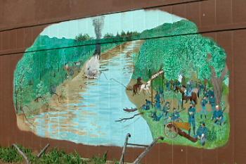
There are a number of interesting aspects to the park. First, it was originally founded as the 2,000-acre Bridgeport Plantation by Duklet Askew in 1859, and is now on the National Register of Historic Places. In addition to running the plantation, he operated a ferry across the river, and managed a general store at the ferry crossing. It has remained in the family, and is now owned and operated by fifth-generation Dan Askew. On May 17, 1863, the plantation and ferry crossing of the Big Black River found themselves in the middle of the Civil War when Pemberton’s 4th Brigade was engaged by Gen. Sherman’s command of a portion of Grant’s 15th Corps as the Confederate forces retreated from Champion Hill. The ferry was of course destroyed. Follow-up engagements were fought there again on June 13 when Confederate forces unsuccessfully tried to challenge the picket line protecting Grant’s Eastern flank. A mural on the end of the picnic pavilion portrays the initial battle.
 
Civil War battle mural.
 
On the first visit, we slept high on the hill above the lake so the night’s rains wouldn’t find us stuck in soft soil. The part that caused me a little loss of sleep was the road into the park. It runs along the berm created by the earthen dam that forms the lake. It is just wide enough for a vehicle to cross in one direction at a time. The prospect of heavy rains washing out the earthen dam to leave us stranded for perhaps months before repairs could be made just kept playing in my head. Why travel a thousand miles in search of an adventure when all you need is an irrational and over-active imagination? The dam, however, has been there a long time, and the morning found everything just fine. The park is not just owned by family, but everyone who visits is made to feel like family, and when we checked in, I spent a nice interlude in the office discussing canoeing, the river, and comparing paddling trips.

 
A Chinese Goose quite at home in a light drizzle.
 
Vicksburg is a very historical area on the banks of the Mississippi, and if you find yourself in the area, Askew’s would be an equally wonderful spot to spend some time and relax.


Friday, February 8, 2013

On The Road 1-A


This sunset was taken from right here in town, overlooking the grain silos on the west edge of town.  The old saying is "Red sky at night, sailor's delight."  Between the time of the picture and the trip, things changed, as the rain started during the night after the first day on the road, and would continue until we arrived in Florida. 

I just downloaded the pictures from the trip, and will begin posting them with the details of the trip.  The original post of the first day on the road was posted January 11.  Most of today was spent cleaning everything out of the RV that made it home for the last six weeks, and doing a serious cleaning.  More tomorrow.  jim

Wednesday, February 6, 2013

Tuesday, January 29, 2013

At Jolly Gator

To say I'm a little bumbed would be an understatement.  To come this far, and invest this much planning, time, and expense getting here only to have the trip fall apart is depressing and discouraging.  After giving the leg time to heal and trying a test run on the St. Johns at Palatka, I went back to give the trip another try.  The trip from Rt. 50 landing to Hatbill was great.  I was a bit surprised when I arrived at Hatbill to find a dozen airboats and about 30 people at the landing.  They had gotten together for a potluck and fishfry.  Their event was winding down, but they happened to have an ice-cold Corona that just fit my hand perfectly.  They left about 5 pm, leaving the camping area all to me.  The night was beautiful for camping with a brilliant moon, and it was peaceful and quiet.  A rainstorm came through, but was gone by morning. 

I had seen the landscape make several changes during the trip.  Today was another change with very low land, almost like a ten-mile wide flooded meadow.  There were very few lees to find shelter in as the wind began to crank up, so the day involved several bouts of heavy digging.  Puzzle Lake was one of the challenges I wanted to conquer.  Everyone I encountered wanted to check to make sure I was ready for it with my navigation.  One guy said, "Ya know there's a reason they call it Puzzle Lake.  It's a Puzzle alright." The waypoints I had searched from Google Earth were a great aid, but nothing prepares you for what you see from the seat of a canoe.  I was happy that I made only one wrong turn, but I had gone such a short distance before discovering my error, that the detour didn't even show on the SPOT track.  When I left Hatbill, the SPOT seemed to show that I went the wrong way around, but the shorter route was chocked by weed, making it impossible to get through.  Some of the route involved water so shallow that I could only immerse half the paddle blade.  A pontoon boat was having trouble, and seeing me, decided there must be water where I was and headed my way.  I tried to wave them off, but the last I saw of them, they were still trying to find a way out.  My reptile count ended at 281 gators and 5 snakes.

I finished at Jolly Gator with the satisfaction that I had done Puzzle Lake, Hell-N-Blazes, Sawgrass and the more notorious sections of the trip, but by the time I landed, my body was in full revolt.  The leg was acting up again, cramps and numbness, fighting the wind had brought my right shoulder back to the fore, and a couple other issues returned I won't go into.  Everyone says I should see a doctor, but the plain truth is old age is a terminal condition they can't do anything about.  As to where I go from here, I have no idea at this point.  I do have a lot of pictures to share with you when I get back, and hope you enjoy them.  My hat is off to Jean.  Making all the trips back and forth had her tallying almost a thousand shuttle-miles.  At least when she came to pick me up, she got a deviled crab dinner at Jolly Gator.

In all, the paddle today was 13.5 miles.  I had intentionally planned a short day in case I had any problems finding my way through.  The trip total just broke a hundred at 111.2 miles.  That's a third of what I had hope for, but...............  The three parts of a trip I enjoy equally are planning, photography, and navigation.  I'm quite satisfied in all three, but would have liked seeing the experience last a bit longer. 
Cheers, jim

Monday, January 28, 2013

Paddlin' Again'

We left Dave and Margie's at 7:30, headed for the Rt. 50 bridge over the St. Johns River, just west of Titusville.  Filled up the truck and had breakfast at McD's in Palm Coast, and were then underway down I-95.  We reached Rt. 50 at 10 AM and saw numerous power-gliders soaring above the marshes.  Wish we could have seen one being launched.  Jim unloaded the truck next to an airboat ramp.  The ramp was constructed of lengthwise wooden skids in parallel rows about 10 feet wide and maybe 30 feet from the roadway down to the water.  Everything was stowed in Ibi and Jim shoved off at 11 AM. I watched his progress until he passed out of sight at the juncture of the side creek and the main river system, and then drove back to our friend's home in St. Johns County.  By 2:10 PM Jim was at his next stopping, Hatbill Park.  Today he will cross Puzzle Lake and stop at the Jolly Gator, adjacent to the Lee County Park.  Hopefully his GPS will guide him safely through the torturous channels of Puzzle Lake without incident.  He saw some huge gators yesterday, one of them seemingly as big as a large SUV.  Guess he had no problems with them last night as he's well underway today.  Will keep an eye on his progress throughout the day on his SPOT.  You can do the same by following IBI's SPOT track, found on the right-hand side of this blog.  Have a good one!  Jean

Friday, January 25, 2013

Took The Leg for a Ride

I have no idea how long it will take for the leg to get back to normal.  It could be quite some time.  It is feeling better, and there is feeling in the outter half, but the inner leg is still lacking feeling below the knee.  Since it is showing progress, I decided to give it a trial run in Ibi today before it wrecks the entire trip.  It was a short paddle, only 7.3 miles, but it felt pretty good with one stop for a short walk-about.  It was a nice Florida day, warm, with light breezes.  I got a few pictures I'll be able to share with you, including an alligator snoozing while straddling a log. 
Paddle on.  jim

Wednesday, January 23, 2013

Getting A Leg Up

No one's interested in my ailments, me in the telling, or you in the hearing.  However, this is an issue that can affect us all, so perhaps you may be interested in what I learned.  Other than three portages, we found there was no place to get out of the boats during the day.  We both suffered from severe fanny fatigue, and I got to the point of my legs starting to cramp up.  The water went right into the tall marsh grass, and there was no shore nor even any banks evident, so we spent long hours with our legs locked in a fixed position and inactive.  My leg circulation problems first became evident about the fourth night when I couldn't get my feet warm at night, even inside my below-zero rated sleeping bag.  I had to go digging in my pack in the middle of the night for a pair of wool socks to put on.  By the time I got out on Saturday, my right leg below the knee was asleep and stayed that way.  I wouldn't call it pain, but I was in constant discomfort.  The leg tingled and felt dead to the touch.  A blood clot in the leg can be extremely dangerous, even life-threatening, so I headed off to a doctor yesterday.  I was told a clot didn't seem evident because (1) there was no swelling, (2) no severe pain, (3) no discoloration, (4) the pulse and blood pressure seemed the same in both legs.  However, (there's always a however) a clot was possible if I didn't make some changes, and this is where I thought you might find something of value. 

The doctor recommended:
l. Keep legs elevated whenever possible.
2. If in a fixed sitting position, in a canoe or kayak, or even on a train or airliner, pump the foot back and forth like mashing an accelerator.  The action on the large muscle in the rear of the leg forces blood back up out of the legs so it doesn't pool.
3. Get out of the habit of crossing one's legs.
4. If in a boat or on a plane for more than four hours, wear knee-length therapy or surgical stockings.
5. If you normally use a baby aspirin a day, go to a full aspirin during the time of restricted activity, and then return to a baby aspirin when activity returns to normal.
6. Don't get old.

Monday, January 21, 2013

Update and SPOT

We took out Saturday at the Rt. 50 bridge near Titusville.  I took a couple days R&R with Jean and did laundry.  Another task was to streamline what I was carrying to lighten Ibi's load.  Gus was headed home to watch football playoffs.  Other issues were at play that develop naturally over a few days of paddling, and the winds were against us and promised to stay that way for awhile.  We were at a good place for a shuttle, so I was the one that pulled the pin.  I was going back tomorrow, but the wind is still gusting to 25 mph on the nose, so I'm out for one more lay day.

Maryellen asked about SPOT.  I don't know the exact issue she is raising, so a little tutorial is in order.  To access the SPOT share page for Ibi, go to the right margin of the blog under "Favorite Links" and click "Follow Ibi's SPOT Track."  This will pull up the spot page.  The plot map is on the right side of the screen, and the reported positions and times are on the left side.  The first thing to do is go to the 'satellite' button on the top right of the map and click it to switch from map to Google Earth.  This will give a more realistic representation of the area.  Once the SPOT is turned on, a position will be reported about every ten minutes.  It will record up to a maximum of 50 positions, and these will fall off or expire after seven days.

The flags will appear as a jumbled blob, so the second thing to do is zoom in until the flags are enlarged and separated enough to view them individually.  The icon flags with footprints are the tracking positions.  The one with something like a fan is the last position given for the day, is a 'check-in' position, and is used to show that Ibi is in safely for the day.  The check-in icon can be clicked on, and it will give the exact position of the end of the day in latitude and longitude to with an accuracy of about 30 feet.  By zooming in and out with the + and - signs, I've been able to see the picnic table the SPOT was sitting on when the message was transmitted.  You can also pass the cursor over the recorded received positions, and that will cause the corresponding icon flag to flash so you can relate the received message to the corresponding exact position at the time shown.  You can navigate about on the map by either using the four arrows on the left side of the map, or clicking and dragging the map to the area you desire.

Note that the track seems to cross land and leap tall buildings in a single bound.  The track joins each recorded position, but has no way of showing where Ibi has been in the intervening ten minutes.  You have to kind of follow the course of the channel between.

There are a number of advantages of SPOT.  For example, if you want to make a similar trip, you can record the person's nightly check-in positions.  When you make your own trip, you will already have points for camping locations that served a previous paddler.  Be aware that things look different from space.  For this trip, areas that appeared like neatly mowed grass were in fact twelve-foot high inpenetrable marsh grass.  Areas that appear like nicely shoaling beaches may indeed be nearly vertical cliffs.  While it's a fantastic tool, what you see has to be taken with caution. 

Then, if you get into trouble, like a medical issue, it's invaluable to be able to send rescue personnel directly to your exact location, cutting recovery time from days to hours.  This precision, however, is a double-edged sword.  There are times you want your position known, and times when you don't.  If you are paddling alone, you may want to send a check-in a couple hundred yards away from where you are actually camping.  I've had people following my SPOT walk right up to my tent out of nowhere, enabling me the chance to meet great folks.  If you are in an area where security and personal safety is an issue, you may not want people having that kind of access. 

Friday, January 18, 2013

wind, rain, WIND

The guys got in at about 4 today after lots of wind, rain showers and more wind, which just kept cranking up.  Jim asked me not to write too much, as it wouldn't leave much for him to tell later, so check back later for his input.  He did spend much of the day in foul-weather gear, and had to chase a mosquito out of the tent while he was talking to me at 6 PM, despite the 35-MPH winds.  One funny thing did happen during the day - they had to evade cows crossing the river, and they had to kick cow patties out of the way in order to set up their tents.  The saga continues, and they are at 73.1 miles into the trip.  The alligator count is at 200.  Till then,  Happy Paddling!  :>D  Jean

Thursday, January 17, 2013

Gator's Good!

Wind, rain and gator for lunch were on the agenda today for Jim and Gus.  There was quite a bit of wind for this part of the country today.  We're used to 20-30 MPH winds on the plains of Oklahoma, but the guys experienced 20-25 NNW winds throughout most of today here in Florida.  When we first moved out to Oklahoma we teased the locals there that what they called a breeze on those wide-open prairies would have been considered a hurricane in Florida.   The wind here today was especially nasty when Jim and Gus were crossing Lake Poinset.  The water is so high there this year that they were paddling through areas of tall grass that should have been well ashore, while trying to stay out of the worst of the wind.  Upon finally arriving at the Rt. 520 bridge they stopped at the Lone Cabbage Fish Camp. They were told meals were available, but there were no camping facilities.  After a meal of gator, a first for Jim, they headed back south about 1/2 mile to a small clearing. Jim said he'd been told that gator would taste like chicken, but he thought it was actually better.  Hopefully the two men will get more sleep tonight than they managed last night.  Apparently gator hunting in the dark is enjoyed by many locals.  The guys were kept awake last night by high-powered spotlights being intermittently shone on their campsite, and frequent gunshots going off nearby.  Jim finally got to sleep, but was awakened at 3:45 by the sound of people walking through their site, and what he described as an awful, unidentifiable noise .  In his groggy condition he couldn't tell if the noise had been real or if he had been dreaming.  It became quite real when he heard it again and realized that it was a large, snuffling hunting dog with his nose right against the wall of Jim's tent.  One good result of today's wind was that the mosquitoes have been knocked down.  Jim only saw one while he was setting up his tent.  Usually they find him irresistible.   During the course of the last couple of days of paddling Jim figured out that he normally strokes 900 times per mile when not going against the wind or current.  With approximately another 100 miles to go to get to Palatka, he'll be doing a lot of paddling!!!  Whew! He and Ibi have gone many miles together, sometimes solo, and sometimes in company with other paddlers.  Let's wish them well.  Their run today was a total of 17.1 miles.  The weather forecast for tonight for their area is for rain and a low of 41-degrees.  Hopefully they'll not get socked in tomorrow.  If so, perhaps gator will be on their lunch menu again, and they'll remember to recharge their phone batteries.  Till next time, Happy Paddling!  :>D  Jean 

Wednesday, January 16, 2013

Airboats and Skeeters

Our intrepid paddlers are at the Oak Tree Camp for the night, arriving there about 4 PM.  The day was not as strenuous as I had feared it would be for the guys.  When they got to the weir for the second portage of the trip, the water level was high enough that they were able to traverse it easily without a lot of hard work.  Jim and Gus stopped for a short break at Camp Holly, a place known locally as a great place to get an airboat ride.  Airboats were a fast, noisy presence throughout the day, with one of the airboat operators a bit less than enthusiastic about sharing the waterway with low, slower craft of the paddle type.  When our guys stopped for the night, they were careful about placement of their campsites so they wouldn't be run over by high flying airboats.  Jim placed his tent between two closely spaced trees, and Gus marked his site with a red blinking strobe light placed on a pole.  When I spoke to Jim at 6PM, it was hard to tell which was the louder background noise, the mosquitoes or the airboats.  The gator count for the trip so far is 181.  I asked Jim if he had seen any snakes, as Jeanne Middleton had warned him that there were plenty in the area.  He hasn't seen any yet, and doesn't know if any have seen him.  Hope it stays that way!  Having experienced a nasty bite from a water moccasin early in our residential years in Florida, I'm not too fond of the slither-type creatures!  Gus is supposed to break off from the trip on Sunday.  Lisa, who was going to take his place, is down with the flu.  This might mean that Jim will have to shorten his trip until he can get someone else to go along.  There definitely is safety in numbers, especially out in the boondocks.  We'll have to see what comes.  One thing here which is really great is the number and different types of birds.  The drought at home in Oklahoma has played havoc with the bird populations.  We've seen very few birds in our area there throughout the Spring and Summer of this year, even though we provide a source of clean water and plentiful food for them in our yard on a daily basis.  It's a real pleasure to hear the varied birdsongs here, and be able to watch the many birds flitting happily about in the pines.  Safe paddling to all our friends.  "See ya' " tomorrow.   :>)  Jean

Tuesday, January 15, 2013

Lake Hell-N-Blazes

Jim and Gus checked in by phone at 6PM today, after crossing Lake Hell-N-Blazes and arriving at the Sawgrass Shelter.  They had made good 12 miles, with Jim ready to quickly crawl into a shelter at 6 because of the hordes of hungry mosquitoes. Lake Hell-N-Blazes, so called because many people wonder while out on it where in the hell and blazes they are (and maybe why?).  It's definitely airboat country, and Jim got pictures of a couple of them today.  One was going over a dike or weir.  The shelter where Jim and Gus set up their tents was built by the St. Johns River Water Management.  It has been well used by intermittent duck and geese flocks, with big accumulations of guana.  Jim said it would definitely NOT qualify for a Good Housekeeping seal of approval!    The site is actually an old Indian midden, composed of over 6,000 years of trash and some graves left by Ais and Timucuan Indians.  Early settlers in the area used to find bones, pottery shells and other detritus, but digging there is illegal now.  The guys are resting on hallowed ground!  Hope they rest well.  They'll have a long day tomorrow, with another portage ahead of them, which requires unloading the vessels, dragging the boats up and over the weir or dike, carrying all their supplies over the top, and then refloating and reloading the boats.  They have a 17-mile paddle to the next stop-over point at Oak Tree Camp.  It's going to be a long day, especially for Jim, who hasn't done much paddling during the past months because of the drought in our home country of Oklahoma.  I forgot to mention in yesterday's post that we had passed to the south of the little village of Fellsmere on our way out to Middleton's Fish Camp.  Fellsmere is known locally for the Fellsmere Frog Leg Festival.  Will have to check that out later.  Bye for now,  and happy paddling.   :>)Jean

Monday, January 14, 2013

Monday, 14 January
Jim called at 6PM to let us know how he and Gus are doing.  They had a portage today, so Jim says it's a 2-Advil night.  Along with the portage they paddled approximately 16 miles today.  They saw a total of 76 alligators, a number which might be lower than it would have been if the water levels in the lake weren't so high.  The higher water levels allow the gators to get into the side streams, so there aren't so many in the lake itself.  Jim said the critters weren't aggressive.  One came up right alongside his canoe, but took very little notice of him.  The men are still in Blue Cypress Lake.  We were very impressed yesterday upon our arrival at the fish camp where Jim and Gus spent the night.  It is really a laid-back type of place, very clean and well maintained.  Jim and I drove down I-95 yesterday to the Vero Beach exit, about 150 miles south of Flagler Estates where I'll be staying for the duration of this trip.  After lunch at a Steak and Shake, we headed about 18 miles west, through extended citrus groves, and then north for approximately 8 miles to Middleton's Fish Camp.  I fell in love with the place at once.  There are nice little homes situated on open canals that lead directly to Blue Cypress Lake.  Each home site has its own boat pier at the front or back door.  How cool is that???   I can do without the snakes and gators that inhabit the area, but the people are very friendly and helpful. Jeanne and Joe Middleton, who own the fish camp greeted us warmly and arranged for Jim and Gus to rent a cabin right on the canal.  They did suggest an extra bottle of mosquito repellent.  With warm temperatures and high water levels, those pests are swarming.    The guy's canoes were kept on the back porch overnight, ready for immediate departure this morning, with just an easy push-off right from the porch .    Hope the guys have a great time paddling!  Oh - one more thing - the men did get to watch the NFL play-off game on TV in their cabin  last night.  Who says you can't have all the comforts of home?  As for me, I'll enjoy the company of non-paddling friends here in St. Johns County, and the comfort of my own cozy air-conditioned home on wheels.  :>)  Signing off for today -    Jean

Saturday, January 12, 2013

In Palatka - 2

Paddling trips sound laid-back enough, but dozens of other tasks need to be accomplished in the process.  Day 6 say us doing the last of the laundry, checked the fluid levels in the RV batteries, unloaded and repacked everything in the truck to double, triple, or quadruple check every piece of gear.  I don't care how many trips I make, I always spend a couple nights before laying awake all night wondering if I have enough of my prescriptions, maybe the VHF batteries should be topped-off again, make sure the trip descriptions, route and charts are all in the truck, and, oh yeah, I should get some other snacks to mix with the big can of mixed nuts I got for Christmas to make day-snack bags.

Then David and Margie took us to lunch at the Kings Bistro.   That was neat.  Michael Barfoot is a retired chef that cooked aboard Air Force 2.  The president has a dedicated crew that travels with him on Air Force 1, but Mike took care of several vice-presidents, visiting heads of state, such as Queen Elizabeth, or any other government dignitaries.  After retiring, he and Judy Patrick opened the Kings Bistro.  If you want to eat like a king that's on an office clerk's salary, that's the place to go.  A coupe of us had steak, and I enjoyed a blackened grouper sandwich with a creamed crab bisque that was too mouth-watering to even try to describe.  It's nice to be back in an area with real seafood dishes.  If you happen to travel to St. Augustine, you'll find the Kings Bistro at King Street and U.S. 1 (6 Mackey Lane, St. Augustine, FL., but only open on Friday, Saturday, and Sunday.  (904)687-3963)

In Palatka

Day 5, the 11th, was the big wrap-up day.  I took the Ram for service so it's ready for the return trip.  We don't carry more groceries in the RV than we need while on the road.  All the extra weight of filling the pantry before starting a trip just translates into more gas consumption simply to haul the weight.  So, the second stop was to get a month's provisions for Jean.  We got the six birds and their cages moved indoors and out of the trailer.  While I'm off paddling, Jean shares her love of birds with David and Margie Hawkins, the friends she is staying with and fellow bird fanciers.  The third stop was to show her where the Pico Road boat ramp is, so she can meet me there at the end of the trip.  After dinner, I set up pages on David's computer so Jean can post trip updates when phone service enables me to contact her.  As I'm sure many others have experienced, phone service is often spotty or inaccessible.  We're presently in an AT&T dead zone, if anyone has been trying to reach us.  It's strange how none of these dead zones seem to show up on the coverage area maps AT&T shows you when selling you 'service'.  Anyhow, it is one more day of tasks and visiting before heading to the St. Johns River.

On The Road - 4

We arrived in Palatka, FL, at 2:30 Thursday afternoon (the 10th) after 1,397.3 miles.  Gas mileage was a blood-chilling 10.8 mpg, especially blood-chilling when the price of gas rose by over 60 cents/gal. between Oklahoma and Florida.  There are compensations, however, if you take the time to take in the scenery.  Everything was green and lush.  The rivers had water....not muddy brown or red water, but a sparkling blue that's just a couple shades darker than the sky.  The difference is so stark, it can't be ignored.  At home, it's difficult to get things to grow.  We've lost a couple thousand dollars in shrubs over the last couple years, even after providing irrigation and mulch for them and hundreds of hours of tender loving care.  In Florida, just the opposite is true.  It sometimes seems it's hard to get things to stop growing.  Wild orchids will take hold of the stucco on the side of a building, and prosper while being totally ignored.  We saw one store that had about thirty orchids growing on the side next to a parking lot.  

Friday, January 11, 2013

On The Road - 3

It was Wednesday, January 9th, and another day of rain.  With no fear of contradiction, we've seen more rain in the last two days than we've seen in Northwest Oklahoma in the last four years.  The flip side of this is that once we were down in Louisiana, there was green everywhere (grass, shrubs, trees) and there was water to be seen everywhere.  There were even actual rivers...rivers with water in them. 

The temperature is still climbing.  By this evening, we reached Marianna, FL, and spent the night in a Walmart parking lot.  We not only had no heat, but kicked everything off the bed except a sheet.  With earplugs to deaden the truck traffic in and out of the lot, it was a very comfortable night.

On The Road - 2

On Tuesday, the 8th, we were underway by 8:15 and headed for Dallas.  Someone (no names) wanted to take an "over the river and through the woods" route to avoid the Dallas traffic, so off we went.  There were 14 small towns, and while I didn't count them, the red lights were in the hundreds.  It took four hours, half our drivng day, to get around Dallas.  The change in route sounded like a plasible idea, but it was a bust.  We probably only averaged 30-35 mph.  The rain that we had started early to avoid came on with a gusto.  Sometimes it was just heavy, but it also reached periods where it was blinding.  This route did accomplish one thing.  I had spent a lot of time trying to adjust the brakes so the rig wouldn't jack-knife if something jumped up in front of us and we had to lock-up the brakes.  I've never encountered this before, especially on a slippery, wet road, but the occasion did arise. I did have to stomp the brakes, and while we slid a bit, the rig stayed perfectly straight.  This is obviously no way to break in a new set of trailer tires, but it added another arrow to the quiver of experience.  To me, the RV towing is totally different from driving a tractor-trailer.  I always felt a lot more secure towing a 55,000 pound trailer behind a proper tractor, than towng a 6,000 pound RV behind a pick-up.

By day's end, we crossed the Mississippi River and passed through Vicksburg.  At Exit 19 in Mississippi, we stopped at Askew Landing RV Park.  (From the exit, go north just 50 ft. past the interstate and left on Askew Landing Road for 2.5 miles to the park.)  We were very impressed with it, and would recommend it.  I think they may see us again.  There is a nice lake, large, spacious campsites, ducks and geese, and very friendly staff welcoming you to a scenic, rustic, wooded area.  It was a former plantation, and the site of two Civil War engagements in 1863.

On The Road - 1

Well give this a try.  I'm using someone else's computer, and the blogger dashboard looks totally different.  Anyhow, on Monday, Jan. 7, after getting the cats inoculated, and settling last minute details on the RV, we still got underway at 10:30.  We traveled south on I-35 from Oklahoma City, and didn't quite make Dallas when we stopped at McClains RV Campsite Park at Exit 485.  It was right along the service road of I-35, so no time was lost driving inland several miles.  The facility was really nice, but after several days of rushed preparation, we were too exhausted to enjoy the amenities, and we were in the sack by 7:20.  Again, if you want to follow the trip, click Follow Ibi's SPOT Track in the right margin.  The positions remain on the plot for a week.

Monday, January 7, 2013

About On The Road

The trailer is loaded, and the canoe is on the truck. Since they are going out of state, we need to take the two cats to get their inoculations updated in the morning, and then we’ll be headed south. The cats will of course stay with Jean while I’m on the river. We were going to leave Tuesday, but we’re hoping to stay ahead of a rain system. I don’t relish towing a big trailer on wet roads. If we were really getting rain here, as rare as that is, it would almost be worth staying home to watch it, but I know they lie. The rain never comes through here, but will head south and east of us, and we’d have to drive through it all the way across SE Oklahoma, Arkansas, Mississippi, and Alabama.

After visiting with friends in North Florida for a couple days, I will head to Middleton’s Fish Camp on Blue Cypress Lake, west of Vero Beach, meet Gus Bianchi, and be ready to head down the St. Johns River with him on Monday the 14th. Another friend, Paul Higbee, will be fishing on the Gulf Coast, and will stop by Middleton’s to see us off. Jean will try to post updates on the blog when I’m able to find cell phone service, and then I’ll start a complete report with pictures when I return. During the trip, just click on “Follow Ibi’s SPOT Track” in the right margin, and follow along. It should be a real interesting trip.

Sunday, January 6, 2013

Critical Timing

Photo credit: Rod Wellington
 
This is a picture of Rod Wellington on Dec. 30, camped on a snow-covered sandbar at Ste. Genevieve, Missouri.  You really need to open Missouri River Paddlers on Facebook to read his account of the recent weather he has endured.  There are very few that could keep going the way he has.
 
I've been watching his SPOT track, and noticed he arrived at Cape Girardeau, MO, and has now been there four days.  That's very uncharacteristic when he has been striving to make miles to the south.  He posted a short message, and if I interpret it correctly, the Mississippi just south of him has been closed during the daylight of each day for dynamiting of rock in the river bottom to increase depth and allow barges to keep running.  The river is open at night, but he has wisely decided not to challenge the high density of tugs and barges, plus all the Corp of Engineers workboats that suddenly start moving during the night.  He is jammed between horrible weather, the dynamite, and the possibility that the river will be closed to all traffic.  

Saturday, January 5, 2013

Tales Of An Empty Cabin

Illus. credit: alibris.com
 

“Tales of an Empty Cabin” by Grey Owl (pub. 1936, reprint 1998, Key Porter Books, Toronto, Ontario, 295pp.)

Grey Owl dedicated his book “for those whose souls are longing for the freedom of the open road, but who are prevented by the invincible decrees of Fate from ever seeing the wonders of the Wilderness save in the pages of a book.” Grey Owl knew the Wilderness, not a woods as most of us know them, but real barren wilderness, devoid of nearly any human contact or convenience. In such an area, where self-sufficiency is critical to survival, few woodsmen will ever admit to being lost in the wilderness. Grey Owl admits to getting turned around for a few hours, and even Indians native to the area will find themselves guilty of “negligence” for an hour or so. He says there are many interpretations of “lost”, but the best was from an old bushwhacker who got so twisted that it took ten men over a week to find him. The old woodsman would admit only to being “right bewildered”, -----for eight days.

The greatest pleasures coming from the pages of Grey Owl’s writings are finding a man as closely in harmony with nature as any man could be. For example, for an alarm clock, he would freeze a piece of meat to a metal tin and place it on the metal roof of his log cabin. If it was to be a fine day, the first hint of a lightening sky would find a bird, usually a whiskey jack, pecking at the tin, which rattled on the metal roof. This was better than most alarm clocks in that if the weather was to be bad, or it was snowing, the birds wouldn’t show until much later, allowing him to sleep-in when there was no need to get up.

A bull moose moved into his camp, and became fast friends with Grey Owl. Moose are usually wary, aggressive, and often dangerous, unpredictable animals. This bull, however, loved the company, and would wander into camp to sit near the door of the cabin, follow Grey Owl around while he tended to his chores, and lie down to nap next to the canoe, the delicate, flimsy little craft this thousand pound animal could destroy with one swipe of a pointed hoof.

Grey Owl had a couple generations of beaver living next to his cabin. In fact, at one point he provided for them to continue building their lodge into the interior of the cabin through an opening in the wall. He could pet the adults and kittens alike, join in their play, and they would join him for canoe paddles as they cuddled between his legs while he knelt in the bottom of the canoe. They knew his habits and personality, and likewise, he each of theirs. Once they started living in part of his cabin, they soon learned how to open and close the door, so he provided a leather lanyard attached to the door latch so they could come and go at will. Besides, this ended the knocking and scratching at the door until he got up to let them in or out. He described their walking as erect as a human, and carrying large bundles of sticks and mud until they couldn’t see over the top. The kittens would sit on top of the mother’s tail, and she would drag them around. On one occasion they all climbed aboard, but there wasn’t sufficient room. They solved the problem by riding with one foot each on her tail, while peddling on the ground with their other foot like they were riding a scooter. Grey Owl established relationships with many species, like deer, loons, birds, nearly any critter that chose to stay near his cabin. The exceptions were wolves, coyotes, bear, mountain lions, and weasels, whose presence usually meant death for members of his community. In short, for anyone who loves nature, this is a great book to curl up with for hours. Also listed in the Paddlers’ Reading List is “The Complete Works of Grey Owl.”

Wednesday, January 2, 2013

Being Seen

Most of the time you don’t want to be heard or seen, but there are times when life and limb demand that you are. By all accounts I’ve read on the subject, there appear to be two concerns on the St. Johns River with regards to airboats. When paddling through reed and grass areas, a paddler is often obscured by the grass. Since airboats don’t always follow the channel, they can come flying off a mud bank or out of the grass from any direction. Traveling at 45mph over land or up to 135 mph on water, they can run you down without ever seeing you. 


Photo credit: James Parker, Pensacola
Yes, it looks unconventional, but it works.
 
It is recommended that a paddler carry a fluorescent bicycle flag on a whip during the day. Both the Kruger Sea Wind and the Superior Expedition have a sturdy anodized pole that is used to join two boats together as a catamaran in heavy weather conditions. I routinely carry mine as a capsize pole. It slides into a sleeve that spans the cockpit coaming, and I keep an old PFD and paddle float secured to the end to help me get back into the boat if I’ve accidentally gone swimming. I previously have fastened a pig stick to the top of the pole with a USPS ensign on it. That will get the flag six to seven feet into the air, both higher and larger than a bike flag would be, and should make me clearly visible during the day. I’ve used this method before in areas that abound with flying bass boats. (Pig stick - two dowels fastened together, one on a swivel and collar. The flag is secured to it, and it rotates so the flag always streams smoothly without ever getting wrapped around the stick.)

ACR Firefly Plus Model 1916
 
 
At night, there are many campsites that are routinely used by airboats who often arrive after dark. They will come flying right up on land and across the grass to reach their favorite campsite. It you can’t pitch your tent among the trees, that puts your tent in the traffic way. It’s a good idea to hang a light or lantern on your tent to be seen at night. I have an ACR Firefly Plus Model 1916 light Jean gave me a number of years ago. It has a strobe at one end for emergencies, and a flashlight at the other end. That should serve nicely to meet needs at night.

Airboats are used mostly in the upper river where the water is thin and there is a lot of marsh. The further one gets down river, the less the risk. I’ve seen an airboat as far down river as Palatka, but that’s extremely rare. Admittedly the risks are minimal, but so is getting hit by lightning, and the old Boy Scout motto is “Be Prepared.”


Tuesday, January 1, 2013

More St. Johns Details

The first post of the new year, and we’re down to the last few days before setting off for the St. Johns River, in Florida. It is North America’s answer to the Amazon River, and a chance to see some wild scenery and wildlife. As always, things need a few last minute checks to see what has changed since the plan was initially put in place. Our first destination is Middleton’s Fish Camp on Blue Cypress Lake, west of Vero Beach.
http://www.middletonsfishcamp.com/

I emailed Jeanne Middleton to confirm our plans to camp there. She said she was looking forward to seeing us, but cautioned that we should plan carefully, as she had heard some of the hammocks further down river were flooded. (A hammock or hummock, used interchangeably, is a wooded knoll or ridge that rises above the marsh.) This is an extreme departure from when we tried to paddle the river two years ago, and were told there was so little water, that the riverbed was being run by ATV’s. In flooding conditions, arriving at a campsite to find that it’s under water would be a serious inconvenience when everything else around us would be alligators and moccasins. I emailed Steven Miller, Bureau Chief of the St. Johns River Water Management District, but also called the Palm Bay area office and talked with the land management official, Doug Voltolina. He said he had been in the area within the last couple weeks, and while there was indeed plenty of water, the campsites would be found above water. He cautioned, however, that there could be another problem.

Ibi at an earlier campsite.
 
The upper reaches of the river region are so remote that there is no way for the management district to supervise any camp reservation or permitting procedure. The sites are available on a first come-first served basis. The problem is that SJRWMD can’t police the area to enforce the seven day camping limit, so a lot of hunters come into the available sites in the fall and basically squat on them until spring. Regardless of when we arrive, we are likely to find the campsites already occupied, and it will be up to us to use diplomacy to obtain the privilege of using the remaining fringes of the camping area. In a spot like North Indian Field, this would be no problem, as it is large enough to bivouac an army. In most areas, however, like Great Egret, there’s only room for two small tents. Besides the adventures on the river, it appears camping may become an adventure as well.