Minnesota DNR Maps.
Santa wanted to make sure I didn’t get bored, so he brought me a big stack of charts and maps. The Mississippi River is covered by three sets of maps. The upper river regions from Lake Itasca, MN, to the Iowa state line are covered by nine folding maps published by the Minnesota Department of Natural Resources. (500 Lafayette Rd., St. Paul, MN 55855-4046, phone: 888-646-6367) They were beautifully done, and contain an absolute wealth of information: boat ramps, rest areas, campsites, marinas, points of interest, history, facilities like showers, water, food and other supplies, locations of dams, which side to portage on, and more. These are supplied without charge by the State of Minnesota. Their site is http://www.dnr.state.mn.us/watertrails/mississippiriver/index.html
Corps of Engineers Bound River Charts
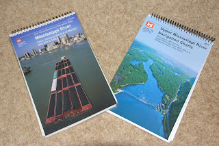
Once you reach Minneapolis, the Corps of Engineers takes over with two big books of charts in spiral bindings. The first set carries you from Minneapolis to Cairo, IL, and the confluence of the Ohio River, which at their junction is bigger than the Mississippi River is. One then turns to the second book of charts, which will lead you from Cairo to the Gulf of Mexico. With some luck, these can be accessed and printed from the Corps site on line, but they were having some site problems when I tried, so we went ahead and ordered them. You can start at http://www2.mvr.usace.army.mil/NIC2/mrcharts.cfm?index=1
These are the same charts used by commercial shipping. The two books of charts and shipping came to $69.90.
The Corps figures by the time you’ve gotten this far down river, you don’t need to be led by the hand as much, so while there’s all the navigational information you need, you won’t find camping, cruising, and provisioning information. Such details and accounts of similar trips can be found by reading such books as:
Canoeing Mississippi by Ernest Herndon
Paddling South: Winnipeg to New Orleans by Canoe by Rick Ransom
Mississippi Howl by Allan and Dianne Roden
Mississippi Solo: A River Quest by Eddy Harris
Mighty Miss: A Mississippi River Experience by Gary Hoffman
Also, Mississippi Madness: Canoeing the Mississippi-Missouri by Nicholas Francis and William Butcher. Each river occupies half the book. This is a “no holds barred” account. If you still want to go after reading this book, you’re ready.
Just a reminder: Your local library can usually get these for you through their inter-library lending program. If you decide you need the book, you can order one for yourself later. If you meet any of these authors, don’t tell them I told you so.
And sites like:
http://www.bucktrack.com/canoeing_down_the_mississippi.html
http://www.bucktrack.com/mississippi_canoe_planning.html
http://www.mississippiriverresource.com/River/101Days.php
When you finish, you will have paddled over 2,350 miles and qualified as a Full-Fledged River Rat.


No comments:
Post a Comment