Monday, December 31, 2012

Happy New Year 2013


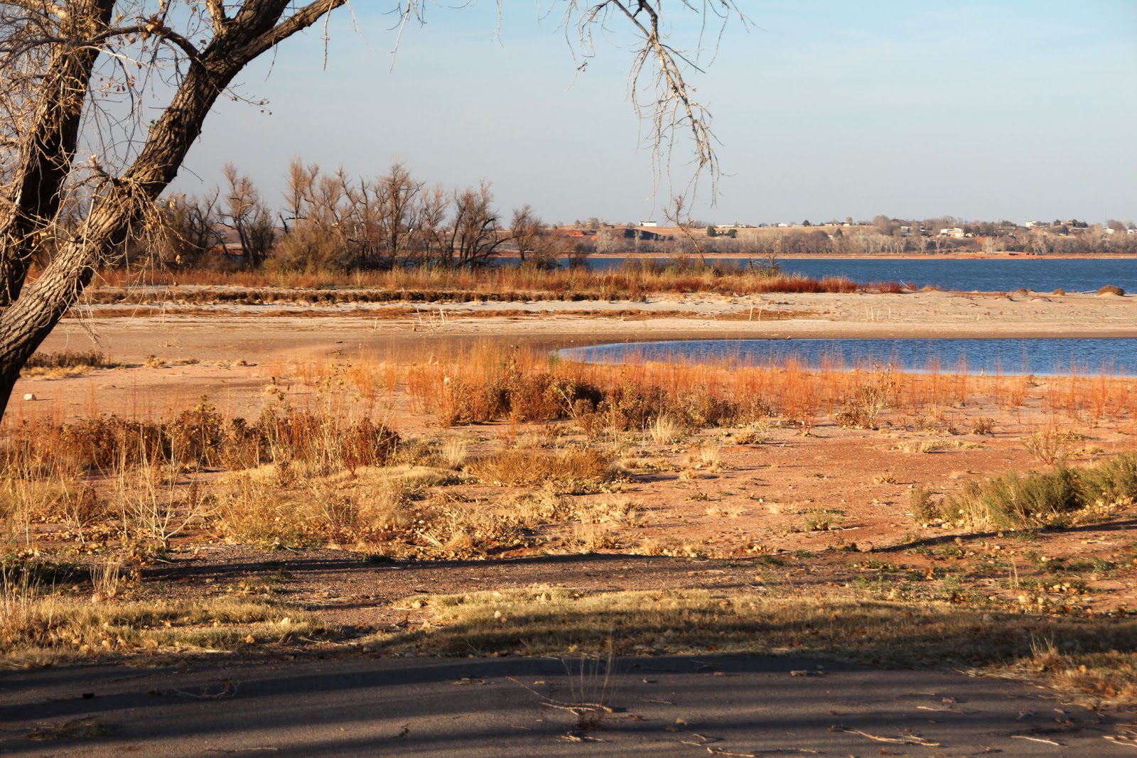
With the end of the year, a look back over 2012 points to some interesting trips, but as always, I had hoped for more. The highlights of the year were the Florida Keys Challenge in January. That was 115 miles from Key Largo’s John Pennekamp State Park to Fort Zachery Taylor on Key West. In April, we visited family in Pennsylvania. It was way too early in the year and the weather was miserable, but Ibi still got into a half-dozen area lakes. In July, I’m grateful to Jean for encouraging me to join the Great River Rumble on the Missouri River. That paddle was from Jefferson City, MO, to the confluence of the Mississippi River for 159 miles. At least that enabled Ibi to say she’d gotten her hull wet in the two great rivers. With the drought here in the Plains, the rest of the year was a disappointing, dreadful loss, a waste. So, while I’m grateful for what we did get done, I look with hope to the New Year for something better---much, much better.  What I hope for more than this, however, is a healthy, happy coming year for all of you, and the chance to see you on the water.
Happy New Years!

Sunday, December 30, 2012

Stohlquist Fisherman


Since I began paddling the Micmac stripper, I’ve been using an inexpensive PFD from Wally World. It has served its purpose, but has provided a few inconveniences. When it’s quiet, I keep looking around to see who’s following me, because of the squeak the PFD foam sheets make rubbing together. Second, it has no pockets, so I have to find someplace to put the few items that must always be at the ready. Third, it has a full back panel, which catches on Ibi’s backrest, causing it to ride up my back until it is perched level with the top of my head.

Being a Scotsman, if something is paid for, I can put up with a lot of nonsense and inconvenience to make it do before giving in and spending money for something else. But, when I had a problem with my Stohlquist booties, Stohlquist was so fantastic in taking care of my problem, telling me how to repair the old ones plus giving me a new upgraded pair besides, that I told them when it came time to buy my new PFD, that I’d get a Stohlquist from Dave Lindo at OKC Kayak in Oklahoma City. His connection, as Stohlquist dealer, was to handle the transaction between me and the manufacturer without cost. While in OKC yesterday, we stopped in to see his paddling shop. While I had talked with Dave a number of times, I had never had the chance to meet him.

We caught him in the middle of installing new flooring in the shop, but he still took the time to show me all his PFD’s. I would never have thought of a fisherman’s PFD, but it seems perfect. It seems to solve all my problems, and was even available in mango, to match Ibi. The defining issue was Jean was determined to shame me into getting it right then. If I didn’t buy it, she would. Stohlquist doesn’t like to drop ship, but prefers to have everything going through the dealer. Since it’s the holiday and we’re trying to get away shortly for the St. Johns River trip, Dave pleaded and got them to drop ship the PFD to us. It arrived in amazingly short order the other day, and I will be able to show up in Florida with a new, bright yellow PFD. As another added bonus, I think the yellow PFD will show up better than orange or other normal PFD colors, so it should make me more visible to both hunters and airboat operators.

Friday, December 28, 2012

Rod Wellington Meets Mississippi

Rod Wellington has been enduring winter's wrath while paddling the Missouri River, and while making a lot of miles, not making much progress in dropping latitude.  Today at 10:52 am, however, he paddled into the Mississippi confluence and turned south.  Rod, with Michael Clark in company, traveled south toward St. Louis until he took out just north of the start of the Chain of Rocks at 2:23 pm.  He will accomplish the portage around the rapids and continue to the Gateway to the West arch in St. Louis tomorrow morning.  You can continue to follow his progress as he makes his way south toward the Gulf.  His SPOT site is:
http://share.findmespot.com/shared/faces/viewspots.jsp?glId=0qCpx9kJFAM9q0MdLhPFFefaf1GCbI7Wk
Other commentary on his progress by fellow expedition paddlers can be followed at Missouri River Paddlers on Facebook.
http://www.facebook.com/?sk=messages&tid=10150161877646435#!/groups/167446086601100/

Thursday, December 27, 2012

Mississippi River Charts

Minnesota DNR Maps.
 
Santa wanted to make sure I didn’t get bored, so he brought me a big stack of charts and maps. The Mississippi River is covered by three sets of maps. The upper river regions from Lake Itasca, MN, to the Iowa state line are covered by nine folding maps published by the Minnesota Department of Natural Resources. (500 Lafayette Rd., St. Paul, MN 55855-4046, phone: 888-646-6367) They were beautifully done, and contain an absolute wealth of information: boat ramps, rest areas, campsites, marinas, points of interest, history, facilities like showers, water, food and other supplies, locations of dams, which side to portage on, and more. These are supplied without charge by the State of Minnesota.  Their site is http://www.dnr.state.mn.us/watertrails/mississippiriver/index.html

Corps of Engineers Bound River Charts
 
Once you reach Minneapolis, the Corps of Engineers takes over with two big books of charts in spiral bindings. The first set carries you from Minneapolis to Cairo, IL, and the confluence of the Ohio River, which at their junction is bigger than the Mississippi River is. One then turns to the second book of charts, which will lead you from Cairo to the Gulf of Mexico. With some luck, these can be accessed and printed from the Corps site on line, but they were having some site problems when I tried, so we went ahead and ordered them. You can start at http://www2.mvr.usace.army.mil/NIC2/mrcharts.cfm?index=1
These are the same charts used by commercial shipping. The two books of charts and shipping came to $69.90.
 
The Corps figures by the time you’ve gotten this far down river, you don’t need to be led by the hand as much, so while there’s all the navigational information you need, you won’t find camping, cruising, and provisioning information. Such details and accounts of similar trips can be found by reading such books as:
Canoeing Mississippi by Ernest Herndon
Paddling South: Winnipeg to New Orleans by Canoe by Rick Ransom
Mississippi Howl by Allan and Dianne Roden
Mississippi Solo: A River Quest by Eddy Harris
Mighty Miss: A Mississippi River Experience by Gary Hoffman
Also, Mississippi Madness: Canoeing the Mississippi-Missouri by Nicholas Francis and William Butcher. Each river occupies half the book. This is a “no holds barred” account. If you still want to go after reading this book, you’re ready.
 
Just a reminder: Your local library can usually get these for you through their inter-library lending program. If you decide you need the book, you can order one for yourself later. If you meet any of these authors, don’t tell them I told you so.

And sites like:
http://www.bucktrack.com/canoeing_down_the_mississippi.html
http://www.bucktrack.com/mississippi_canoe_planning.html
http://www.mississippiriverresource.com/River/101Days.php

When you finish, you will have paddled over 2,350 miles and qualified as a Full-Fledged River Rat.


Wednesday, December 26, 2012

Christmas 2012

 
Family is still gathering, presents are still being opening, I hear the turkey has just been declared "done", candles are still burning, but with the calendar at Merry Christmas plus one, another holiday is headed for the archives.


Jean just goes absolutely all out for the holidays.  Everything is done fresh and from scratch.  There's the apple pie, apple crumb crust (whatever it's really called), pumpkin, several kinds of candy, several kinds of cookies, cake, enough dinner to make cooking unnecessary for the next week, and images of Weight Watchers dancing in our heads. 
 
 
Jean loves to make handcrafted cards for all occasions.  It's something else she loves to share.  Besides each of us getting a personal homemade card, often in addition to another from the pharmacy, she made 72 Christmas cards for each resident of the Fairview Fellowship Home, each delivered complete with a candy cane. 
 
Best wishes, and I look forward to seeing some of you on the water.
Cheers, jim


Monday, December 24, 2012

Christmas Wishes

 
From our home to yours, and all your family and friends, Jean and I extend our warmest wishes for a wonderful and safe Christmas and holiday season.

Things are progressing nicely here. I’ve spent the last three days inputting waypoints for the St. Johns River trip in the GPS. I had that done before, but I’ve redone the trip so many times that I began to have doubts about the track, so after considerable thinking on the subject, I finally decided to delete the whole mess and start again.

I’m much encouraged by the reports coming from the area on the water levels. Middleton Fish Camp reported on their site that they have the highest water levels since 2008. They also have a new St. Johns Water Management District supervisor who says he’s going to keep the levels higher than years past. I would suppose that’s controlled with the weir at the Lake Washington outlet.

We’re supposed to have a white Christmas with 3-5 inches of snow, but 28 mph winds and a zero wind chill. I had serious concerns about Rod Wellington on the Mississippi River, but checking his forecast showed he will get a lot of rain, but actually milder conditions than we will have here. He is currently at Washington, MO. It would be nice if someone near him could get him off the river for the holiday. It’s not easy making contact. His phone died, and he’s not carrying a computer, so contacting him means tracking him on his DeLorme satellite plot and hailing him somehow on the river. Dom Liboiron is also still on the river, but he’s further south. He has just passed the confluence of the Arkansas River, north of Rosedale, MS. (See Canada to New Orleans under Favorite Blogs.) If you'd like to follow Rod, searching Missouri River Paddlers on Facebook is the best way.  So, again, Merry Christmas.


Sunday, December 23, 2012

The Town of Foss

Turkey Creek.  In a normal year, water fills it bank
to bank.  Now the creek bed is hidden in the shadows.
 
Foss Lake was named for the nearby town of Foss. Our trip from Foss Lake to Clinton Lake took us through Foss, and for those that asked for a little bit about Oklahoma, if there is a great example of what settlers in this area went through, Foss is it. The Cheyenne-Arapaho reservation was established in 1892. The town began with a group of settlers moving four miles north from the area around the Wilson Post Office to build a town on the north bank of Turkey Creek where they felt they would be more secure from the Indians

Turkey Creek flows by in the foreground.  The meadow
is where Foss stood before being swept away by the flood of 1902.
 
The folks wanted to call the town Graham, but the postal service nixed that because that name was already used, so it was changed to Maharg. The first school was in a dugout along the creek, and had ten students. In 1895, a 12 X 14-foot one-room school was erected. By 1900, attendance had grown to 100. The town charter was one year old when on May 2, 1902, Turkey Creek flooded and swept away 35 homes and nine people. It was decided to move the town north of the railroad tracks on higher ground. J. M. Foss Cordell was instrumental in founding the new town, and became its post master. The new town would be given his name.

The First Baptist Church, built of native stone, still in active
use, and still minus its bell tower and steeple.
 
They had established a Baptist congregation in 1900, and the church building, built in 1902, was funded through $2000 subscriptions and erected with donated labor. The owner of the saloon offered to donate the land for the church, but there was a big argument over accepting the fruits of the Devil’s money. Nearly anything can be rationalized with enough thought, so the offer was accepted when they were able to agree that no better use of the Devil’s money could be found than using it to do God’s work. During World War II, the church’s steeple and bell tower was removed to donate the metal to the war effort, and has never been replaced.

The new town of 1902 got a new two-story six-room school, which was used until the last school was built in 1923 of brick on School House Hill.
 
All that remains on School House Hill are the school's
front steps, and a couple planters and benches.
 
The Choctaw, Oklahoma and Gulf Railroad became the Rock Island Railroad, and it fostered the town's growth until it was the largest trade center between Oklahoma City and Amarillo, TX. The town’s first surge of growth was 1905 when the population numbered between 900 and a thousand, and commerce had grown to two banks, three cotton gins, two hotels, an opera house, and the saloon. The town also now sat only a half-mile off the new Route 66. However, in August, 1908, a fire destroyed an entire block of the town, and then only a year later, another fire destroyed many more buildings. The heyday of the town was between 1915 and 1930 with a population of 1,600, a blacksmith, grain elevators, livery stables, doctor’s office, grocery, hardware store, funeral home, and an electric power plant. Finally, in 1939 yet another fire swept the town, and between that, the Depression, the Dust Bowl years of the 1930, and World War II, the town never fully recovered. By 1957, school population had dwindled so much that the brick school was demolished.

Though the school has been gone 55 years, a few floor
tiles still cling tenaciously to the concrete floor.
 
If they had only waited two years, the school would have been needed again in 1959 following the construction of an Air Force installation at nearby Burns Flat. This brought a short revival to the town in the 1950’s and 60’s. When that installation then closed, people and businesses again began moving to other towns.  That was it. The last bank left in September, 1977. By the 2010 census, a population at 151 definitely showed the town had shrunk to a bedroom community.


Friday, December 21, 2012

Rod Wellington

Photo by Jonathan Lauten


This is a picture of Rod Wellington pinned down on a sandbar near Jefferson City, MO, for 40 hours in 5-degree F temperatures and 50-60 mph winds.  This morning his kayak was covered and filled with snow.  He started from the headwaters of the Missouri River, at the Continental Divide, in June.  His start was in deep snow in the mountains.

You can access more information on his trip by searching Missouri River Paddlers on Facebook, or click on Love Your Big Muddy in the right margin under Favorite Blogs.  This is Janet Moreland's blog.  She plans to start the same trip this coming May.  If successful (or I should say "when successful") she will be the first woman in history to run the entire river, source to sea.

Thursday, December 20, 2012

Foss Lake - 3

To begin with, Joe and Ruth Kliment sent me this from Florida, and I'll pass it along to perhaps add to your Christmas enjoyment.  It is the 23rd Annual Punta Gorda Harbor Christmas Boat Parade.  I like the boat with the tree and Santa train, complete with smoke.
 
http://www.youtube.com/watch?v=eQF9bg0v9q4&feature=youtu.be

It’s vital to be a light sleeper when camping, especially in primitive or isolated areas. This morning, light sleeping wasn’t needed to know what was going on. At 4:48 a.m., I was jolted awake by a pack of coyotes erupting into a screaming kie-yieing frenzy close to the tent. I have no doubt it was the same pack I had heard down the shore when I turned in hours before. It sounded like they were in the grove of trees I had camped close to while trying to escape the wind. It was the only thicket of trees and undergrowth that close. It lasted only a matter of seconds, less than a minute, just the time needed to tear apart the prey they had flushed from the brush, most likely a rabbit. After looking at my watch, I lay there awhile to listen, but the next thing I heard was a donkey braying excitedly maybe a hundred yards or so further down the road. They had apparently stressed it as they ran through or by its pasture.

Silhouettes in the sunrise.
 
This was as good an alarm clock as any, and I was wanting an early start, so I rolled out and put water on the stove for coffee and oatmeal. While the water heated, I pulled everything from the tent and started to break everything down and get it packed. Just as breakfast and packing were done, sunrise started to put on a show as nice as the sunset from the evening before.

 
As I was leaving the state park, I stopped by the marina to see what kind of shape it was in.  Nearly half of the marina is non-marine as the first six slips sit high and dry on the lake bottom.  


A female mallard uses the early morning light to cruise the shallow water looking for breakfast.


The pickings seem a little slim, but appear to be what she's looking for. 


Tuesday, December 18, 2012

Foss Lake - 2

Before sunset, I took a walk around the exposed shoreline of Foss Lake.  Here are a few pictures to help describe what I saw and the conditions there.

The gray riprap marks where the shoreline should be.  I guess any paddler is
always looking for the perfect put-in.  It was odd to be looking at the grassy
 chutes either side of the small tree along the "shore" as beautiful spots to
launch a canoe while the water is still a hundred yards away.
 
This would have been a thicket of small trees not removed when the dam
was built in 1961.  I talked with a man who said he had only seen it this low
 once before in the last half century, but when the water came back, it was
like a new lake.  All the brush now growing along the immense
exposed area will then be breeding grounds for fish, and protection for little
 fingerlings. Why is a beer can lying on the lake bottom?  Please carry your
litter ashore.  The lake is surrounded by garbage cans, and there are more at
 the marina, and more at the convenience store where you'll get gas and drinks,
 and likely at your home.  Our waterways should remain things of beauty, and not
be used for sewers and solid waste disposal.
 
The wind building dunes and sandy waves along the shore, which normally
 runs for 42 miles around the 8,800 acre lake.
 
Before the lake, the road I was camping along continued on into the valley. 
 It is now the exposed remnants of a road to nowhere.

The last horizontal shadow from the tree marks where we launched our canoe
 a few years ago.  It was then a drop-off of a few feet from the road to nowhere
to where the shoreline was.  What should be a lake bottom is now an expanding
 area of undergrowth. 


Saturday, December 15, 2012

Foss Lake

I would not envy the homesteaders who came across the Plains. Even worse would be the work of a scout, a job often performed by a Native American. Being out on the Plains alone, often a half-day or more ahead of the wagons would, I believe, be a lot like being the point man on a patrol in Viet Nam---easily spotted, alone and unsupported, and a temptingly easy target. Being a Native American would not make the job safer, but quite the contrary. As an Indian friendly to the white man and the long knives, he would be equally hated by everyone.

A deep ravine, made to look less imposing by the cedar
trees growing in it, but quite impassable.
 
You’ve seen from some of my pictures the obstacles facing people trying to pick their way west. Ravines are just another example. You look across the land that looks flat and featureless, and suddenly you come on an impassable ravine that stretches in both directions and blocks your route.

A farmer growing a field of wind turbines.
 
I was headed for Clinton Lake, but the afternoon was wearing on, and I knew Clinton had no camping sites. It seemed the thing to do was to stop at Foss Lake for the night, and make an early start to get down to Clinton Lake in the morning. Plus, I had not seen Foss Lake in a couple years.

Pushed close in the lee of a grove of trees
to escape some of the wind.
 
Foss Lake is down 39% of capacity, or twelve feet in water level. The percentage would be a lot lower were it not for the 50-foot deep valley that comprises the center of the lake. The most interesting part of lake paddling is pushing up the feeder streams and coves. Those are all bone dry. Unfortunately, paddling around the deep vein that remains would be as featureless and uninteresting as paddling around a swimming pool. I had paddled the entire lake a couple years ago, and there were some really interesting side channels then, but that’s all gone. While there was still some light, I decided to take a walk around the bare lake shore.

A touch of sunset turns into a brilliant blaze.
 
By the time I got the tent set and had made dinner, it was getting dark. I took my bowl of food and climbed into the truck to escape the wind and enjoy the warmth. It was a chicken pot pie stew for chow, followed with a hot cup of cider and a Pop-Tart two years past its expiration date. But, as I’ve said, there’s nothing you can do to those things, and it was still good.

As the sky darkens, a bright full moon illuminates the lake.
 
As I crawled into the sleeping bag, I could hear a pack of coyotes somewhere further south along the lake shore.


Friday, December 14, 2012

A Drive Across the Plains

Abandoned homesteads and farms.
 
It was a long drive to the first lake, and I took the time to inspect some of my surroundings. This is still a young part of the country compared with other regions. Our local town just celebrated its hundredth anniversary a couple years ago. Sometimes towns seem to follow the same life cycle of a blade of grass. Towns spring up with great promise, prosper, flourish for a bit as they live out their season, and then wither, die, and disappear, often with the loss of their history. Some wither and die long before they disappear. Schools, businesses, whole towns vanish as if their very existence were the delusion of a faulty memory. Only those who have lived their whole lives here know where to go out and find the relics of some crumbled foundations. Nothing remains. Like the biblical image of a town being wiped away until no two stones stand one atop another, they are scattered, and the people disappear.


The structures that were the center of life, commerce, and culture, and those that provided shelter, warmth, and were the center of family life, holidays, the growth of children, are just left to lay in waste, are vandalized, or demolished. It was explained to me that towns were located about every ten miles, or the distance that a team of mules or ox could reasonably haul a freight wagon in a day. A livery, a church, and a saloon will become the nucleus of a community, but to sustain a town, there would need to be something to maintain commerce, like grain elevators, primary trail or freight road, or a railroad. Once the commerce goes, so do the towns unless their existence is marked by a gas station/convenience store, or it remains only as a bedroom community for some other town..


The countryside is littered with more such melancholy sights than I could warrant reasonable. Some may look and just see crumbling buildings, but I can’t help but wonder at the lives that were lived out in such places. There are many homes where the people just walked away, the piano just left in one perhaps because no one in the family plays any longer, the bedsprings left lying on the floor, and the stove shoved out the back door. There is a shop or a barn, where some man spent the fruitful years of his life toiling away to support his family, from which fields were tilled and livestock tended, which now lies empty, forlorn, and crumbling.


How many years did a farmer look out the end of his barn at this view?
 
Can you imagine how long a mother sat at this window knitting, mending
clothes, watching kids play in the yard, or waiting for the canned fruit lids to seal?


Wednesday, December 12, 2012

St. Johns River Notes

Along the Econlockhatchie River.
Credit: google.com/images
 
I promised to do some Western Oklahoma pictures, and got pulled off subject. Just a few more comments about making this trip, and then back to the Wild West.

For anyone interested in making this trip, begin with my posts in November, 2010. You will also see reviews there of the two most interesting books on the St. Johns River. The original plan was to include the entire river, plus the Wekiva and Econlockhatchie Rivers, and Lakes Jesup and Crescent. We finally compromised by keeping the two rivers, considered by most accounts I’ve read as the most beautiful and pristine parts of the St. Johns River experience, but we scratched the two lakes and the remainder of the river north of Palatka. All of us have experience on the upper river already, so there was little point duplicating that part of the trip. Plus, that segment is highly commercialized and developed, making camping more difficult and diminishing the natural surroundings we were seeking. In the end, it is still a 21-day trip and 322 miles.

Assuming the world doesn’t end with the winter solstice on 21 December, we plan to make the trip a couple weeks later, which will still be some of the shortest days of the year. The objective was to make the trip leisurely enough to enjoy the sights, but still reach the next camp with an hour or so of daylight left for dinner and setting up camp for the night. For the most part, the day’s run is dictated by the location of camping sites, so while most days are around 18 miles, the longest is 21 miles, and a single day became almost a lay-day with a run of only 6 miles, but with a stop at Parramore‘s Fish Camp. The camp is highly regarded, and also serves as a nice staging spot for the push across Lake George, which can become quite hairy if the weather turns sour. As always, we know the plan will evolve again while on the water as conditions dictate.

For navigation, kingfishermaps.com has a nice set of St. Johns River maps that are waterproof and tear resistant. Those are the ones pictured on yesterday’s post. I got the Central and South river sets, Maps 314 and 331 respectively, but while there is a North section map by kingfisher, I will use the ChartKit Region 7, by MapTech, for the river from Sanford north. At 17 X 22 inches, the ChartKit is cumbersome in a canoe, but I have it, it’s paid for, and so will serve. I’ve used ChartKits for many years. While they are excellent products, and fit nicely on the nav table on most boats, DeLorme Atlases and specialized maps for paddling trails or river maps by the Corps of Engineers are the best for paddle boats. There is another option, if they fit your paddling plans, and that is Richardson Chartbooks, which are done in a smaller 12 X 18-inch spiral-bound format.


Tuesday, December 11, 2012

Computer Back - Driving Ahead

 
I began working on a trip down the St. Johns River in 2010, with the expectation of running the river in January of 2011. The drought and water use demand had been bad enough that I was advised the upper river was dry and being run with ATV’s, so the trip was off. So far this year, water levels seem better, and we can only hope that can hold.

The winter is the best time to run many of the primitive areas of Florida. All resources are absorbed by hunters until the end of the year, and I had been cautioned against thrashing through tall grass in the midst of armed, drinking, and over-zealous men anxious to shoot at something. By March, the swarms of bugs return, and the alligator breeding season begins with bulls becoming fearless and aggressive. That leaves a two-month window when conditions should be the best of the year.

Following the channel, the river is 311 miles long from Central Florida, north to where the river meets the ocean north of Jacksonville, FL. A couple of us were planning to do the entire river together, but then life got in the way. In the end, no one could do the entire river, and more people wanted to join in for smaller segments of the trip, so I was asked to do a schedule so folks would know when to rendezvous with us. So, with the aid of Google Earth, I made my fourth trip down the river as I broke the trip into daily paddles. I was half-way through three pages of detailed planning information when the computer went into meltdown. I wanted to indent a line, so hit tab, and everything on the page immediately shot to the top of the page and apparently continued flying off into space, as it was never seen again. Just like that, two and a half days of work was gone. Yes, I’m fanatical about saving every few lines, every paragraph, and certainly the entire document again before shutting down, but it didn’t matter. All my saved material was…poof. The local computer tech did the usual virus, cookie, and other junk search, cleaned its innards, but didn’t see the St. Johns file anywhere. I got the computer back Sunday night, and immediately started my fifth digital trip down the river, reconstructing the plan along the way.

Long story short, the plan is done. All we need now is for the Florida golf courses to not suck so much water out of the river that there’s none left in a month. All I want for Christmas is enough water to float a canoe.


Wednesday, December 5, 2012

Computer Dying

Be back to you as soon as the magic box comes back from the doctor.

Sunday, December 2, 2012

Killing Type-A Bad Habits

My Type A obsessive compulsive personality was inherited. Ask my father. It was an invaluable benefit to all my employers, but now that I’m retired, it defeats me at every turn. One of the great obstacles to relaxing on a trip is that it’s often difficult to meet the proposed schedule and planned objectives. Noon to 1400, arrive at next waypoint. 1400 to 1445, have fun. I know that’s not the way it’s supposed to be, but 60 years of indoctrination are hard to overcome. So, on this trip, even though I knew the weather, the drought, the Plains were all against me, if I couldn’t relax doing one thing, I’d try to fine fulfillment in something else---the local version of stopping to smell the dried-up sagebrush.

Drilling rig.
 
The first thing you’ll see driving across Oklahoma is the thousands of oil and gas wells and facilities. There are more wells than hairs on a dog. There’s not much of interest there, however, unless you’ve never seen a well before, but they’re everywhere, and you can’t go out for a drive without seeing new wells going in. One of the drilling companies were in the newspaper today lamenting that they only have 1,386 rigs in operation, and that’s just one company.

Pumping away with a slow chucka-chucka that sounds
like an old one-lunger fishing boat.
 
A rare treat is seeing an occasional herd of buffalo or bison. These are not naturally free-grazing bison, but commercial herds raised for meat. This herd is owned by the Comanche-Arapaho tribe. The tribal members told me about having problems with their buffalo being killed. Local brain-dead rednecks have been using the buffalo for rifle practice. There are also beefalo farms for cross-bred buffalo and cattle.

 
American Bison
 
I paced myself as I drove. I had checked the weather before leaving, and it looked great---warm temperatures and low wind. What I found on the road was far removed from light wind, and the conditions began to cast doubts about any paddling. Not only would it be rough on the water, but it was rough on the road, as the truck was buffeted about, and I had to keep 15-degrees of turn in the steering wheel to stay in my lane.


Happy Camper

http://www.youtube.com/watch?v=cHjNFMVG77k

Kevin Callan had this on his Happy Camper site this morning.  You'll enjoy this.