Monday, January 31, 2011

The Next Morning at Canton

I walked down to the lake at first light and was surprised to see the lake covered with skim ice. It was 32-deg. when I called home at 0800 after the sun was already up. The lake water must have been right at freezing for one cold night to make it suddenly flash over to ice. A fisherman came in and launched at 0600, and there was enough ice that his path was still visible two hours later to show where he had pulled away from the ramp and traveled around the point.
While the maple and brown sugar oatmeal was working in the cozy, I stood with my morning coffee and just looked around. I was a bit disappointed in myself when I realized I was looking at a widow-maker. That is a dead tree limb, so named for the occasional one that falls in the middle of the night killing a camper. They usually come down when a storm or wind comes up during the night. It had been calm all night, and it would have missed the tent anyhow, but the fact that I hadn’t seen it before only served to remind me that I had forgotten to scan the treetops yesterday afternoon when picking the tent site.

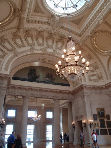
On the subject of tents, the North Face Rock 22 two-man tent did very well. It was easy to set up, has two entrances inside two vestibules, waterproof floor that rises about 6-8 inches above the ground, a fully-enveloping rain fly, and a couple nice stowage pockets and a hanger inside. Like all tents, the two-man tent is really a one-man tent. A three-man is really made for two, and so on. The two man tent gives me enough room for the bedroll, pack, and my boots when I take them off. That’s it. Best of all, as cold as it was, there was not a trace of condensation in the tent.

All the gear worked well and deserved a five-star rating each, except one. The blue dense foam sleeping pad I got from Walmart is a one-star. It’s not much more than half the width of the sleeping bag, and while it earned its sole star by insulating me from the cold ground, it had me up three times during the night shoving it back under the sleeping bag, and it left me this morning with sore, aching shoulders. That’s certainly not the best way to start a whole day of paddling, so a more appropriate solution for this problem is under consideration.

I knew where there was a herd of buffalo, and had hoped to get you a nice close-up picture of one, but my efforts didn’t go quite as planned. They were standing about 300 yds. back in the field in a wooded area. I whistled and waved my hat, hoping their curiosity would attract them out closer to the road. They came within about 75 yards, and refused to come closer, so what I have here is the best I could do without a nice SLR camera and telephoto lens. About that time a carload---full carload---of young Indian men pulled up behind my truck. The land is Cheyenne-Arapaho Indian tribal land, and the buffalo are theirs as well. It seems some idiot had shot one of their buffalo with an arrow, and seeing me linger by the gate to their field had brought a war party out in force. I explained the reason for my presence, and seeing me with nothing but a camera seemed to put their minds at ease.

Saturday, January 29, 2011

A Night At Canton Lake

It was incredibly warm---in the low 70’s. For Oklahoma this time of year, this was amazing, even if short lived. By Tuesday night, the low is forecast to be back down to 5-deg. However, it was a great chance to take all the gear down to Canton Lake for a real-life trial. It seemed there’d be no better way to make sure all the equipment was ready to go than to rely on it for a couple days while trying to use every piece.

It was warm enough that I was riding with the truck window down. When I drove up onto the dam, I was at the leeward end of the lake, and in an instant the temperature dove at least five, if not ten, degrees from the wind sweeping across the cold water of the lake. The last time I was down to the lake it was frozen. Now there was no ice anywhere, but ice and snow were still caked in the riprap along the dam and shoreline.


All the facilities were locked at the campground, but I did find a frost-free water hydrant for fresh water. As soon as the tent was up, I began scouting for some dead wood for a small fire later. A lot of the state is under a burn ban because of the dry 20-25 mph wind, but this area was not included. Also, at sunset the wind went dead calm, but I finally still decided against the fire.

I started the Coleman single-burner propane stove to heat water, and got out a package of freeze-dried Mountain House Turkey Tetrozzini with turkey, asparagus, spaghetti noodles, mushrooms, pimientos, chicken stock, all in a rich gravy sauce. The directions say it is a dinner for two. Not so. I had heard this before, and it’s true---one envelope is one serving, period. I had made a cozy (an insulated container we’ll talk about more later) to save on gas, so as soon as it was boiling, I poured the water and dinner ingredients into the cozy to let it sit and make dinner. This eliminates the need to keep the stove going for simmering. The cozy worked so well that even after sitting for a half-hour, dinner was still hot enough I had to blow on each bite before eating. As the sun set, it was all rounded off with a big mug of steaming hot cider.

There was an amazing amount of wildlife that began to stir once it was dark. I heard several coyotes, a couple owls, several large, screaming birds I couldn’t begin to identify, and a small critter rustling about in the brush behind the tent. I’m very particular about not having food around the tent, or allowing any food spillage or even wash water from dishes in camp, so usually am not bothered by animals smelling and seeking food. After a walk to enjoy the brilliant stars so visible in the total darkness, I hit the bedroll.

Thursday, January 27, 2011

Cruise, Day 26

Well, folks, this is it---the last day of the cruise. I feel almost as melancholy posting it as I did sailing it, but it was a fantastic sail that day, and I can only hope the adventures ahead will be just as wonderful.

With the weird weather patterns I’d been having, no wind for two days and then near gale force for three, I had been concerned for several days about the risk of getting south of Tilghman Island. My cruise was drawing to a close, and my concern was getting south and then perhaps having to wait a week for a weather window to open that would allow me to make the long sail back up and around Tilghman and Poplar Islands. Today looked like the best weather window I might get for awhile for getting back across the bay to the Eastern Shore. The wind was now southwest, but was to go north by nightfall and then start to build back to 30-40 knots by morning and for the next couple days. I was getting the impression that the only way folks on the bay would get decent weather would be for me to go home.

Thistle and I were underway from Harness Creek by 0720. The wind was near calm, and we just drifted along until the breeze started to gain strength around 0900. By 0930 Thistle had crossed the bay and was rounding Bloody Point Bar Light at the south end of Kent Island to enter Eastern Bay.

Bloody Point Light in her better days.
...and as it is today.

One would wonder how Bloody Point got its name. There are several tentative explanations, but it goes back far enough in history that there is nothing positive to distinguish fact from fantasy. The light was built in 1882, is 37-feet high, and had a visibility at one time of thirteen miles. It is now listed with a seven-mile visibility. It has had a sad existence. The current scoured under one side causing it to lean five-feet off vertical. That was corrected for the most part. Then in April, 1960, an electrical short set the structure on fire. The two coastguardsmen on duty tried to extinguish the fire, but it continued to spread. When the fire approached the 500-lb. propane tank, they decided to abandon the light. They climbed into the utility boat and lowered themselves. The tide was low and the boat just touched the surface, but there wasn’t enough slack to disconnect the falls from the davits, so they hung there as the inferno raged just over their heads. Finally a wave lifted them enough for the falls to come free, and they got away just as the tank exploded. A coastguard cutter fought the fire for six hours, but the brick and wood interior of the iron structure was destroyed. The destroyed light was replaced with a plastic lens in 1961, which is powered by solar panels. As I sailed by the light, my thought was, “Well, they’ll never sell that one,” but in fact it was sold at auction in 2006. The current owner claims that he will renovate the light. I certainly wish him well, but don’t envy him the job ahead. The iron plates are layered with deep layers of rust, the interior is gone, and the deck is covered with thick guano in which weeds grow.

Continuing up Eastern Bay, we rounded Parsons Island to enter Prospect Bay. We continued up to the head of Prospect Bay where we dropped sails and started the engine to make the run through Kent Narrows. We just missed one bridge opening, so had to wait 21 minutes for the next. At 1330, we cleared Kent Narrows Bridge to head north into the Chester River. Thistle continued to run up Chester River with a bone in her teeth. We rounded Mkr. “2” into Southeast Creek, and were secured alongside the boathouse at the marina at 1800.

Today, Thistle had been in her element. She is a great sailing boat, but until today just hadn’t had much to work with for any period of time. If for any reason that day was to be my last sail, it couldn’t have been better, and would be a day worth remembering. In ten hours (minus the 21 minutes waiting at Kent Narrows Bridge), we had run 44.0 nm. We had reached a top speed of 6.8 kts., and that was towing a dinghy half her length. Considering that we had started in light air and spent a couple hours around two knots, Thistle had done some real sailing. We started the day with a red sky, and finished it with a purple sunset. A glorious day. The only things left are to unload and unrig Thistle, get the marina travelift to load her back on the trailer, and haul her 1,500 miles back to Oklahoma.

The Cruise Recap: Total distance: 395.3 nm. During the cruise we had sailed:
10 Rivers
67 Creeks
17 Coves
11 Bays


Wednesday, January 26, 2011

Last Will and Testament

Boy! Talk about trying to take all the fun out of going paddling! Now we’re going from snake bites to the last will and testament. Like it or not, we’re in an alien environment when we go into the outback. It’s a place where Murphy’s Law reigns supreme. In doing risk management, we need to not only worry about assessing daily dangers on a trip, and how we’ll handle something like a broken bone, capsizing, or severe laceration, but how things will be managed if we fail to return. It’s not a comforting subject, but it’s called reality. If we’re going to pack a survival kit to help insure our return, then we need to think of the last will and testament as a survival pack for those left behind if we don’t.

I had done such a document a couple decades ago, but things change, so it was time to do some updating. It insures that our heirs get the fruits of our labors rather than the government, or that possessions are parceled by your wishes rather those of a judge. It helps to provide for your wife, children, even your grandchildren. Included should be a power of attorney that allows your wife or person of your choice to serve in your place as though you were still here. It gives them immediate access to funds, insurance, property, safe deposit boxes, vehicles, and all things necessary to settle your bills and other obligations and carry on with life. Failure to have this settled in advance forces them to endure long, frustrating, and costly legal battles that you could have averted merely by the signing of your signature. It would also be a good time to include a living will provision that gives you authority to determine in advance if organ donation would be appropriate for you, or if you would like to be maintained artificially in a vegetative state while having all your assets destroyed by senseless medical procedures. These are all very personal choices and decisions, but we can paddle with greater peace and contentment knowing that we have everything in order and shipshape in advance?

Tuesday, January 25, 2011

Cruise, Day 25

The northwest wind that had been building all evening decided to get me up at midnight to set a second anchor. The anchor bearings indicated we had dragged. We had just moved just a bit. I had to study the anchor bearings awhile before confirming that we had indeed moved, but the soft bottom wasn’t going to get any better, and if I wanted a sound night’s sleep, the extra ground tackle was essential. When I got up just before dawn it was obvious we were weatherbound yet again. The wind was a steady 30 kts. with occasional higher gusts. The Gale Force was gone, but as the name implies, it was built with a high displacement/length ratio, one of those said to be fun to sail in a gale. Plus, he was headed south, so the northwest wind would have given him a broad reach on the starboard tack. He would have had an utterly fantastic day.

The battery was only holding about a 55% charge, so I dug into the cockpit locker to check the fluid levels in the battery. They were fine, so it was obviously the steady dose of overcast weather and shorter days were combining to cut my charging rate. It had been working flawlessly, however, so I was sure that everything would be fine as soon as we got a bit of sunlight.

Monday, January 24, 2011

Snake Bite

Credit: junglewalk.com

One of the ironic things about planning for safety and survival is that we usually end up spending money, lots of it, on things we hope to never use. It’s money we hope we are wasting. This would include things like EPIRBS (emergency position indicating radio beacons), life rafts, fire extinguishers, signal mirrors, etc. One item that has to make this list is, without a doubt, the snake bite kit. Wild rivers, black waters, marshes and swamps all mean you’re in survival conditions in close proximity with poisonous snakes, so I felt compelled to order a snake bite kit for the survival pack. This one comes from Sawyer Products, of Safety Harbor, Florida (www.sawyer.com), and I ordered it from Campmor.
It’s different from snake bite kits of yesteryear. There’s no scalpel, for one thing, due to the risk of nerve damage. It also addresses the increasing incidence of Aids, and the fact that snakes often bite areas that can’t be reached for treatment by the victim using the old methods. The old directive was to cut an ’X’ across both punctures of the bite wound and orally suck out the blood and venom. If a snake bites the outside, rear quarter of the calf, you’d have to be an exceptional contortionist to suck the venom out by mouth when you’re alone.

To address these problems, the Sawyer Complete Bite and Sting First Aid Kit uses a pump able to draw a 750 millibar suction to withdraw the poison. It includes the pump, four cups of graduated size to best cover the wounded area, a razor to remove any hair in the area that may weaken a vacuum, alcohol pads and bandages, and a guidance and instructional manual. One of the purposes of a blog is to speak on the effectiveness of different tools of the trade for the benefit of others. Sorry, but you’re on your own here. For my part, I plan to do my best to avoid gaining practical experience with this.
My wife has one up on me here, not that I’m jealous. She had been terrified of snakes until she was bitten on the leg in the backyard by a water moccasin. Surprisingly, she felt less intimidated by them after the experience, and went on to kill pygmy rattlers and coral snakes she found in the yard. She doesn’t belittle the damage, however. She had to have a cubic inch of flesh surgically removed from her leg where the tissue had been killed, and to remove a fang that had broken off in her leg, and endured repeated treatments for inserting and removing drainage tubes. It took her a whole year to overcome the damage that was done. So, I’ll carry the kit and study the manual just because I should, but will be happy to watch it rot unused in my pack, thank you very much.


Sunday, January 23, 2011

Cruise, Day 24

By 0800, we had pulled from the slip and were underway from Back Creek. Humidity was still 100-percent and everything below was wet. We were shortly under full main and jib, and fifteen minutes later cleared Mkr. “1AH” at Tolly Point. There were several fishing boats around Thomas Point Shoal Lighthouse, so I had to tack to and from the light several times before I could get a clear picture. The current was ebbing pretty good, and there at the shoal I was getting the combined current of the bay, Severn River and South River all trying sweep me past the light, so to get the picture I wanted, ended up having to tack back up the bay against the current.


Thomas Point Light is undoubtedly the most photographed light on the bay. A stone lighthouse was first built nearby in 1825 on the shore of Thomas Point, designed by John Donohoo, who also did Concord Point Lighthouse and Turkey Point Light. Constant erosion around the point required it to be replaced by another stone tower in 1838. Both stone towers have long since been undermined and have collapsed into the bay. An appropriation was obtained in 1873 to build a screw-pile lighthouse directly on the shoal, and it was commissioned two years later. In 1877 the ice floes were shaking the lighthouse so violently that the lens toppled from its top. The light was replaced, more screw-piles were sunk, and riprap was stacked around the structure’s base to protect it from ice. By 1964 it was the last manned lighthouse on the Chesapeake Bay, but it was automated in 1986. It is the oldest unaltered cottage-type screw-pile lighthouse on its original foundation in the United States.
At 1040, we sailed past R “4” and entered South River. We gunkholed through Selby Bay, Limehouse Cove, and then anchored clear of the cable area at the head of Brewer Creek for lunch. Afterwards we sailed through Glebe Bay and headed for Almshouse Creek. Both the chart and signs on both shores warned of dangerous submerged obstructions across the channel entrance. There were boats inside the creek, so there was obviously a way in, but I was not about to continue in without local knowledge, so came about and continued on for Warehouse Creek, Gingerville Creek, Church Creek, and Crab Creek where I couldn’t avoid taking a picture of this beautiful house there.


We then went on to Aberdeen Creek, and finally anchored for the night in Harness Creek on the north shore of South River. As I entered the cut, I saw a Kaiser Gale Force, a serious cruising boat that was built in Wilmington, DE, for a number of years before the company went out of business. It was always one of my out-of-reach dream boats. Once anchored, I went over to meet the skipper. He was in the middle of preparing dinner, but graciously invited me aboard for a drink and visit. Not wanting to overstay my welcome, I congratulated him yet again on his beautiful vessel, thanks him for his hospitality, and rowed the half-mile back to Thistle.

Friday, January 21, 2011

No Water in St. Johns

I just spoke with Jeanne at Middleton's Fish Camp on Blue Cypress Lake west of Vero Beach, Florida.  I've been anguishing over the water level in the river for the last several months.  Jeanne does the fishing reports for the upper St. Johns, so I sought her out for local knowledge on the condition of the river.  As you may have read earlier when I was  doing the planning for the St. Johns trip, the St. Johns River Water Management District reported that the water levels were the lowest they have seen in a couple decades---so low that the river bed was being run with ATV's.  I've watched weather reports showing rain storms rolling through Northern Florida, but they've been north of the headwaters of the river, so haven't contributed to the health of  marshes and river.  Jeanne reported that none of that has changed.  The water level in the Blue Cypress Lake is down two feet, which still means the headwaters between Blue Cypress and Lake Washington are still dry.  The result is that the St. Johns River trip is off for this year, and since I had already planned on the Florida Circumnavigation as Plan B, that will now move to the forefront. 
The Florida Circumnavigation goes counter-clockwise around the state from near of the Alabama state line, down through the Keys, and up the East Coast to the Georgia state line north of Jacksonville.

Wednesday, January 19, 2011

Cruise, Day 23

Once weather rolls in, it’s not uncommon for it to last three days before it blows out, but common or not, I was getting tired of squatting in one spot. I needed off the boat.
When you make it to Annapolis, a must-see is the U. S. Naval Academy. It was established in 1845 by Secretary of Navy George Bancroft. You’ll just have to take my word for it that there’s just too much to see to make a list here, but the highlights are the naval museum, the noon formation of the Brigade of Midshipmen, visitor’s center, Bancroft Hall, the Chapel and crypt of John Paul Jones…..whoops, I almost started a list. The academy is a hive of activity. You can walk miles within the grounds, or you can take a guided tour, and it’s not uncommon to step right into the middle of some function. When Paul Higbee, a friend from Georgia, and I made a day trip from Thistle to the academy during our fall cruise last year, we no sooner stepped from the car than we heard bands playing. We followed the sound and climbed into the stands to watch performances by both the U. S. Air Force and the U. S. Naval Academy Drum and Bugle Corps. Since Paul is a retired Air Force pilot, that pleased both of us. At other times you’ll see Midshipmen in close-order drill, or hear an evening jazz concert or orchestra performance by a full Navy band. Check at the information desk at the visitor’s center for a schedule of activities. These are a few of the pictures I took during our visit last fall.

Bancroft Hall
Bancroft Hall interior
Stairs to Memorial Hall
Memorial Hall
Naval Academy Chapel
Chapel Sanctuary
Crypt of John Paul Jones


I walked up today to have lunch at Dahlgren Hall, and then watch the noon brigade formation. Then I walked back through Annapolis to visit some of our old haunts ‘from back in the day‘ when the Chesapeake was our home waters, and bought a gift to take home as a Christmas present. If you like to shop, especially if you like hunting for the fabulous and the unusual, the shops of Annapolis are amazing.
It started to drizzle lightly, then rain, and finally just came on to a full-fledged downpour. I ducked under the canopy of the Reserve Club to put on the foul weather gear, but it was roughly a two-mile forced march back to the boat. Between rain from the outside and the steam I was generating on the inside of the suit, by the time I got back aboard, I was soaked enough to pour water out my shoes.

Monday, January 17, 2011

Cruise Day 20, 21, and 22

(Day 20) There were several groups of ducks in Cove of Cork, but I have a feeling that they are year-round residents rather than migrating. They seemed a bit too laid back to be trying to get south. At 0750, I powered out of the creek and headed further up the Severn River. For those who have never seen the Severn, it is really beautiful country. A look at the chart will show the closely stacked topographic contour lines that reflect the steep banks and hills surrounding the river. The shoreline is pocked with a great number of creeks and coves that provide good hideaways in spite of the dense population in the area. So, I was off today to visit those. We ran through Luce Creek, Saltworks Creek, Clements Creek, Brewer Creek, Round Bay and Little Round Bay, Hopkins Creek, Maynadier Creek, Valentine Creek, Plum Creek, Forked Creek, Sullivan Creek, and Chase Creek. By this time it was time to get back down the river to Back Creek, a place where I could safely ride at anchor for a couple days. NOAA was again predicting a large weather system for the area that would have me weatherbound in port. Running south past the U.S. Naval Academy and Annapolis Harbor, I got back into Back Creek and set two anchors in the same spot I had left yesterday.

Annapolis Harbor

(Day 21) The next day Thistle remained in port. As promised, we had high winds. Two boats near us were dragging their anchors, and I got tired watching a German boat that must have reset its anchor twenty times, night and day, over the next couple days. A couple shopping trips were made on foot, but Dave saw me on the road and picked me up during one trip.
Whenever I heard a boat going by, I’d pop my head out of the companionway to say ‘hello’. On one occasion, a dinghy was passing as a strong gust of wind ripped the hat off the man’s head and dropped it in the water. He made a couple loops and picked in up, throwing the sodden cap in the bottom of the dinghy. A sailor motoring by yelled, “Nice save!” The man in the dinghy responded, “Yeah, I need this to cover my balding spot.” The sailor called back, “We don’t call that balding any more. We say we’re growing a solar panel.” That was a new one.
In the evening, Dave invited me to join him for dinner at Davis’ Pub. Apparently this is the last of the true sailors’ pubs remaining in Annapolis. We were joined there by Nick, dockmaster of Watergate Village, and his wife, Renee, and infant daughter, who had to be the best behaved baby I’ve ever seen. The hour was way beyond her bedtime, but she was having a ball. She smiled and laughed with everyone in the pub, and became the unofficial hostess. It was a great evening, and good food. Give Davis’ a go if you’re in Annapolis at Eastport on Back Creek. Dave and Nick, I thank you both for the experience.

(Day 22) I became Dances with Rain Clouds. I was making several trips ashore for hardware and provisions, and had been having fair luck with rain. I carried my foul weather gear in my canvas brief case, but the closest I had come to a soaking was having to dive into a bus shelter for about 15 minutes. Today I moved into a slip, putting an end to having to worry about dragging or getting in the way of traffic. The wind wasn’t about to give up.  I tried to remain upbeat, but let’s face it, I was really having crappy luck with the weather. The reliable wind the bay is supposed to enjoy in the fall just wasn’t there. It was either no wind at all, or 30 kts. and rain. Oh well. That’s part of the game when playing with Mother Nature.


Sunday, January 16, 2011

Right on Target

Most of yesterday had to do with neither sailing nor paddling, but was interesting nonetheless. Our ten-year-old granddaughter got involved a couple months ago in archery, through 4-H. She seems to enjoy it, and as always with children, we hope she has found something that can be her passion for life. So we went to her archery competition in Paine Co., Oklahoma, to show our support. I had heard from a couple people in town that she has picked it up quickly, and for the time she has been exposed to the sport, has become quite good.

I had also been exposed to archery at a young age, through Boy Scouts, but while I’ve always been fascinated by it, it was not a sport I was going to pursue. Not having been around archery for the last half-century plus was going to leave me open to a couple surprises. First, there were only a couple bows there that I would even recognize as such. Most have evolved into something you’d expect to be carried by an alien invader. Robin Hood probably wouldn’t have even known which was the front or which was the back.


There are multiple strings running down the bow rather than one. There are wheels on the ends of the bow, shock absorbers, aiming sights, and stabilizers. When I was a kid, I had only had occasion to see one or two stabilizers on a bow. They immediately marked the owner as a shooter of national competence. Yesterday I only saw a couple without stabilizers, and several had three, one in the front and two swept aft from either side. Their purpose is to add weight to the bow, which helps to stabilize it (Daaah! Why else would they be called stabilizers?) They counterbalance the bow, give the arrow a more stable platform from which to be launched, improve aiming consistency, reduce vibration and recoil, and allow the bow to be much shorter. Beyond that, I didn’t see a wood arrow all day. They went from wood to fiberglass, aluminum, and are all now graphite or carbon fiber, or so I was told. Then, you don’t release the bowstring with the fingertips. A firing device with a trigger is hooked onto the string. The bow is drawn, and almost like a gun, the trigger is slowly moved to release the string.

In all, it was indeed fascinating, but what fascinated me most was our granddaughter. In a crowd of a couple hundred people, she was cool and unflustered. Everything seemed business as usual. She indeed did very well for her experience level, but more importantly, whether a particular flight of arrows was good or less than she hoped for, her reaction was the same, and she walked back from the firing line with a smile on her face. She fired a five-arrow practice round, and then sixty arrows in competition, and walked away at the end with a maturity well beyond her ten years. She reminded us of her Dad, who at the age of about seven, made his first public violin solo performance on stage in front of several hundred people. He looked so terribly small alone on that big stage, but never faltered nor showed any response to what could easily be considered overpowering, terrifying surroundings. He played his solo, took his bow, and walked off the stage like it was just any other moment in any other day. It was nice to see his daughter had inherited those same genes.


On the way home, we scouted Lake Carl Blackwell and Lake McMurtry east of Stillwater. They are near each other about seven miles east of town, and are my next targets for a paddling trip. Besides a quick view of the lakes, I picked up the relevant maps and regulations for lake use. Since they are both now covered with ice, they will have to await a better day. Also, I’ll have to investigate further any restrictions about waterfowl. Several lakes in the area have large sections set aside as waterfowl refuges during the winter, usually November to May, when no vessels are permitted into the restricted areas.

Friday, January 14, 2011

Cruise, Day 19

At 0715, having already brought the second anchor aboard, cleaned and stowed it, we left Martin’s Cove, made a short run up Burley Creek, and then exited Mill Creek. We ran across Whitehall Bay and up into Whitehall Creek, Minnow Creek, and Ridout Creek. When we exited Mill Creek, I set full main and jib, but as soon as we got out of the lee of the land it was obvious that a reef needed to be tucked back in the main. I had met Dave Skolnick on the internet at sailfar.net. There he goes by the name of Auspicious, which is the name of his boat. He had invited me to stop and visit if I made it into the area, so we sailed across the mouth of the Severn River and into back creek. We anchored in the creek and I rowed Thorn over to find him. He was busy trying to get his boat ready for his trip to the British Virgin Islands, but made time to get me to a post office, hardware store, and laundromat, which the dictionary claims I should actually be calling a launderette. I haven‘t heard that one before.

Dave and I had lunch together before I returned to Thistle, and by 1405 I was under power and headed back out Back Creek. This was during the Annapolis Boat Show weekend, so traffic was really hectic. I turned north in the Severn, passed the Naval Academy and the Gov. Ritchie Hwy. (Rt. 450) bridge, and headed for Manresa Cove.

You can’t cross the Ritchie Hwy. bridge without seeing Manresa on the Severn. It is a huge, imposing white structure perched high on a rise overlooking the river. Yet, while everyone sees it, it’s amazing how few have any idea what it is. To understand Manresa, you need to go back to 1522.


A wealthy Inigo Lopez de Loyola was visiting a cavern near the Spanish town of Manresa (man-REE-sa), 30 miles outside of Barcelona. A deep transformational spiritual experience there convinced him he should abandon the life of privilege in favor of one that was reflective, austere, spiritual and humble as befitted a servant of God. He founded the Society of Jesus, better known as the Jesuits, which was to become the largest religious order of the Roman Catholic Church. In 1914, eighteen men at Georgetown University began to gather for communal meals, spiritual readings, mass, and contemplation. Their efforts led to the establishment of two religious retreats, Manresa on the Severn and Loyola on the Potomac. They purchased six acres of “worthless” land from the Washington, Baltimore, and Annapolis Railroad. Construction began in 1926, and a chapel was added in 1930. Over 100,000 people have stayed there for religious retreats. By the late 1980’s fewer people were using the facility, and they began to suffer from financial shortages. The decision was made to sell the property, and in 1995 it was bought for use as an assisted living facility.
The cut into Manresa cove showed a depth of four feet with shoaling reported in 2001. The current was pouring out as I entered. I obviously allowed the bow to get offset to port, and before I knew it the current had walked me sideways onto a bar. If I’d been watching astern as well as ahead I would have caught the offset, but there I was, hard and fast. The engine and rocking did nothing to free me, and with the tide dropping, time was not on my side. I loaded the anchor into the dinghy with all the rode and rowed it well into the center of the cove so I could kedge off. Back on board, I ran the rode back to a cockpit winch. I would winch it bar tight, and then go onto the bow to take some weight off the rudder and swing the bow side to side. This process was repeated about three times, and then Thistle slowly slid off the bar. Once I had the ground tackle back on board, I ran into the cove and then came about and powered back out without further incident.

I continued north under full sail, but as soon as I got under the Rt. 50 bridge, the wind went flat. An occasional zephyr would stir the sails, but with the foul current, that only allowed us to stay in the same spot.
As long as I can remember, when we crossed the Rt. 50 bridge, we would look off the northwest edge of the bridge down into a perfect little cove that was almost under the bridge. There was just a little slit of an entrance, much like that into Manresa. We always thought it would be a neat place to anchor for a night, and I suddenly decided there would never be a better chance than right now, so I turned to port, ran in along the bridge supports, and cut into the little cove called The Cove of Cork, and anchored for the night. This photo is from our anchorage in the cove and looking back through the narrow entrance.

Thursday, January 13, 2011

Ibi's Construction Underway

I just talked with Scott Smith at Superior Canoes.  The deck of the Superior Expedition is done, and he's setting up to do the hull.  Hopefully, we're looking at a completion about the end of February.  You can still see a picture of one of Ibi's sisters on the blog entry for Nov. 23, 2010, Boat of Choice.  Color me excited!

We're going to drive up to Michigan to pick up the canoe when it's done.  I plan to have some pictures for you when we get back.  Scott's boats are custom-built, one at a time.  He says he's gotten enough orders that he's backlogged and may have to hire some help.  That's good news both for the economy, and for the paddling community.

Wednesday, January 12, 2011

Cruise, Day 18

Today would prove to be a work day. Any day on the water, for me at least, is a joy and a blessing, regardless of how strenuous or uncomfortable it may be, but the weather was going to insure that I didn’t get comfortable or relax. By 0800 the engine was on, and we headed out of Deep Creek. Ten minutes later I set a working jib and single reefed main. At 0830, we were clear of R “2” and turned S-SE for Sandy Point Shoal Light, just north of the Chesapeake Bay Bridge.


Sandy Point Shoal Light was preceded by a lighthouse that was originally built on the west shore just about where the bay bridge now comes onto the land. It was started in 1854, and commissioned four years later. A fog bell was later added. By the mid-1870’s, however, the shoal had continued to build into the bay, now extending a mile off the shore. The channel was far enough away that the light was of little value, and the fog bell often too far away to hear. With commercial traffic into Baltimore increasing, especially passenger steamer traffic, a new lighthouse to guard the shoal was needed. It took eight years of dancing with Congress to get an appropriation, but construction was started in August, 1883, and finished a mere three months later. The house is of wood timber and masonry construction with enough exterior ornamental brickwork to give it a Victorian appearance. The base contains a 16-ft. wide basement in the caisson to hold water, oil, and coal. The first floor provided a kitchen, pantry, and living room with fireplace. Three bedrooms were on the second floor. In the roof was the watch room, and from there a spiral staircase into the light. Once again, once the keepers were removed when the light was automated, vandals broke out all the windows except one, and destroyed the 19th century Fresnel crystal lenses. The light was sold to private ownership on the internet in 2005.

The wind was still building, so as soon as I cleared the lighthouse, I took a second reef in the main. We sailed under the bay bridge, and it was obvious that as soon as I turned more up wind, I’d need to reduce sail further. Once I was sure I had enough clearance on the bridge, I took a reef in the jib. Now with a reefed jib and double reefed main, Thistle beat in toward Hackett Point. As soon as we reached the waypoint for the south tip of North Shoal, I dropped sail and started the engine. If I needed to run the hell out of the engine, we were about to give it just what it needed. We came up dead into the wind, which now was howling. We barely made headway initially, but as we got in closer to Whitehall Bay, the waves got smaller.

From the Whitehall Bay entrance light, we turned northwest for Mill Creek. It wasn’t until we got through the cut into Mill Creek that I began to relax. The engine was indeed showing great improvement ever since I started changing the way I used it. The bottom of the creek was charted as soft ooze, but I thought if I got under the trees, I’d be in enough of a lee to be okay. We ran to the head of the creek and anchored, picked out a couple anchor bearings, and started to prepare lunch. By the time lunch was over, it was obvious we were slowly dragging. Part of the problem of dragging in a mucky bottom is having to move and start all over. The other problem, which takes just as much time, is cleaning up the mess from the muck the anchor brings on board. Once lunch was cleared away, we motored down to Martin Cove, and ran as far north in the creek as I could and anchored close under a wooded high bluff. I didn’t think the wind would be able to touch me there, but it wasn’t long before I again saw that we were dragging in the soft bottom. Also, since I was anchored in a cove created by the bend of the river, the wind was swirling either from the abrupt bend in the creek or the wind eddies coming over the bluff, causing Thistle to swing circles around the anchor. Again, I hauled the anchor, cleaned up enough so I wouldn’t be tracking mud everywhere, and headed back down to the mouth of Martens Creek. Here I had more room, and set both anchors on plenty of scope. That set us in good stead for the night.

Tuesday, January 11, 2011

Time Bandit

TIME BANDIT: Two Brothers, the Bering Sea,
and One of the World's Deadliest Jobs

Written by Andy and Johnathan Hillstrand, (Ballentine Books, NY), Time Bandit (obviously named after their boat) is not only a great story, but an interesting compliment for the TV series, Deadliest Catch.  The book lays the background story about life in the Aleutian chain of Alaska, growing up there as kids, how they were molded by the life and environment, and how they've been able to survive it. Much greater detail is included about life on board than can be included in the television series, and there are more stories as well, like Johnathan being attacked by a sealion, or the shark that ate his coffee cup.  I've watched every single episode of the program, most episodes many times over, so I thought, "How much can there be in the book that I haven't already seen?"  There's plenty, and what's provided gives a much greater understanding of the life.  While you're waiting to survive another winter, I'd recommend this as a good read.  

Monday, January 10, 2011

Cruise, Day 17

This was another of those ’good news/bad news’ days. I was standing at the office door of the marina when the manager came in to open. He asked if I was the man that had called him on the VHF last night about the outboard problem. I said I was, and he said he’d be down to the boat in a couple minutes. It turned out the manager was also the mechanic.
He had me start it up so he could listen to it. Then he stepped aboard and worked the throttle himself. One thing that frustrates me continuously is the modern tendency to neither say what’s on your mind, or talk around the point in such wide circles that the meaning is lost. So, while it was a shock initially, it was a relief to have him turn to me and say, “There’s nothing wrong with this engine, except you. You sailors are all alike. You putt along and putt along at quarter throttle, thinking you’re going to save gas, when all you’re doing is gumming up the engine. These things are meant to run at three-quarter to full throttle. If it’s run too slow, the engine never gets hot enough to burn the oil out of the gas, so it just coagulates into a gummy, waxy residue that clogs the engine. Go run the hell out it. It’ll be fine. Now, just give me what you think’s fair for tying up here for the night and get out of here.” Simple. To the point. No need for interpretation or reading between the lines. He wasn’t trying to be rude or brusque. In fact we stood on the pier for another half-hour talking about things nautical, mostly classic boats, cruising, and living aboard. The engine was fine, and that was the good news.
I started the engine and back and filled the boat around to get out of the tight spot I had ended up in. I pulled out from between the piers and headed back out Cattail Creek. We ran into Dividing Creek and Mill Creek. By 0940 a bit of a breeze started to fill in, so I set full main and genoa. It was a long sail to Annapolis, so I opted to pass Deep Creek and head straight out the Magothy and around Cape St. Claire. As we approached and passed through the entrance channel, however, I was watching what looked like a strong front to the northeast. Once I was clear of the markers and buoys and had some drifting room, I ducked below to listen to the NOAA forecast again. It had changed. The W 10-15 wind they had forecast earlier was now S-SW 20-30, and small craft advisories were being posted. That was the bad news. So far I’d had a great HOUR of sailing. Yeeha! Such a sudden change in the forecast and weather didn’t bode well. As I watched, the wind that would have been fair for a nice reach to the south was backing to the south and building. Beating to the south in a 30 kt. foul wind was not to be, so I came about and made for Deep Creek. Entering the creek, I set anchor in the junction of the first finger to the northwest, and while I was at it, set the second anchor as well. The total run for the day was 7.2 miles! Oh well.
The evening after the frontal passage, a full moon
rose over Deep Creek.


Sunday, January 9, 2011

A Nice Afternoon on the Lake

It was 24-degrees yesterday morning, but with a snowy, sub-freezing winter storm approaching, getting the canoe out yesterday was kind of a ’now-or-never’ proposition. It would be best to load the canoe and gear the night before, but after the last minute forecast change the other day, I was waiting to see what the weather was actually going to be. The forecast was for light to 8 mph east winds, so I decided to launch off the east side of the lake to put me in the lee of the land. The east side of the lake is really nice for a winter paddle in ice-water . The bottom shoals gradually and is reasonably uniform, so it’s possible to paddle in a nearly consistent 12-24 inches of water. In the event of a capsize, there would be no total immersion, and it would be possible to either walk to shore or right the canoe right where I was. But, since you can never predict what might happen, I wore a dry suit nonetheless.
I started north and got about a mile up the lake when the wind started to build rapidly to 15 kts. from out of the south. There were whitecaps, and I was just tearing up the shoreline. Finally I figured I’d better come about to see how I’d do against the wind in case it was going to build more. The east shore is also good for seeing wildlife.


The shallow water keeps boats further offshore even in the summer, and the shore is almost totally undeveloped. I saw a couple hawks, then a bald eagle. There were several smaller birds, one in particular followed me along the shore, flitting tree to tree as it sang loudly. I’m not able to identify most birds by their call, so can’t say what it was. I continued south against the wind, all the way down to the dam.


As I was going south, a couple dogs were running up the shore. There were no people around, and they were in the middle of nowhere, so I have no idea where they may have come from. They apparently saw a lone paddler on an empty lake as novel enough to warrant further attention, so after spotting me from a hundred yards away, both sat down at water’s edge and patiently watched me approach. I paddled in toward the shore, and they walked out to meet me. One showed that he’d be quite content to climb right in the canoe with me, and twice tried to do just that.  After a bit they apparently decided I wasn't as interesting as first suspected, and continued their romp up the shoreline.

The wind finally settled into the southeast at about 9-10 kts. That made paddling much more comfortable, so after reaching the dam, I turned and just paddled easily to let the wind help push me about two and a half miles back north to the take-out ramp.
For just a chance to get on the water and stretch the muscles for a little exercise, it was a very nice afternoon. We only covered 7.3 miles, but the sky was clear, and the sun helped ease the chill. If we get the storm being forecast, I’ll be much more content shovelling snow after having been on the water a bit.
 

Thursday, January 6, 2011

Cruise, Day 16, Part 2

Well, this bites, but what are you going to do? What am I talking about? I was finishing the storm door job yesterday afternoon, and came in to look at the forecast. Winds today were going to be 5-8 NW. Yeeha!! It’s time to get the canoe wet. That’s why I made the run to the lake last evening to check it out. So anyhow, I step out the door with my pack bright and early this morning, ready to load the canoe, and a blast of cold wind hits me in the face. A nearby flag is standing straight out like it’s made out of sheet metal. A run back inside to check the forecast again showed it had been changed to 16-23 mph, and the wind direction would have it bowling right down the full length of the lake. So, back to the cruise.

From Baltimore Light, we sailed directly west for the southern point of Gibson Island and the entrance into the Magothy River. Thistle sailed north following the six-foot contour line through Sillery Bay. We sailed into the Magothy Narrows and around into the harbor of Gibson Island, and continued into Redhouse Cove. There were a few moorings there from the nearby marina, but no obvious evidence of a red house.

Gibson Island Harbor Yacht Yard
A utility building "lighthouse" near the travelift.

From there it was up into Cornfield Creek and across to Gray’s Creek . There was still no wind when we came out of Gray’s Creek, so I just shut the engine off and let Thistle drift as I prepared lunch. There’s a huge home on Little Island. It’s a beautiful place, but it gives the appearance that at any moment the huge house may cause the island to roll over and capsize. As I had lunch I was looking at Dobbins Island, just south of Little Island, and reminisced about my friend Hugh, and an autumn trip we made here in his boat many years ago.
Dobbins Island

There were four of us on board as I recall. We sailed south from the Sassafras, not arriving at Dobbins Island until 0100. In spite of the hour, Hugh mixed drinks and we sat in the cockpit and laughed and talked for a couple more hours before finally turning in. He was a good friend, a very sharp engineer, and he enjoyed teaching celestial navigation. Alzheimer’s attacked him with a viciousness I didn’t know was possible. In just a couple months he went from someone who never stopped, physically or mentally, to a man who couldn’t climb stairs, even walk or feed himself. Not wanting anyone to see him in that state, he wouldn’t allow even his friends to visit. It was only about three months until we learned that he had passed. It was strange never having the chance to say goodbye, but I think of him often, and as I sat there, I raised my mug to Dobbins Island and Hugh’s memory.

From there we powered around Dobbins and west into Broad Creek, Blackhole Creek, and then to the back of Cockey Creek where I got a chance to photograph a Friendship Sloop. This is a style of vessel we were first introduced to in Friendship Harbor, Maine. They were originally a fishing vessel, but are maintained now as yachts, and some of the original boats are still around to participate in a healthy racing fleet.  
 

A light shower began to fall as we entered Old Man Creek, but it started to pour as we came out, so I ran around into the next cove, just across from Indian Village, and dropped anchor. Two hours later, the rain stopped, so we continued on into Cattail Creek.

I was having problems keeping the outboard running. It kept coughing and sputtering, so I stopped at a couple marinas looking for one that had a mechanic on staff. It was 1600, so I was running out of time before everyone closed for the day and went home, but the manager of Cypress Creek Marina told me to come alongside next to his travelift, and he would have someone look at it the next morning.
 

Wednesday, January 5, 2011

Storm Door Job

The past four days have been spent installing storm doors. I got several Larson doors to take advantage of the energy tax incentives. The doors are solid, heavy, and overall quite nice. It’s been a long time since I bought my previous storm door. I’m sure the blood drained from my face when I stood there in Lowe’s looking at the doors and their attached price tags. The last aluminum door I bought was about $25. They now start near ten times that and run to $2,000.


The installation instructions were very good except for how to install retaining trim on full-view glass doors. Those instructions are somewhat less than zero on a ten-scale. I can’t believe I spent several hours, literally, trying to get the retainer trim installed. I tried to contact Larson for guidance, and I guess they’re still in holiday mode. I got no answer by either phone or e.mail yesterday, but they did e.mail back this afternoon to say it is their busiest time of year. I finally decided to go for broke, but it worked. I lubricated both the door edge and trim with Vaseline, and then drove them in place with a mallet, hammering all around the door within a quarter inch of the glass. I expected to hear shattering at any second, but all’s well that ends well. The only casualty was a finger when I ripped the fingernail back trying to pry the retainers in place. That’s giving my typing a bit of a fit today. There are just a few more steps to finish the last door, and today should wrap it up. I’m generally pleased with the doors and hope they’ll make a long-term impact on heating costs.

In the late afternoon, we took a ride down to a nearby lake to see what the ice situation is. The area ditches are frozen over, but the lake is clear. The local prairie dogs were active as usual throwing big clouds of dirt into the air as they continue their ongoing excavation.

Tuesday, January 4, 2011

Cruise, Day 16, Part 1


This picture is actually from the night before and our anchorage in Locust Creek, off Bodkin Creek.  The heavy overcast cleared just before nightfall, with the sun breaking through the clouds to light the faces of the houses and tree-tops just before it dropped below the horizon.  The clear skies, however, were fleeting.

According to NOAA, the temperature and dewpoint were only two degrees apart last night, so I awoke to fog and more slate gray skies. Visibility was two miles, and often less. We got underway from Locust Cove and headed out Bodkin Creek. There was not a breath of air. Within a couple miles of clearing the creek we came upon a lone oyster dredge working. After passing him, we made for Baltimore Light. A ship was coming up the channel, and I was hoping to get a nice picture of it passing the lighthouse, but it was moving so fast, I couldn’t get into position in time.


A navigational beacon was needed off the Magothy River to mark the Craighill Channel approach to Baltimore Harbor. The Lighthouse Board had some idea of the difficulty that might be incurred in constructing a lighthouse there because of the character of the shoal and the amount of ice it would have to withstand. Still, they had no idea just how serious the problems would be and that it would take 18 years to finish it.

The request for funding from Congress was made in 1890 for $60,000. Borings into the bottom revealed soft mud extended down 55 feet. It was doubtful that a foundation could be laid in 55 feet of soup, so they tried a screwpile base, but there was nothing for the piles to find a footing in. A caisson foundation would be needed, which would double the cost of the structure. It would have to withstand 100 mph winds, 30,000 pounds per square foot of ice pressure, and the three knot current. Three requests were made to Congress for the additional funding, but they didn’t approve it until 1902. When bidding was opened for the job, they received only one bid, and it was $60,000 over budget. Congress refused the bid, but allocated the additional $60,000 to bring the total budget to $180,000. New bidding was opened, and again they only received one bid, but it was within budget and accepted. The metalwork for the 30-foot diameter cylinder was contracted to a company in Georgia. It was towed up the coast and to the sight and set in place. By the time heavy seas arrived only two days later, it had only been set eight feet into the shoal. The cylinder filled with water and was knocked seven feet off plumb. The contractor left to get materials needed to reset the base. He returned a month later, in October, just in time to see another storm capsize the caisson and roll it on to its side. The contractor left again, but this time, he just disappeared.

The insurance company that had bonded the construction had to step in. It took them three years to get the caisson reset and vertical. They then began to sink it into the shoal, adding steel plate around the top as it settled, until they had sunk it 82 feet below the level of the bay. The top of the cylinder was flared to support the octagonal, two-story house. The first floor housed the kitchen and sitting room. There were two bedrooms on the second floor, a watch room was situated within the mansard roof, and a fourth order
Fresnel lens topped it off. It was commissioned in 1908, and was the last lighthouse to be constructed on the bay.
The lights second claim to fame, besides being one of the most difficult to construct, was that it was to be the nation’s first nuclear powered lighthouse. The atomic generator was installed in l964, and was to supply uninterrupted power for ten years, but was removed only two years later due to concerns over cost and environmental contamination.

Again, when the keepers were removed, the lighthouse became a target for vandals. Windows and the lenses were shot out. An attempt was made to set the house on fire. The pigeons and seagulls moved in and built a thick layer of guano over everything. Open to the elements, the deck of the light platform started to rot out and had to be replaced. In June, 2006, the lighthouse was placed on the National Register and sold at auction to a private corporation dedicated to preserving the light. The Coast Guard retains right of access to maintain the aid, but the new owners are working to restore the house, and will allow the public to rent the house for stays on the bay. If you wish to support their effort, they are at the site below.

http://www.baltimorelight.org/home.htm
You can also volunteer to get your hands dirty, or take an excursion to the light and tour the house. There is a photo gallery on the site.


Sunday, January 2, 2011

Cruise, Day 15

It rained most of the night in Back Cove and continued into the morning, but was supposed to taper off. The bascule bridge didn’t have its first scheduled opening until 0900, so we had enough time on our hands to have pancakes for breakfast. Once we were cleaned up with everything stowed, we got underway for Stony Creek bridge. Being a bit early, we ran on up Stony Creek a ways before coming about and making the opening. We went back into the Patapsco and turned southeast, rounding Riviera Beach and running into Rock Creek. We continued to explore Wall Cove and Tar Cove. We sailed back out of the creek and made for the White Rocks north of Rock Point. In Maine, you don't see much other than glacial rocks, but huge examples of these in the Chesapeake are extremely rare.  The rocks themselves are anything but white, except for their tops. It is assumed they got their name from the blanket of white bird guano left by the gulls, cormorants, and other seabirds that routinely roost there.

The rocks were the only thing that weren’t gray. The water was gray, as was the sky, even landscape, regardless of its normal color, had taken on a gray appearance. The horizon virtually disappeared in the sameness of weak, drab light.
We ran down to Bodkin Creek. Once inside the cut, the creek splits into a number of tributaries. We checked out Back Creek, Main Creek, and Wharf Creek. While ducking into the entrances of Perry Cove and Mathias Cove, overhead power cables prevented going far. It was only 1539 when we ran into Locust Cove, but since there was no way to make it down the bay and into the Magothy River before dark, we anchored for the night. It was just before sunset that the sun finally broke through and lit the opposite shore. As twilight deepened, I was suddenly startled by the sound of a woman screaming. I only had to hear it a couple times to know it wasn’t a human voice, but what then?
There would be silence for awhile, and then the scream again. This went on for about a half-hour before I finally decided it was an eagle or osprey having an altercation with its young. They must have really been incorrigible chicks, because the screaming went on all night. Just as I would doze off, the scream would come again.